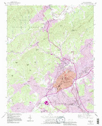
1993 Map of Lenoir
USGS Topo · Published 1996About this map
The Lenoir urban center serves as the focal point of this survey, surrounded by the diverse geography of the Pisgah National Forest and the upper reaches of the Yadkin River. The transition from the developed city core to the eastern foothills is marked by industrial and civic landmarks such as the Caldwell Memorial Hospital, Lenoir Golf Club, and various educational sites like Lower Creek Sch.
Find a feature on this map
73 named features on this map. Tap any name to fly to it.
Don’t see what you’re looking for? This feature index may not catch every label — zoom into the map to look around manually.
Map Details
Editions of this 1993 Lenoir Map
This is the sole edition of this map. No revisions or reprints were ever made.
Other maps of this area

1889 · Wilkesboro
USGS Topo · 1:125,000

1891 · Wilkesboro
USGS Topo · 1:125,000

1893 · Cranberry
USGS Topo · 1:125,000

1895 · Hickory
USGS Topo · 1:125,000

1895 · Cranberry
USGS Topo · 1:125,000

1899 · Cranberry
USGS Topo · 1:125,000

1902 · Cranberry
USGS Topo · 1:125,000

1905 · Morganton
USGS Topo · 1:125,000

1936 · Blowing Rock
USGS Topo · 1:48,000

1942 · Blowing Rock
USGS Topo · 1:62,500