1950s Maps of Clay County, North Carolina
Explore 10 historic maps of Clay County from the 1950s. These maps offer a rare glimpse into what life looked like during the 1950s — showing old roads, neighborhoods, homes, and landmarks that have changed or disappeared over time.
Whether you're researching your family's past, planning a metal detecting trip, or studying how Clay County's landscape evolved across the 1950s, these high-resolution maps are a powerful tool for exploring the history of this region.
- Focus on a specific era: All maps on this page are from the 1950s, giving you a focused view of this time period.
- See what’s changed: Compare century-old streets, trails, and buildings to today's modern landscape using overlays and satellite layers.
- Research with precision: Use these maps for genealogy, historical research, land use analysis, or educational projects.
- View, download, or print: Maps are fully viewable online in high resolution, and can be downloaded or printed for your own records.
Start exploring Clay County's history through authentic maps from the 1950s. This is your window into the past.
Clay County, NC maps
(10)- 1954 Map of Greenville, 1965 Print
 1954 Greenville1965 Print · USGSThe Upstate and Northeast Georgia are captured here during a decade of massive transformation as new reservoirs reshaped the Piedmont. Genealogists and hikers can trace the Appalachian Trail over Brasstown Bald or locate old community centers like Demorest, Westminster, and Royston.3 unique versions available
 - 1955 Map of Knoxville
 1955 Knoxville1955 Print · USGSThe Southern Appalachians and the Smoky Mountains are shown here at a peak of mid-century development and conservation. Genealogists and historians can trace the early road networks connecting Gatlinburg, Waynesville, and the Cherokee Indian Reservation across the high ridges.
 - 1955 Map of Rome
 1955 Rome1955 Print · USGSThe tri-state borderlands of Georgia, Alabama, and Tennessee appear in the mid-fifties as a landscape of ridge-and-valley industry and river navigation. Genealogists can trace family footprints near Chattanooga, the iron works of Gadsden, and textile towns like Trion or Summerville.
 - 1957 Map of Shooting Creek, 1959 Print
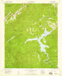
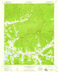 1957 Shooting Creek1959 Print · USGSClay County's high mountain valleys and the upper reaches of Chatuge Lake appear here in the late fifties. Genealogists and hikers can trace family landmarks and mountain passes, from Galloway Hill Cem to the heights of Chunky Gal Mountain.5 unique versions available
 - 1957 Map of Topton, 1959 Print
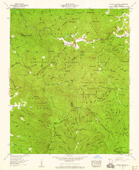
 1957 Topton1959 Print · USGSThe high mountain country of Macon and Cherokee counties is shown here during the peak of mid-century hydroelectric development. Genealogists and hikers can trace the Southern railroad through Topton or locate the remote Nantahala No 2 Ch near the reservoir.3 unique versions available
 - 1957 Map of Wayah Bald, 1959 Print
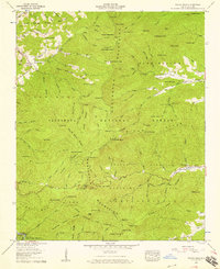 1957 Wayah Bald1959 Print · USGSThe Nantahala Mountains come alive in the late fifties as the Appalachian Trail crosses high balds and deep coves. Trace local roots at Whiteoak Flats Ch, the Tippet Cem, or the old Corundum No 1 mine.4 unique versions available
 - 1957 Map of Rainbow Springs, 1959 Print
 1957 Rainbow Springs1959 Print · USGSThe Southern Nantahala region in the late fifties is captured here at the height of its mid-century forest management. You can trace the Appalachian Trail across the Nantahala Mountains and locate landmarks like the Standing Indian Lookout tower and Rainbow Springs.4 unique versions available
 - 1957 Map of Knoxville, 1966 Print
 1957 Knoxville1966 Print · USGSThe Southern Appalachians of Tennessee and North Carolina are mapped here during the mid-twentieth century as new highways reached the high country. Genealogists and historians can trace the topography between Knoxville and Asheville, locating family landmarks near Fontana Lake or along the Blue Ridge Parkway.4 unique versions available
 - 1958 Map of Greenville
 1958 Greenville1958 Print · USGSThe Piedmont and Blue Ridge foothills come alive in this mid-century survey of the Upstate and Northeast Georgia. Trace the regional rail-and-river economy through the Southern Railway corridors and early reservoir developments like Lake Sidney Lanier.
 - 1958 Map of Rome, 1966 Print
 1958 Rome1966 Print · USGSNorthwest Georgia and neighboring Tennessee and Alabama are captured here in the late fifties, showcasing a landscape of high ridges and river valleys. Researchers can trace historic rail lines like the Seaboard Air Line RR and explore the bounds of Cloudland Canyon State Park or Fort Oglethorpe.3 unique versions available
End of results
Showing maps 1-10 of 10
Top cities of Clay County
Frequently asked questions
- What are the different types of historical maps available for Clay County?
- What is the oldest map of Clay County?
- Where can I purchase historical maps of Clay County for my home or office?
- Where can I download high-res historical maps of Clay County?
- Are there historical topographic maps available for Clay County?
- Is there historical aerial imagery available for Clay County?
- Where are historical maps of Clay County sourced from?