1980s Maps of Clay County, North Carolina
Explore 9 historic maps of Clay County from the 1980s. These maps offer a rare glimpse into what life looked like during the 1980s — showing old roads, neighborhoods, homes, and landmarks that have changed or disappeared over time.
Whether you're researching your family's past, planning a metal detecting trip, or studying how Clay County's landscape evolved across the 1980s, these high-resolution maps are a powerful tool for exploring the history of this region.
- Focus on a specific era: All maps on this page are from the 1980s, giving you a focused view of this time period.
- See what’s changed: Compare century-old streets, trails, and buildings to today's modern landscape using overlays and satellite layers.
- Research with precision: Use these maps for genealogy, historical research, land use analysis, or educational projects.
- View, download, or print: Maps are fully viewable online in high resolution, and can be downloaded or printed for your own records.
Start exploring Clay County's history through authentic maps from the 1980s. This is your window into the past.
Clay County, NC maps
(9)- 1981 Map of Dalton, 1982 Print
 1981 Dalton1982 Print · USGSNorth Georgia and the tristate borderlands are captured in the early eighties as the textile economy of Dalton thrived alongside the expanding Chattahoochee National Forest. Genealogists and hikers can trace the Appalachian Trail through the high country or locate family-named landmarks like Haskins Mill and Carters Mill.
 - 1981 Map of Toccoa, 1982 Print
 1981 Toccoa1982 Print · USGSThe tri-state mountain region where Georgia meets the Carolinas is shown here in the early eighties. Genealogists and historians can trace family-named locations and settlements from Dahlonega to Tallulah Falls, along with the Southern rail corridor.2 unique versions available
 - 1983 Map of Fontana Lake
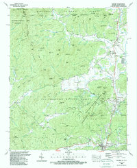
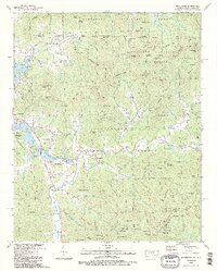
 1983 Fontana Lake1983 Print · USGSWestern North Carolina's high peaks and reservoir-carved valleys are documented here during the early eighties. Genealogists and local historians can trace the mountain communities of Bryson City and Franklin or explore the boundaries of the Qualla Boundary.2 unique versions available
 - 1988 Map of Dillard
 1988 Dillard1988 Print · USGSThe high divide of the Blue Ridge Mountains comes alive in the late eighties as Georgia and North Carolina meet. Genealogists and hikers can trace family sites like Germany Cem, schools such as Rabun Gap Nacoochee Sch, and the winding Appalachian National Scenic Trail.2 unique versions available
 - 1988 Map of Hiawassee
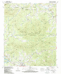
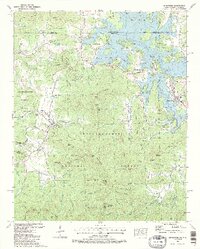 1988 Hiawassee1988 Print · USGSThe Georgia-North Carolina border country comes to life in the late eighties as Chatuge Lake shapes the mountain valleys. Genealogists and local historians can trace family landmarks like Townsend Mill, Young Harris College, and Old Burch Cem.3 unique versions available
 - 1988 Map of Nottely Dam
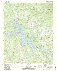 1988 Nottely Dam1988 Print · USGSThe Georgia-North Carolina borderlands come alive in the late eighties as Nottely Lake winds through the mountain forests. Researchers can locate numerous local landmarks including Ivylog Cem, Bethlehem Ch, and the agricultural grounds of Notalee Orchards.2 unique versions available
 - 1988 Map of Hightower Bald
 1988 Hightower Bald1988 Print · USGSThe high ridges of the Blue Ridge Mountains are documented here in the late eighties, spanning the Georgia and North Carolina border. Researchers can trace the Appalachian Scenic Trail past Hightower Bald or find local landmarks like King Chapel and Tate City.
 - 1988 Map of Macedonia
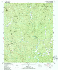
 1988 Macedonia1988 Print · USGSThe Georgia and North Carolina borderlands are captured here in the late eighties, centered on the high peaks and lakefront settlements. Genealogists and hikers can trace the Appalachian Trail alongside local landmarks like Bell Scene Ch and Garrett Cem.2 unique versions available
 - 1988 Map of Blairsville
 1988 Blairsville1988 Print · USGSNorth Georgia and the North Carolina border meet in the late eighties at the foot of the Blue Ridge Mountains. Genealogists and historians can trace community roots through numerous landmarks like Pine Log Village, Henderson Cem, and Many Forks Ch.
End of results
Showing maps 1-9 of 9
Top cities of Clay County
Frequently asked questions
- What are the different types of historical maps available for Clay County?
- What is the oldest map of Clay County?
- Where can I purchase historical maps of Clay County for my home or office?
- Where can I download high-res historical maps of Clay County?
- Are there historical topographic maps available for Clay County?
- Is there historical aerial imagery available for Clay County?
- Where are historical maps of Clay County sourced from?