1970s Maps of Beam Mill, North Carolina
Explore 2 historic maps of Beam Mill from the 1970s. These maps offer a rare glimpse into what life looked like during the 1970s — showing old roads, neighborhoods, homes, and landmarks that have changed or disappeared over time.
Whether you're researching your family's past, planning a metal detecting trip, or studying how Beam Mill's landscape evolved across the 1970s, these high-resolution maps are a powerful tool for exploring the history of this region.
- Focus on a specific era: All maps on this page are from the 1970s, giving you a focused view of this time period.
- See what’s changed: Compare century-old streets, trails, and buildings to today's modern landscape using overlays and satellite layers.
- Research with precision: Use these maps for genealogy, historical research, land use analysis, or educational projects.
- View, download, or print: Maps are fully viewable online in high resolution, and can be downloaded or printed for your own records.
Start exploring Beam Mill's history through authentic maps from the 1970s. This is your window into the past.
Beam Mill, NC maps
(2)- 1973 Map of Cherryville, 1976 Print
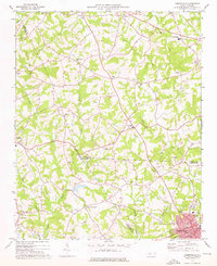 1973 Cherryville1976 Print · USGSThe foothills of the North Carolina Piedmont come alive in this early 1970s survey of the tri-county border region. Genealogists and historians can trace the rural landscape through family-named landmarks like Beam Mill, local schools such as North Brook Sch No 2, and churches like Indian Creek Ch.
 - 1976 Map of Cherryville, 1978 Print
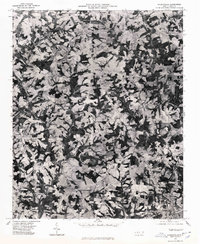 1976 Cherryville1978 Print · USGSCherryville and the surrounding Piedmont farmlands are captured in this mid-1970s aerial survey just as rural development began to accelerate. Researchers can identify precise property lines and land use patterns near Cherryville, Fallston, and Baker Crossroads.
End of results
Showing maps 1-2 of 2
Top cities near Beam Mill
- Gastonia historical maps
- Shelby historical maps
- Lincolnton historical maps
- Kings Mountain historical maps
- Cherryville historical maps
- Bessemer City historical maps
See more
Frequently asked questions
- What are the different types of historical maps available for Beam Mill?
- What is the oldest map of Beam Mill?
- Where can I purchase historical maps of Beam Mill for my home or office?
- Where can I download high-res historical maps of Beam Mill?
- Are there historical topographic maps available for Beam Mill?
- Is there historical aerial imagery available for Beam Mill?
- Where are historical maps of Beam Mill sourced from?