2000s (21st Century) Maps of Kenmon Acres, Shelby
Explore 6 historic maps of Kenmon Acres from the 2000s (21st Century). These maps offer a rare glimpse into what life looked like during the 2000s — showing old roads, neighborhoods, homes, and landmarks that have changed or disappeared over time.
Whether you're researching your family's past, planning a metal detecting trip, or studying how Kenmon Acres's landscape evolved across the 2000s, these high-resolution maps are a powerful tool for exploring the history of this region.
- Focus on a specific era: All maps on this page are from the 2000s, giving you a focused view of this time period.
- See what’s changed: Compare century-old streets, trails, and buildings to today's modern landscape using overlays and satellite layers.
- Research with precision: Use these maps for genealogy, historical research, land use analysis, or educational projects.
- View, download, or print: Maps are fully viewable online in high resolution, and can be downloaded or printed for your own records.
Start exploring Kenmon Acres's history through authentic maps from the 2000s. This is your window into the past.
Kenmon Acres, Shelby maps
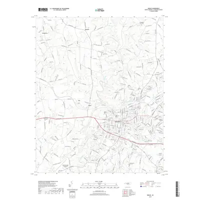
(6)- 2002 Map of Shelby, 2003 Print
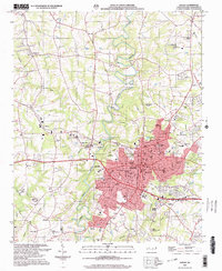 2002 Shelby2003 Print · USGSShelby and its surrounding Cleveland County townships are shown here at the start of the millennium. Local researchers can locate numerous community landmarks such as Eskridge Grove Ch, the Drive-in Theater, and the Shelby Municipal Airport.
 - 2010 Map of Shelby, 2010 Print
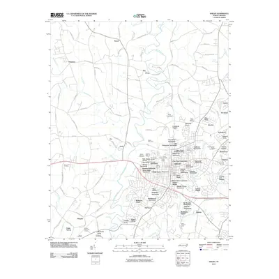 2010 Shelby2010 Print · USGSCovers Kenmon Acres, including Shelby, Kingstown, and other nearby areas
 - 2013 Map of Shelby, 2013 Print
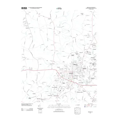 2013 Shelby2013 Print · USGSCovers Kenmon Acres, including Shelby, Kingstown, and other nearby areas
 - 2016 Map of Shelby, 2016 Print
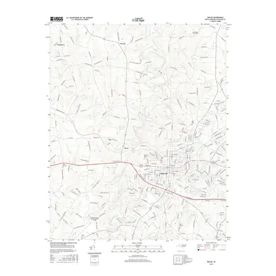 2016 Shelby2016 Print · USGSCovers Kenmon Acres, including Shelby, Kingstown, and other nearby areas
 - 2019 Map of Shelby, 2019 Print
 2019 Shelby2019 Print · USGSCovers Kenmon Acres, including Shelby, Kingstown, and other nearby areas
 - 2022 Map of Shelby, 2022 Print
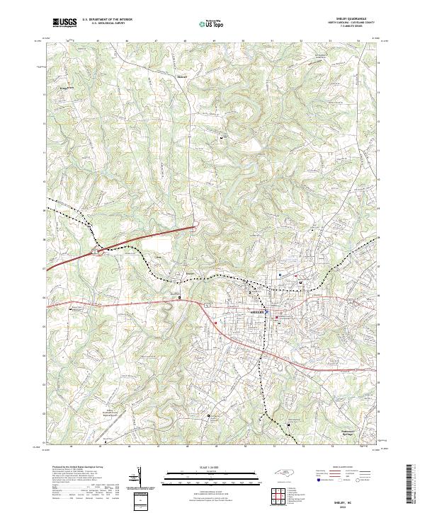 2022 Shelby2022 Print · USGSShelby and its surrounding Cleveland County communities are shown here in the early twenty-first century, centered on the Cleveland County Courthouse. Researchers can locate numerous family and church burial sites, including Ross Grove Cem and the Martin Elliott Cem.
End of results
Showing maps 1-6 of 6
Top cities near Kenmon Acres
- Gastonia historical maps
- Shelby historical maps
- Gaffney historical maps
- Lincolnton historical maps
- Kings Mountain historical maps
- Cherryville historical maps
See more
Frequently asked questions
- What are the different types of historical maps available for Kenmon Acres?
- What is the oldest map of Kenmon Acres?
- Where can I purchase historical maps of Kenmon Acres for my home or office?
- Where can I download high-res historical maps of Kenmon Acres?
- Are there historical topographic maps available for Kenmon Acres?
- Is there historical aerial imagery available for Kenmon Acres?
- Where are historical maps of Kenmon Acres sourced from?