Old Maps of Fayetteville, North Carolina for Hiking & Exploration
Hike through history with 73 historic maps of Fayetteville. Explore old trails, ghost towns, and forgotten backroads — perfect for outdoor adventurers and local explorers.
- Rediscover forgotten places: Map out old mining camps, roads, and footpaths that no longer exist on modern maps.
- Layer with modern tools: Combine with LiDAR or satellite views to plan hikes through historical terrain.
- Made for exploration: Popular among hikers, overlanders, and local history lovers.
Use these maps to find adventure and explore the hidden past of Fayetteville.
Fayetteville, NC maps
(73)- 1948 Map of Fayetteville, 1954 Print
 1948 Fayetteville1954 Print · USGSFayetteville and its sprawling military neighbor are caught here just after the war, showing the area's mix of urban growth and rural heritage. Genealogists can locate family landmarks like Bonnie Doone and Magnolia Ch, or trace the rails of the Atlantic Coast Line.
 - 1948 Map of Clifdale, 1967 Print
 1948 Clifdale1967 Print · USGSHoke and Cumberland Counties appear just after World War II, showing the vast footprint of the Fort Bragg Military Reservation. Local historians can trace old community landmarks like Longstreet Church, the Atlantic Coast Line railroad, and the Frys Mission School.
 - 1948 Map of Slocomb, 1982 Print
 1948 Slocomb1982 Print · USGSCumberland County's river valleys are captured here in the late forties, showing a landscape of small churches and rail lines. Trace family roots at Palestine Church or the Long Hill School, and follow the old routes of the Norfolk Southern.2 unique versions available
 - 1948 Map of Clifdale, 1983 Print
 1948 Clifdale1983 Print · USGSCumberland County at the midpoint of the century shows a unique transition between military land and residential growth. Genealogists and historians can trace family locations near Galatia Church, the Aberdeen and Rockfish line, and the Caisson Hill Cem.
 - 1949 Map of Vander
 1949 Vander1949 Print · USGSCumberland County just after the war reveals a landscape of rural schoolhouses and busy rail junctions east of the Cape Fear River. Researchers can locate family landmarks like Armstrong School, Lebanon Missionary Church, and the timber works at Vander.2 unique versions available
 - 1950 Map of Clifdale
 1950 Clifdale1950 Print · USGSCumberland County at mid-century reveals the intersection of expanding military operations and established rural communities south of the base. Genealogists and historians can trace family-named landmarks and gathering places like Galatia Church, 71st High School, and the settlement at Clifdale.2 unique versions available
 - 1950 Map of Fayetteville
 1950 Fayetteville1950 Print · USGSMid-century Fayetteville is a bustling hub where the growing city limits meet the rural traditions of Cumberland County. Genealogists and historians can trace the foundations of local neighborhoods through sites like the State Teachers College, McPhersons Ch Cem, and the old rail stop at Skibo Station.2 unique versions available
 - 1950 Map of Manchester
 1950 Manchester1950 Print · USGSMid-century Cumberland County is captured here during a period of significant military growth and rail activity. Researchers can trace the development of Fort Bragg alongside civilian landmarks like Manchester Spring Lake PO and Bethel Ch.
 - 1950 Map of Slocomb
 1950 Slocomb1950 Print · USGSCumberland County at the dawn of the 1950s shows a landscape of river-bend settlements and rail-line industry. Researchers can trace the roots of small communities like Slocomb and Carlos, or locate rural landmarks like Palestine Church and the Brick Kilns.2 unique versions available
 - 1951 Map of Clifdale
 1951 Clifdale1951 Print · USGSMid-century Hoke and Cumberland counties are defined here by the growth of the Fort Bragg Military Reservation. Genealogists and historians can trace older community landmarks like Longstreet Church, the Aberdeen & Rockfish RR, and the Frys Mission School.
 - 1953 Map of Florence, 1964 Print
 1953 Florence1964 Print · USGSThe Carolina borderlands in the mid-fifties were a landscape of vast river swamps and rising rail towns. Trace the legacy of the Seaboard Air Line through Florence or explore the wetlands surrounding Lake Waccamaw and the Green Swamp.3 unique versions available
 - 1953 Map of Raleigh, 1965 Print
 1953 Raleigh1965 Print · USGSCentral North Carolina in the early sixties shows a landscape of growing towns and military hubs before the full expansion of the interstate system. Genealogists can trace family footprints across the Piedmont through Wake Forest, Siler City, and the large Fort Bragg Military Reservation.4 unique versions available
 - 1954 Map of Florence
 1954 Florence1954 Print · USGSThe Carolinas borderlands come alive in the early fifties, showing the vital rail-and-river networks of the coastal plain. Genealogists can trace family footprints across the Green Swamp or through settlements like Red Springs, Chadbourn, and McColl.
 - 1954 Map of Raleigh
 1954 Raleigh1954 Print · USGSThe North Carolina Piedmont and Sandhills are captured in the mid-fifties during a period of steady regional growth. Genealogists and historians can trace the development of towns like Siler City or locate landmarks such as Falls of Neuse and Camp Mackall.
 - 1957 Map of Vander, 1960 Print
 1957 Vander1960 Print · USGSCumberland County eastward from the river during the late fifties reveals a landscape of growing suburbs and traditional crossroads. Genealogists can locate family landmarks like Locks Creek Ch, Armstrong Sch, and the community of Eastover.4 unique versions available
 - 1957 Map of Fayetteville, 1960 Print
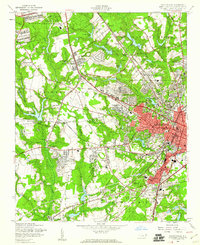 1957 Fayetteville1960 Print · USGSFayetteville at the peak of the post-war era shows a bustling city expanding toward the Fort Bragg Military Reservation. Genealogists and historians can trace old neighborhoods like Haymount, locate institutions like the State Teachers College, and find family landmarks like Lafayette Memorial Cem.5 unique versions available
 - 1957 Map of Manchester, 1960 Print
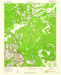 1957 Manchester1960 Print · USGSThe Fort Bragg and Pope Air Force Base area is shown here during a period of mid-century expansion. Genealogists and historians can trace the intersection of military and civilian life at Manchester, Spring Lake, and Raksam Chapel.4 unique versions available
 - 1957 Map of Fayetteville, 1961 Print
 1957 Fayetteville1961 Print · USGSThe Cape Fear River valley and Fayetteville's growing suburbs are captured here in the late fifties, showing the expanding footprint of the Fort Bragg Military Reservation. Genealogists can trace early neighborhood development and rural landmarks like Lakedale, Manchester, and Central High Sch.2 unique versions available
 - 1959 Map of Saint Pauls, 1961 Print
 1959 Saint Pauls1961 Print · USGSThe rural stretches of Cumberland and Robeson counties are captured here in the late fifties, showing a landscape defined by the Cape Fear River and its rail networks. Researchers can trace numerous country landmarks like Antioch Ch, Spring Hill Cem, and the timber bay of Gallberry Bay.2 unique versions available
 - 1972 Map of Parkton, 1976 Print
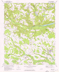 1972 Parkton1976 Print · USGSParkton and the surrounding North Carolina swamps are captured in the early 1970s as the regional rail network still tied together rural communities. Researchers can trace family history through sites like Pittman Grove Ch, McNatts Sta, and the SEABOARD COAST LINE rail corridor.2 unique versions available
 - 1976 Map of Vander, 1978 Print
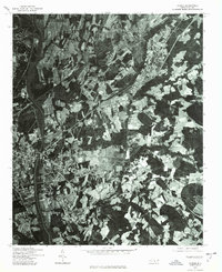 1976 Vander1978 Print · USGSFayetteville and its eastern outskirts are captured in the mid-seventies, showing the intersection of urban growth and rural landscapes. Researchers can trace land use patterns and property boundaries near Fayetteville and the settlement of Vander.
 - 1976 Map of Fayetteville, 1978 Print
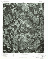 1976 Fayetteville1978 Print · USGSMid-1970s Cumberland County is documented in this detailed aerial survey showing the rapid suburban growth of the era. Researchers can trace the exact layout of residential streets and land clearing around Fayetteville, Bonnie Doone, and Lakedale.
 - 1976 Map of Slocomb, 1978 Print
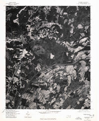 1976 Slocomb1978 Print · USGSCumberland County rural life is captured in the mid-seventies just as the landscape remained defined by timber and traditional farming. Genealogists and land researchers can pinpoint homesteads and property boundaries near the Cape Fear River, Slocomb, and Lane.
 - 1976 Map of Clifdale, 1978 Print
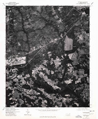 1976 Clifdale1978 Print · USGSThe area around Clifdale during the mid-seventies is captured here through detailed orthophotography. Genealogists and historians can trace property lines and land use near Clifdale, Caisson Hill, and Route 401.
 - 1976 Map of Parkton, 1978 Print
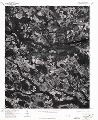 1976 Parkton1978 Print · USGSRobeson County agricultural life is frozen in the mid-1970s in this detailed aerial study. Researchers can pinpoint property boundaries and rural development surrounding the towns of Parkton, Lumber Bridge, and Rockfish.
Showing maps 1-25 of 73
Top cities near Fayetteville
- Linden Oaks historical maps
- Hope Mills historical maps
- Spring Lake historical maps
- Stedman historical maps
- Wade historical maps
- Parkton historical maps
See more
Top neighborhoods of Fayetteville
- Englewood historical maps
- Beaver Creek historical maps
- Haymount historical maps
- Skibo historical maps
- Hillendale historical maps
- South Hills historical maps
See more
Frequently asked questions
- What are the different types of historical maps available for Fayetteville?
- What is the oldest map of Fayetteville?
- Where can I purchase historical maps of Fayetteville for my home or office?
- Where can I download high-res historical maps of Fayetteville?
- Are there historical topographic maps available for Fayetteville?
- Is there historical aerial imagery available for Fayetteville?
- Where are historical maps of Fayetteville sourced from?