Old Maps of Loch Lommond, Fayetteville for Genealogy
Trace your family roots with 12 historic maps of Loch Lommond. These high-res maps reveal old neighborhoods, homesites, landmarks, and streets — helping you uncover where your ancestors lived and how the area evolved over time.
- Explore historic neighborhoods: Identify where your relatives may have lived in the 1800s or 1900s.
- Compare maps over time: Trace the changes in streets, buildings, and landmarks for multi-generational research.
- Perfect for genealogy & ancestry research: Used by family historians and researchers to map out lineage and migration.
These maps are an incredible resource for exploring your personal connection to Loch Lommond's past.
Loch Lommond, Fayetteville maps
(12)- 1948 Map of Clifdale, 1967 Print
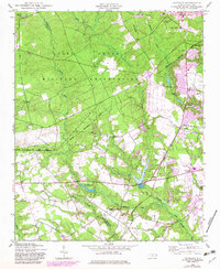
 1948 Clifdale1967 Print · USGSHoke and Cumberland Counties appear just after World War II, showing the vast footprint of the Fort Bragg Military Reservation. Local historians can trace old community landmarks like Longstreet Church, the Atlantic Coast Line railroad, and the Frys Mission School.
 - 1948 Map of Clifdale, 1983 Print
 1948 Clifdale1983 Print · USGSCumberland County at the midpoint of the century shows a unique transition between military land and residential growth. Genealogists and historians can trace family locations near Galatia Church, the Aberdeen and Rockfish line, and the Caisson Hill Cem.
 - 1950 Map of Clifdale
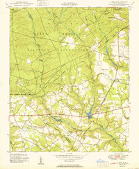 1950 Clifdale1950 Print · USGSCumberland County at mid-century reveals the intersection of expanding military operations and established rural communities south of the base. Genealogists and historians can trace family-named landmarks and gathering places like Galatia Church, 71st High School, and the settlement at Clifdale.2 unique versions available
 - 1951 Map of Clifdale
 1951 Clifdale1951 Print · USGSMid-century Hoke and Cumberland counties are defined here by the growth of the Fort Bragg Military Reservation. Genealogists and historians can trace older community landmarks like Longstreet Church, the Aberdeen & Rockfish RR, and the Frys Mission School.
 - 1953 Map of Raleigh, 1965 Print
 1953 Raleigh1965 Print · USGSCentral North Carolina in the early sixties shows a landscape of growing towns and military hubs before the full expansion of the interstate system. Genealogists can trace family footprints across the Piedmont through Wake Forest, Siler City, and the large Fort Bragg Military Reservation.4 unique versions available
 - 1954 Map of Raleigh
 1954 Raleigh1954 Print · USGSThe North Carolina Piedmont and Sandhills are captured in the mid-fifties during a period of steady regional growth. Genealogists and historians can trace the development of towns like Siler City or locate landmarks such as Falls of Neuse and Camp Mackall.
 - 1976 Map of Clifdale, 1978 Print
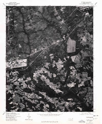 1976 Clifdale1978 Print · USGSThe area around Clifdale during the mid-seventies is captured here through detailed orthophotography. Genealogists and historians can trace property lines and land use near Clifdale, Caisson Hill, and Route 401.
 - 1982 Map of Southern Pines, 1983 Print
 1982 Southern Pines1983 Print · USGSCentral North Carolina in the early eighties shows a landscape defined by military expansion and historic rail corridors. Researchers can trace the legacy of the Seaboard Coast Line through Pinehurst or locate landmarks like the Town Creek Indian Mound State Historic Site.
 - 2013 Map of Clifdale, 2013 Print
 2013 Clifdale2013 Print · USGSCovers Loch Lommond, including Fayetteville, Bones Ford, and other nearby areas
 - 2016 Map of Clifdale, 2016 Print
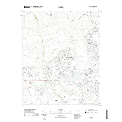
 2016 Clifdale2016 Print · USGSCovers Loch Lommond, including Fayetteville, Bones Ford, and other nearby areas
 - 2019 Map of Clifdale, 2019 Print
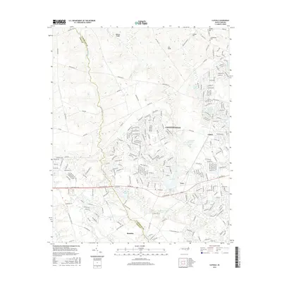
 2019 Clifdale2019 Print · USGSCovers Loch Lommond, including Fayetteville, Bones Ford, and other nearby areas
 - 2022 Map of Clifdale, 2022 Print
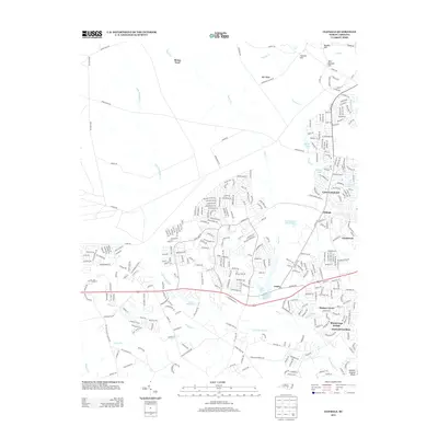
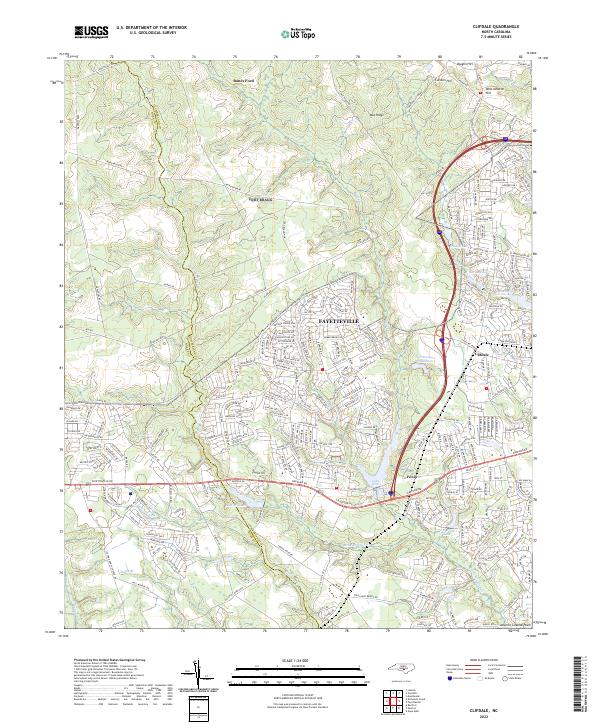 2022 Clifdale2022 Print · USGSCumberland County and Hoke County see significant suburban expansion in the early twenty-first century as modern neighborhoods press against the Atlantic Coastal Plain. Researchers can trace local development around Clifdale, locate Galatia Ch, and follow the historic Bones Ford crossing.
End of results
Showing maps 1-12 of 12
Top cities near Loch Lommond
- Fayetteville historical maps
- Linden Oaks historical maps
- Hope Mills historical maps
- Spring Lake historical maps
- Raeford historical maps
- Parkton historical maps
See more
Frequently asked questions
- What are the different types of historical maps available for Loch Lommond?
- What is the oldest map of Loch Lommond?
- Where can I purchase historical maps of Loch Lommond for my home or office?
- Where can I download high-res historical maps of Loch Lommond?
- Are there historical topographic maps available for Loch Lommond?
- Is there historical aerial imagery available for Loch Lommond?
- Where are historical maps of Loch Lommond sourced from?