1940s Maps of Currituck County, North Carolina
Explore 11 historic maps of Currituck County from the 1940s. These maps offer a rare glimpse into what life looked like during the 1940s — showing old roads, neighborhoods, homes, and landmarks that have changed or disappeared over time.
Whether you're researching your family's past, planning a metal detecting trip, or studying how Currituck County's landscape evolved across the 1940s, these high-resolution maps are a powerful tool for exploring the history of this region.
- Focus on a specific era: All maps on this page are from the 1940s, giving you a focused view of this time period.
- See what’s changed: Compare century-old streets, trails, and buildings to today's modern landscape using overlays and satellite layers.
- Research with precision: Use these maps for genealogy, historical research, land use analysis, or educational projects.
- View, download, or print: Maps are fully viewable online in high resolution, and can be downloaded or printed for your own records.
Start exploring Currituck County's history through authentic maps from the 1940s. This is your window into the past.
Currituck County, NC maps
(11)- 1940 Map of Barco
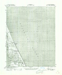
 1940 Barco1940 Print · USGSThe Currituck Banks and mainland North Carolina appear here during the early 1940s, highlighting a landscape of remote maritime villages and essential coastal navigation. Researchers can trace the Inland Waterway past Coinjock or locate early landmarks like the Currituck Beach Lighthouse and Poyner Hill C. G. Sta.2 unique versions available
 - 1940 Map of Kitty Hawk
 1940 Kitty Hawk1940 Print · USGSThe Outer Banks are captured here in the early 1940s, showing a landscape defined by maritime history and the early years of flight commemoration. Trace the grounds of the Wright Monument and locate small coastal settlements like Eagleton and Sound Landing.2 unique versions available
 - 1940 Map of Powells Point
 1940 Powells Point1940 Print · USGSThe North Carolina coast at the start of the 1940s shows the Currituck peninsula just as the Wright Memorial Bridge opened it to more travel. Trace family roots and old landings in Jarvisburg, Powells Point, and Sawyers Lodge.2 unique versions available
 - 1940 Map of Lake Drummond, 1964 Print
 1940 Lake Drummond1964 Print · USGSThe Great Dismal Swamp and its drainage canals are captured here in the 1940s, showing a landscape defined by timber extraction and transit. Genealogists and historians can trace old schools and landings from Jacks Camp to Wallaceton Sch and the Lumber RR.
 - 1940 Map of South Mills, 1976 Print
 1940 South Mills1976 Print · USGSCamden and Pasquotank counties are shown in the early 1940s as communities navigated the edges of the Dismal Swamp. Genealogists can locate family-named hubs like Pierceville and Johnsons Corner or trace the Norfolk Southern Railroad line.
 - 1943 Map of Back Bay
 1943 Back Bay1943 Print · USGSThe coastal border between Virginia and North Carolina is documented here in the early 1940s, showing a world of maritime landings and game refuges. Trace family roots at Sigma or Dawley Corners and locate old service sites like the CCC Camp and False Cape Landing.
 - 1945 Map of Lake Drummond
 1945 Lake Drummond1945 Print · USGSThe Dismal Swamp straddles the Virginia-North Carolina line in the 1940s, revealing a landscape defined by timber extraction and historic waterways. Researchers can trace the Intracoastal Waterway, the Lumber RR, and local centers like Wallaceton and Deep Creek.
 - 1946 Map of Moyock
 1946 Moyock1946 Print · USGSThe Virginia and North Carolina borderlands come alive in the mid-1940s, showing a landscape of rail-connected crossroads and tidal waterways. Genealogists can locate family landmarks like Moyock Cem, St Brides, and the Willow Grove Sch.2 unique versions available
 - 1946 Map of Eastville, 1971 Print
 1946 Eastville1971 Print · USGSCoastal Virginia and the Outer Banks are captured here during a period of expanding naval and aerospace presence. Researchers can trace the path of the Penn Central railroad through Chincoteague and Modest Town, or locate landmarks like the Wright Brothers National Memorial.
 - 1946 Map of Currituck Sound, 1980 Print
 1946 Currituck Sound1980 Print · USGSThe Virginia and North Carolina coastline appears in detail during the mid-twentieth century as a network of maritime villages and military outposts. Genealogists and local historians can trace family locations from Virginia Beach south to Kitty Hawk, including landmarks like the Currituck Beach Lighthouse and the Wright Brothers National Memorial.
 - 1948 Map of Elizabeth City
 1948 Elizabeth City1948 Print · USGSCoastal North Carolina at the end of the 1940s reveals a landscape of massive swamps and vital rail corridors. Genealogists and historians can trace family-named crossroads like Hastings Corner and Smiths Corner, or locate the old Lumber Mill and Norfolk Southern Railroad stops.2 unique versions available
End of results
Showing maps 1-11 of 11
Top cities of Currituck County
Frequently asked questions
- What are the different types of historical maps available for Currituck County?
- What is the oldest map of Currituck County?
- Where can I purchase historical maps of Currituck County for my home or office?
- Where can I download high-res historical maps of Currituck County?
- Are there historical topographic maps available for Currituck County?
- Is there historical aerial imagery available for Currituck County?
- Where are historical maps of Currituck County sourced from?