1900s (20th Century) Maps of Kill Devil Hills, North Carolina
Explore 13 historic maps of Kill Devil Hills from the 1900s (20th Century). These maps offer a rare glimpse into what life looked like during the 1900s — showing old roads, neighborhoods, homes, and landmarks that have changed or disappeared over time.
Whether you're researching your family's past, planning a metal detecting trip, or studying how Kill Devil Hills's landscape evolved across the 1900s, these high-resolution maps are a powerful tool for exploring the history of this region.
- Focus on a specific era: All maps on this page are from the 1900s, giving you a focused view of this time period.
- See what’s changed: Compare century-old streets, trails, and buildings to today's modern landscape using overlays and satellite layers.
- Research with precision: Use these maps for genealogy, historical research, land use analysis, or educational projects.
- View, download, or print: Maps are fully viewable online in high resolution, and can be downloaded or printed for your own records.
Start exploring Kill Devil Hills's history through authentic maps from the 1900s. This is your window into the past.
Kill Devil Hills, NC maps
(13)- 1940 Map of Kitty Hawk
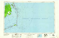
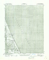 1940 Kitty Hawk1940 Print · USGSThe Outer Banks are captured here in the early 1940s, showing a landscape defined by maritime history and the early years of flight commemoration. Trace the grounds of the Wright Monument and locate small coastal settlements like Eagleton and Sound Landing.2 unique versions available
 - 1943 Map of Roanoke Island
 1943 Roanoke Island1943 Print · USGSCoastal North Carolina during the war years shows a network of maritime outposts and isolated mainland settlements connected by ferry. Trace the old village of Buffalo City, locate the Bodie Island Lighthouse, and find historic Coast Guard stations at Nags Head and Chicamacomico CG.
 - 1946 Map of Eastville, 1971 Print
 1946 Eastville1971 Print · USGSCoastal Virginia and the Outer Banks are captured here during a period of expanding naval and aerospace presence. Researchers can trace the path of the Penn Central railroad through Chincoteague and Modest Town, or locate landmarks like the Wright Brothers National Memorial.
 - 1946 Map of Currituck Sound, 1980 Print
 1946 Currituck Sound1980 Print · USGSThe Virginia and North Carolina coastline appears in detail during the mid-twentieth century as a network of maritime villages and military outposts. Genealogists and local historians can trace family locations from Virginia Beach south to Kitty Hawk, including landmarks like the Currituck Beach Lighthouse and the Wright Brothers National Memorial.
 - 1953 Map of Manteo, 1956 Print
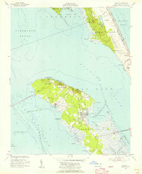 1953 Manteo1956 Print · USGSRoanoke Island and the Outer Banks are captured here in the early fifties, before decades of intensive coastal development. Genealogists and historians can trace family-named sites like Mother Vineyard and the early layout of Manteo and Skyco.5 unique versions available
 - 1955 Map of Wanchese
 1955 Wanchese1955 Print · USGSThe Outer Banks and Dare County mainland are captured in the mid-1950s, showing the maritime isolation and early highway connections of the coast. Researchers can locate coastal landmarks like the Cape Hatteras Light, the remote settlement of Buffalo City, and fishing villages from Rodanthe to Ocracoke.
 - 1957 Map of Manteo, 1967 Print
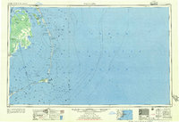
 1957 Manteo1967 Print · USGSThe Outer Banks and Albemarle Sound are captured in the late fifties as the national seashore and wildlife refuges were newly established. Trace the coastal villages from Manteo to Hatteras, and locate landmarks like the Cape Hatteras Lighthouse and Billy Mitchell field.3 unique versions available
 - 1960 Map of Manteo
 1960 Manteo1960 Print · USGSThe Outer Banks and Dare County in the early sixties reveal a landscape defined by maritime tradition and shifting sands. Genealogists can trace family lines through villages like Rodanthe and Buxton or locate landmarks like Fort Raleigh and the Cape Hatteras Lighthouse.
 - 1961 Map of Eastville
 1961 Eastville1961 Print · USGSThe Eastern Shore and Outer Banks are captured here in the mid-twentieth century, showing a maritime landscape of lighthouses, rail-linked towns, and naval outposts. Researchers can trace the Pennsylvania Railroad through Parksley or locate historical sites like Chincoteague Field Naval Auxiliary Air Station and Tangier Island.
 - 1966 Map of Eastville
 1966 Eastville1966 Print · USGSThe Delmarva Peninsula and Outer Banks appear in the mid-sixties, showing a landscape of maritime trade, military outposts, and fishing villages. Researchers can trace the lines of the Norfolk & Southern through Exmore and Parksley or locate historical sites like Fort John Custis and the Janes Island Lighthouse.
 - 1982 Map of Kitty Hawk, 1983 Print
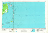
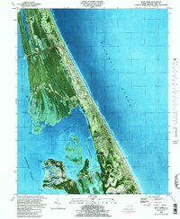 1982 Kitty Hawk1983 Print · USGSThe Outer Banks come into focus in the early eighties as coastal communities and landmarks like the Wright Brothers Nat Mem define the landscape. Trace the development of Kitty Hawk and Colington, and locate family sites like Austin Cem or Hilltop Cem.
 - 1985 Map of Currituck Sound
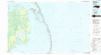
 1985 Currituck Sound1985 Print · USGSThe Outer Banks and Currituck Sound are documented in the mid-1980s, during a period of steady coastal growth and preservation. Researchers can locate long-standing maritime landmarks like the Currituck Beach Lighthouse and trace the original footprints of settlements from Corolla to Kitty Hawk.2 unique versions available
 - 1985 Map of Manteo
 1985 Manteo1985 Print · USGSThe Outer Banks and Roanoke Island appear in the mid-1980s, showcasing the early development of the modern coastal landscape. Researchers can trace family ties and coastal landmarks from Kill Devil Hills down to the remote village of Stumpy Point.2 unique versions available
End of results
Showing maps 1-13 of 13
Top cities near Kill Devil Hills
- Kitty Hawk historical maps
- Nags Head historical maps
- Grandy historical maps
- Southern Shores historical maps
- Wanchese historical maps
- Manteo historical maps
See more
Frequently asked questions
- What are the different types of historical maps available for Kill Devil Hills?
- What is the oldest map of Kill Devil Hills?
- Where can I purchase historical maps of Kill Devil Hills for my home or office?
- Where can I download high-res historical maps of Kill Devil Hills?
- Are there historical topographic maps available for Kill Devil Hills?
- Is there historical aerial imagery available for Kill Devil Hills?
- Where are historical maps of Kill Devil Hills sourced from?