1900s (20th Century) Maps of Duplin County, North Carolina
Explore 52 historic maps of Duplin County from the 1900s (20th Century). These maps offer a rare glimpse into what life looked like during the 1900s — showing old roads, neighborhoods, homes, and landmarks that have changed or disappeared over time.
Whether you're researching your family's past, planning a metal detecting trip, or studying how Duplin County's landscape evolved across the 1900s, these high-resolution maps are a powerful tool for exploring the history of this region.
- Focus on a specific era: All maps on this page are from the 1900s, giving you a focused view of this time period.
- See what’s changed: Compare century-old streets, trails, and buildings to today's modern landscape using overlays and satellite layers.
- Research with precision: Use these maps for genealogy, historical research, land use analysis, or educational projects.
- View, download, or print: Maps are fully viewable online in high resolution, and can be downloaded or printed for your own records.
Start exploring Duplin County's history through authentic maps from the 1900s. This is your window into the past.
Duplin County, NC maps
(52)- 1942 Map of Burgaw
 1942 Burgaw1942 Print · USGSMid-century Pender County reveals a fascinating mix of swamp wilderness and planned agricultural colonies. Genealogists and researchers can trace family lands in Penderlea Homesteads, explore the immigrant history of St. Helena, and locate features like the Prison Camp and Boney Mill Pond.2 unique versions available
 - 1943 Map of Kenansville
 1943 Kenansville1943 Print · USGSDuplin County during the early 1940s shows a landscape of river-dependent settlements and rural commerce. Genealogists and researchers can trace family-named landmarks such as Teacheys Store, Sholars Crossroads, and Jones Chapel.
 - 1948 Map of Kenansville
 1948 Kenansville1948 Print · USGSDuplin County appears here in the late 1940s as a landscape of small crossroads and family-run stores connected by a growing highway system. Researchers can trace ancestral roots through local landmarks like Teacheys Store, Petersburg Crossing, and rural congregations at Dobson Ch.
 - 1948 Map of Maple Hill
 1948 Maple Hill1948 Print · USGSSoutheastern North Carolina is mapped here just after the war, showing the deep swamp landscapes of the coastal plain. Genealogists and researchers can trace the roads connecting Maple Hill to Camp Davis and locate rural landmarks like Waltons Store.2 unique versions available
 - 1948 Map of Richlands
 1948 Richlands1948 Print · USGSCoastal North Carolina's rural landscape comes alive in this post-war study of the Onslow and Duplin county borderlands. Genealogists and historians can trace family-named sites like Huffmantown, Potters Hill, and distinctive terrain like Hell Pocosin.2 unique versions available
 - 1953 Map of Florence, 1964 Print
 1953 Florence1964 Print · USGSThe Carolina borderlands in the mid-fifties were a landscape of vast river swamps and rising rail towns. Trace the legacy of the Seaboard Air Line through Florence or explore the wetlands surrounding Lake Waccamaw and the Green Swamp.3 unique versions available
 - 1953 Map of Rocky Mount, 1964 Print
 1953 Rocky Mount1964 Print · USGSEastern North Carolina in the mid-fifties is defined by its deep river basins and the vast wetlands of the Tidewater. Genealogists can trace family roots through hubs like Kinston and New Bern or explore the wilderness of Pettigrew State Park and Lake Mattamuskeet.4 unique versions available
 - 1953 Map of Raleigh, 1965 Print
 1953 Raleigh1965 Print · USGSCentral North Carolina in the early sixties shows a landscape of growing towns and military hubs before the full expansion of the interstate system. Genealogists can trace family footprints across the Piedmont through Wake Forest, Siler City, and the large Fort Bragg Military Reservation.4 unique versions available
 - 1953 Map of Beaufort, 1965 Print
 1953 Beaufort1965 Print · USGSThe North Carolina coastline in the mid-fifties reveals an era of massive military expansion alongside traditional maritime life. Genealogists can trace family names and small settlements from Sealevel to Sneads Ferry or locate landmarks like Fort Macon.3 unique versions available
 - 1954 Map of Rocky Mount
 1954 Rocky Mount1954 Print · USGSEastern North Carolina is mapped in the mid-fifties, showing a landscape of sounds, swamps, and steam-era rail lines. Genealogists can trace the rural road networks and rail spurs connecting towns like Tarboro, Greenville, and the remote Columbia.
 - 1954 Map of Florence
 1954 Florence1954 Print · USGSThe Carolinas borderlands come alive in the early fifties, showing the vital rail-and-river networks of the coastal plain. Genealogists can trace family footprints across the Green Swamp or through settlements like Red Springs, Chadbourn, and McColl.
 - 1954 Map of Raleigh
 1954 Raleigh1954 Print · USGSThe North Carolina Piedmont and Sandhills are captured in the mid-fifties during a period of steady regional growth. Genealogists and historians can trace the development of towns like Siler City or locate landmarks such as Falls of Neuse and Camp Mackall.
 - 1954 Map of Beaufort
 1954 Beaufort1954 Print · USGSCoastal North Carolina in the mid-fifties reveals a landscape of strategic military installations, sprawling wetlands, and thriving rail towns. Genealogists and historians can trace the foundations of Wilmington, the rural reaches of Duplin County, and shoreline landmarks like Cape Lookout and Carolina Beach.
 - 1955 Map of Atkinson, 1957 Print
 1955 Atkinson1957 Print · USGSCoastal plain life in the mid-1950s revolves around the timberlands and rail-stops between the Black River and Moores Creek. Genealogists and historians can trace family ties through dozens of rural landmarks like Newtons Crossroads, St. Marys Ch, and Bland High Sch.2 unique versions available
 - 1957 Map of Seven Springs, 1959 Print
 1957 Seven Springs1959 Print · USGSEastern North Carolina was a patchwork of crossroads communities and swampy river bottoms in the late fifties. Genealogists can locate family-named landmarks like Williams Millpond, trace rural congregations at Indian Springs, and find old centers like Scotts Store.
 - 1958 Map of Deep Run, 1959 Print
 1958 Deep Run1959 Print · USGSCoastal plain life in the late fifties is captured here through a dense network of Lenoir and Jones County crossroads and river landings. Trace family roots at Lawsons Mill, Quaker House Ch, and vanished school sites like Township Sch.2 unique versions available
 - 1962 Map of Rose Hill, 1964 Print
 1962 Rose Hill1964 Print · USGSCoastal plain life in the early sixties centers on the rail-aligned towns of Rose Hill and Warsaw. Genealogists and local historians can locate dozens of country churches and schools, from Holly Grove Ch to the Williams Sch, alongside the Rose Hill Speedway.
 - 1965 Map of Richlands
 1965 Richlands1965 Print · USGSRichlands and the surrounding coastal plains of Onslow County are captured here in the mid-sixties as rural communities were evolving. Genealogists can locate family-named landmarks and institutions like Huffmantown, Potters Hill Sch, and Bethany Chapel.
 - 1972 Map of Beaufort, 1975 Print
 1972 Beaufort1975 Print · USGSThe North Carolina coast in the early seventies shows a landscape defined by massive military bases and coastal sounds. Trace rural family roots at Sarecta and Catherine Lake or explore the barrier islands of the Cape Lookout National Seashore.
 - 1975 Map of Faison, 1977 Print
 1975 Faison1977 Print · USGSThe coastal plain of North Carolina is captured here in the mid-seventies, showing the intersection of the Seaboard Coast Line and rural farming life. Genealogists can locate family landmarks like Millers Chapel, Hargrove Sch, and dozens of unnamed rural cemeteries near Faison.
 - 1977 Map of Warsaw North
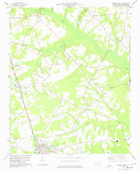 1977 Warsaw North1977 Print · USGSDuplin County in the late seventies is captured here as a landscape of rural hamlets and swamp drainage networks. Genealogists and historians can trace family locations through numerous country churches like Sanford Ch, old railroad infrastructure, and the streets of Warsaw.
 - 1977 Map of Mount Olive
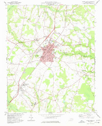 1977 Mount Olive1977 Print · USGSMount Olive and the surrounding Wayne County farmlands are seen here in the late seventies as the region's rail and educational centers expanded. Genealogists can trace family landmarks and numerous rural congregations like Rones Chapel, Mt Gilead Ch, and Maplewood Cem.
 - 1978 Map of Dobbersville
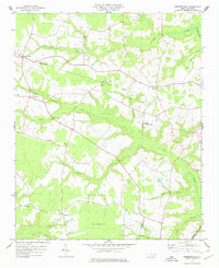 1978 Dobbersville1978 Print · USGSSampson County and the surrounding tri-county area are shown in the late 1970s, characterized by rural settlements and expansive swamp systems. Genealogists can trace family connections through numerous country churches like Brownings Ch and Goshen Ch or locate homes near Suttontown.
 - 1980 Map of Seven Springs
 1980 Seven Springs1980 Print · USGSCoastal plain life in eastern North Carolina comes into focus during the late seventies, centered on the oxbows of the Neuse River. Genealogists and historians can trace community roots at Outlaws Bridge, Husseys Crossroads, and the grounds of New Jerusalem Ch.
 - 1980 Map of Summerlins Crossroads
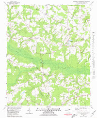 1980 Summerlins Crossroads1980 Print · USGSDuplin County rural life is preserved here in the era just before the 1980s, centered on the wetlands of Goshen Swamp. Genealogists can trace family landmarks at Summerlins Crossroads, Scotts Store, and the Alum Springs Cem.
Showing maps 1-25 of 52
Top cities of Duplin County
- Warsaw historical maps
- Rose Hill historical maps
- Beulaville historical maps
- Magnolia historical maps
- Kenansville historical maps
- Faison historical maps
See more
Frequently asked questions
- What are the different types of historical maps available for Duplin County?
- What is the oldest map of Duplin County?
- Where can I purchase historical maps of Duplin County for my home or office?
- Where can I download high-res historical maps of Duplin County?
- Are there historical topographic maps available for Duplin County?
- Is there historical aerial imagery available for Duplin County?
- Where are historical maps of Duplin County sourced from?