1900s (20th Century) Maps of Forsyth County, North Carolina
Explore 42 historic maps of Forsyth County from the 1900s (20th Century). These maps offer a rare glimpse into what life looked like during the 1900s — showing old roads, neighborhoods, homes, and landmarks that have changed or disappeared over time.
Whether you're researching your family's past, planning a metal detecting trip, or studying how Forsyth County's landscape evolved across the 1900s, these high-resolution maps are a powerful tool for exploring the history of this region.
- Focus on a specific era: All maps on this page are from the 1900s, giving you a focused view of this time period.
- See what’s changed: Compare century-old streets, trails, and buildings to today's modern landscape using overlays and satellite layers.
- Research with precision: Use these maps for genealogy, historical research, land use analysis, or educational projects.
- View, download, or print: Maps are fully viewable online in high resolution, and can be downloaded or printed for your own records.
Start exploring Forsyth County's history through authentic maps from the 1900s. This is your window into the past.
Forsyth County, NC maps
(42)- 1949 Map of Eller, 1952 Print
 1949 Eller1952 Print · USGSDavidson County in the late 1940s was a landscape of farmsteads and rural parishes connected by winding creek-side roads. Genealogists and local historians can locate specific community hubs like Midway School, Gum Tree, and churches such as Bethlehem Church or Hebron Church.2 unique versions available
 - 1950 Map of Winston-Salem West, 1965 Print
 1950 Winston-Salem West1965 Print · USGSWinston-Salem and its western Forsyth County environs are documented here at a mid-century turning point between city and country. Genealogists and local historians can trace family locations near Clemmons, Old Town, and historic congregations like Fraternity Ch.4 unique versions available
 - 1950 Map of Winston-Salem East, 1965 Print
 1950 Winston-Salem East1965 Print · USGSMid-century Winston-Salem is captured here during its post-war growth, showing the city's eastern neighborhoods and surrounding rural crossroads. Genealogists and historians can trace institutional roots at State Teachers College and find family-named churches like New Friendship Church.5 unique versions available
 - 1951 Map of Winston-Salem West
 1951 Winston-Salem West1951 Print · USGSThe western suburbs of Winston-Salem meet the rural Piedmont during the early 1950s growth spurt. Genealogists can trace family landmarks and local institutions from Ketner Chapel to Jonestown, as well as older school sites like Wiley Sch and Griffith Sch.
 - 1951 Map of Winston-Salem East
 1951 Winston-Salem East1951 Print · USGSMid-century Forsyth County shows the expansion of Winston-Salem toward Kernersville during a period of significant institutional and industrial growth. Researchers can locate local landmarks like Salem College, trace the Southern rail lines, and find rural centers such as Waughtown and Friedland Ch.
 - 1951 Map of Rural Hall, 1952 Print
 1951 Rural Hall1952 Print · USGSForsyth County in the early fifties shows a transition from rural Moravian tracts to mid-century growth. Trace family roots at Stewards Chapel Cem, find old school sites like Old Town Sch, or locate the Bethania Station along the Southern rail line.4 unique versions available
 - 1951 Map of Walkertown, 1953 Print
 1951 Walkertown1953 Print · USGSForsyth County at mid-century shows the expanding footprint of Winston-Salem meeting the rural homesteads of Middle Fork. Genealogists can trace family names through landmarks like the Memorial Industrial Sch, Odd Fellows Cemetery, and Ogburn Sta.5 unique versions available
 - 1953 Map of Charlotte, 1968 Print
 1953 Charlotte1968 Print · USGSThe North Carolina Piedmont and South Carolina borderlands are shown in detail during a period of significant growth and reservoir development. Trace the rail corridors of the Southern Railway or find family roots in towns like China Grove, Misenheimer, and Lincolnton.3 unique versions available
 - 1953 Map of Winston-Salem, 1974 Print
 1953 Winston-Salem1974 Print · USGSThe North Carolina Piedmont and Virginia highlands meet in the mid-1950s, a landscape defined by the tobacco and textile hubs of the Blue Ridge foothills. Researchers can trace the rail-and-river geography connecting Winston-Salem to mountain towns like Mount Airy and Galax.2 unique versions available
 - 1954 Map of Charlotte
 1954 Charlotte1954 Print · USGSThe North Carolina Piedmont in the mid-1950s shows a region of rapid growth and industrial expansion centered around Charlotte. Trace the era's infrastructure through the Southern railroad lines and locate significant landmarks like the Charlotte Naval Ammunition Depot and Lake Norman.2 unique versions available
 - 1955 Map of Winston-Salem
 1955 Winston-Salem1955 Print · USGSThe Central Blue Ridge and Piedmont transition are captured here in the mid-fifties, from the industrial hub of Winston-Salem to the high peaks of Southwest Virginia. Genealogists can trace family landmarks like Richmond Hill Ch, Siloam Ch, and the old rail stops along the Southern Railway.
 - 1960 Map of Charlotte
 1960 Charlotte1960 Print · USGSMid-century North Carolina and South Carolina meet in this 1960 survey of the Piedmont's industrial and textile heartland. Trace the growth of Charlotte alongside historic landmarks like Kings Mountain National Military Park and the Charlotte Naval Ammunition Depot.2 unique versions available
 - 1962 Map of Winston-Salem
 1962 Winston-Salem1962 Print · USGSThe North Carolina Piedmont meets the Virginia highlands in the early sixties, showing the rail corridors and mountain gaps of the southern Appalachians. Researchers can trace the Blue Ridge Parkway or locate family sites near Winston-Salem, Mount Airy, and Hanging Rock Mountain.
 - 1962 Map of Charlotte
 1962 Charlotte1962 Print · USGSThe North Carolina Piedmont in the early sixties showcases a landscape transformed by massive reservoirs and industrial growth. Researchers can trace the development of Lake Norman, locate the Charlotte Naval Ammunition Depot, or find family landmarks like Wesley Chapel and Brown & Norcott Mills.
 - 1964 Map of Pinnacle, 1965 Print
 1964 Pinnacle1965 Print · USGSStokes County at the mid-century shows a landscape defined by the towering Pilot Mountain and the Southern railroad. Trace family roots and local history at Pinnacle, Mt Moriah Ch, and the Wall Cem.4 unique versions available
 - 1964 Map of King, 1965 Print
 1964 King1965 Print · USGSStokes County and the Piedmont plateau are captured here in the mid-sixties as small rural communities like Quaker Gap and Mountain View thrive. Genealogists can trace family landmarks and rural life through Jefferson Church, the King Airport, and numerous small cemeteries.3 unique versions available
 - 1966 Map of Farmington, 1967 Print
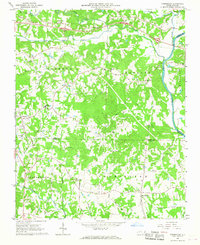 1966 Farmington1967 Print · USGSYadkin and Davie Counties are shown in the mid-1960s as the rural landscape centered on the Yadkin River began to modernize. Genealogists and local historians can trace family-named landmarks and old routes like the Old Stage Road, Huntsville, and the Sportsmans Park Drag Strip.2 unique versions available
 - 1968 Map of Clemmons, 1970 Print
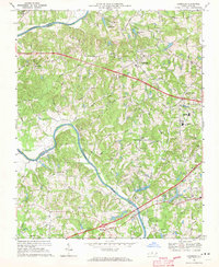 1968 Clemmons1970 Print · USGSForsyth County experiences a period of steady growth during the late sixties as the area between Lewisville and Clemmons develops. Researchers can trace family landmarks and local institutions from Tanglewood Park to rural congregations like Shiloh Ch and Union Hill Ch.3 unique versions available
 - 1968 Map of Vienna, 1970 Print
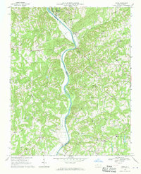 1968 Vienna1970 Print · USGSThe Yadkin River valley in the late sixties reveals a landscape of rural congregations and small river-adjacent communities. Researchers can locate family landmarks like New Bethel Cem Ch or trace the early paths of the Southern railroad and the local Drag Strip.2 unique versions available
 - 1969 Map of Kernersville, 1972 Print
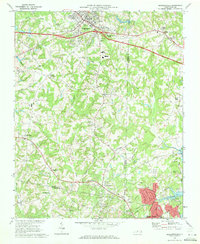 1969 Kernersville1972 Print · USGSThe Piedmont Triad takes shape in the late sixties as Kernersville and High Point begin to grow together. Genealogists and historians can trace the foundations of local communities at Beeson Crossroads, Southern Pilgrim College, and Union Cross.3 unique versions available
 - 1969 Map of Welcome, 1972 Print
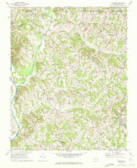 1969 Welcome1972 Print · USGSThe Piedmont countryside of North Carolina appears here in the late sixties, showing the rural communities of Davidson County before modern expansion. Genealogists and local historians can trace family roots through numerous landmarks like Eureka Mills, Good Hope Ch, and the Winston-Salem Southbound railroad line.2 unique versions available
 - 1969 Map of Belews Creek, 1972 Print
 1969 Belews Creek1972 Print · USGSThe rural Piedmont region of Forsyth County is captured here just as the landscape was adapting to post-war growth. Researchers can trace the roots of local communities through landmarks like Crims Crossroads, Pine Ridge Ch, and the waters of Belews Lake.3 unique versions available
 - 1969 Map of Advance, 1972 Print
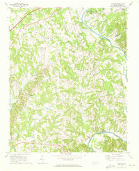 1969 Advance1972 Print · USGSThe Yadkin River valley near the turn of the 1970s shows a landscape of rural crossroads and riverfront recreation. Genealogists and local historians can trace family locations near Fork Church, Mocks Ch, and the old community of Yadkin College.2 unique versions available
 - 1969 Map of Midway, 1973 Print
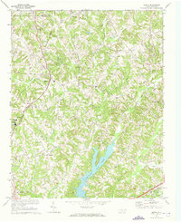 1969 Midway1973 Print · USGSDavidson County's rural communities and developing infrastructure are captured here in the late sixties as the Piedmont landscape transitioned. Genealogists and researchers can locate family sites like Bethlehem Cem, Saints Delite Ch, and the sprawling Tom-A-Lex Lake.4 unique versions available
 - 1971 Map of Walnut Cove, 1973 Print
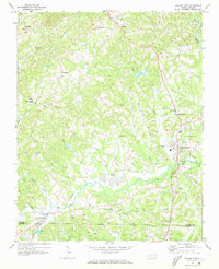 1971 Walnut Cove1973 Print · USGSStokes County in the early seventies shows a landscape where rail lines and river valleys shaped the growth of communities like Walnut Cove. Researchers can trace local heritage through landmarks like Germanton, the Meadow Brook Airfield, and Palmyra Ch.3 unique versions available
Showing maps 1-25 of 42
Top cities of Forsyth County
- Winston-Salem historical maps
- Kernersville historical maps
- Clemmons historical maps
- Lewisville historical maps
- Walkertown historical maps
- Rural Hall historical maps
See more
Frequently asked questions
- What are the different types of historical maps available for Forsyth County?
- What is the oldest map of Forsyth County?
- Where can I purchase historical maps of Forsyth County for my home or office?
- Where can I download high-res historical maps of Forsyth County?
- Are there historical topographic maps available for Forsyth County?
- Is there historical aerial imagery available for Forsyth County?
- Where are historical maps of Forsyth County sourced from?