1970s Maps of Forsyth County, North Carolina
Explore 10 historic maps of Forsyth County from the 1970s. These maps offer a rare glimpse into what life looked like during the 1970s — showing old roads, neighborhoods, homes, and landmarks that have changed or disappeared over time.
Whether you're researching your family's past, planning a metal detecting trip, or studying how Forsyth County's landscape evolved across the 1970s, these high-resolution maps are a powerful tool for exploring the history of this region.
- Focus on a specific era: All maps on this page are from the 1970s, giving you a focused view of this time period.
- See what’s changed: Compare century-old streets, trails, and buildings to today's modern landscape using overlays and satellite layers.
- Research with precision: Use these maps for genealogy, historical research, land use analysis, or educational projects.
- View, download, or print: Maps are fully viewable online in high resolution, and can be downloaded or printed for your own records.
Start exploring Forsyth County's history through authentic maps from the 1970s. This is your window into the past.
Forsyth County, NC maps
(10)- 1971 Map of Walnut Cove, 1973 Print
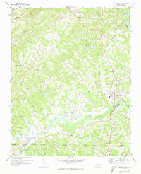 1971 Walnut Cove1973 Print · USGSStokes County in the early seventies shows a landscape where rail lines and river valleys shaped the growth of communities like Walnut Cove. Researchers can trace local heritage through landmarks like Germanton, the Meadow Brook Airfield, and Palmyra Ch.3 unique versions available
 - 1971 Map of Belews Lake, 1973 Print
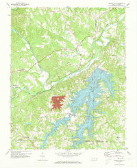 1971 Belews Lake1973 Print · USGSThe rural borderlands of Stokes and Rockingham counties are captured here in the early 1970s as the landscape transformed around Belews Lake. Researchers can trace old family sites near Pine Hall, Camp Vaughn, and country landmarks like Sycamore Ch.3 unique versions available
 - 1977 Map of Walkertown, 1979 Print
 1977 Walkertown1979 Print · USGSForsyth County is shown in transition during the late seventies as the suburban reach of Winston-Salem meets the rural Piedmont. Genealogists and local researchers can trace the growth of Walkertown and the woodlots near Belews Creek.
 - 1977 Map of Kernersville, 1979 Print
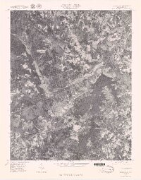
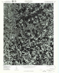
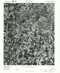
 1977 Kernersville1979 Print · USGSIn the late seventies, the Piedmont landscape around Kernersville was undergoing a significant transformation from rural fields to suburban outskirts. Genealogists and local historians can trace family-named locations such as Beeson Crossroads, Horneytown, and Union Cross.
 - 1977 Map of Clemmons, 1979 Print
 1977 Clemmons1979 Print · USGSThe northern Piedmont and the winding Yadkin River appear in detailed aerial photography from the late seventies. Researchers can trace property lines and the early footprints of settlements like Lewisville, Grapewood, and Hillsdale.
 - 1977 Map of Belews Lake, 1979 Print
 1977 Belews Lake1979 Print · USGSThe Dan River and its surrounding Piedmont landscapes are captured in detail in the late seventies. Researchers can trace the sprawling shoreline of Belews Lake or locate the historic settlement of Pine Hall along the Dan River.
 - 1977 Map of Belews Creek, 1979 Print
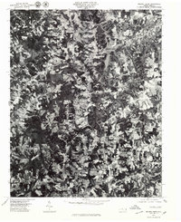 1977 Belews Creek1979 Print · USGSNorth Carolina's central Piedmont is captured here during the late 1970s, showcasing the rural character and emerging development of Forsyth County. Researchers can trace the exact 1977 land-use patterns around Kernersville and the expansive shoreline of Belews Lake.
 - 1977 Map of Rural Hall, 1979 Print
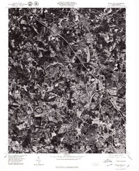 1977 Rural Hall1979 Print · USGSForsyth County's Piedmont landscape is captured here in the late seventies, showing a period of suburban transition. Researchers can trace the development of Rural Hall, Bethania, and Tobaccoville through these detailed aerial views.
 - 1977 Map of Winston-Salem East, 1979 Print
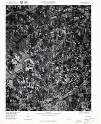
 1977 Winston-Salem East1979 Print · USGSWinston-Salem and its eastern suburbs are captured in high-altitude detail during the late seventies, showing the city's modern expansion. Trace the growth of local neighborhoods like Sunnyside and Rosemont or the wooded shores of Salem Lake.
 - 1977 Map of Winston-Salem West, 1979 Print
 1977 Winston-Salem West1979 Print · USGSWinston-Salem and its western suburbs appear in striking detail during the late seventies as the city expanded toward the outskirts. Genealogists and local researchers can trace specific street layouts and property boundaries in neighborhoods like Ardmore, Clemmons, and Reynolda.
End of results
Showing maps 1-10 of 10
Top cities of Forsyth County
- Winston-Salem historical maps
- Kernersville historical maps
- Clemmons historical maps
- Lewisville historical maps
- Walkertown historical maps
- Rural Hall historical maps
See more
Frequently asked questions
- What are the different types of historical maps available for Forsyth County?
- What is the oldest map of Forsyth County?
- Where can I purchase historical maps of Forsyth County for my home or office?
- Where can I download high-res historical maps of Forsyth County?
- Are there historical topographic maps available for Forsyth County?
- Is there historical aerial imagery available for Forsyth County?
- Where are historical maps of Forsyth County sourced from?