2020s Maps of Fort Liberty, North Carolina
Explore 10 historic maps of Fort Liberty from the 2020s. These maps offer a rare glimpse into what life looked like during the 2020s — showing old roads, neighborhoods, homes, and landmarks that have changed or disappeared over time.
Whether you're researching your family's past, planning a metal detecting trip, or studying how Fort Liberty's landscape evolved across the 2020s, these high-resolution maps are a powerful tool for exploring the history of this region.
- Focus on a specific era: All maps on this page are from the 2020s, giving you a focused view of this time period.
- See what’s changed: Compare century-old streets, trails, and buildings to today's modern landscape using overlays and satellite layers.
- Research with precision: Use these maps for genealogy, historical research, land use analysis, or educational projects.
- View, download, or print: Maps are fully viewable online in high resolution, and can be downloaded or printed for your own records.
Start exploring Fort Liberty's history through authentic maps from the 2020s. This is your window into the past.
Fort Liberty, NC maps
(10)- 2022 Map of Manchester, 2022 Print
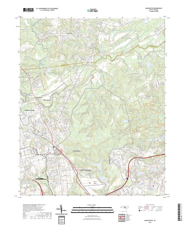 2022 Manchester2022 Print · USGSCumberland County’s military and civilian life intersect north of Fayetteville in the early 2020s. Researchers can locate family landmarks at the Sandhills State Veterans Cem and trace the development around Spring Lake and Simmons Army Airfield.
 - 2022 Map of Nicholson Creek, 2022 Print
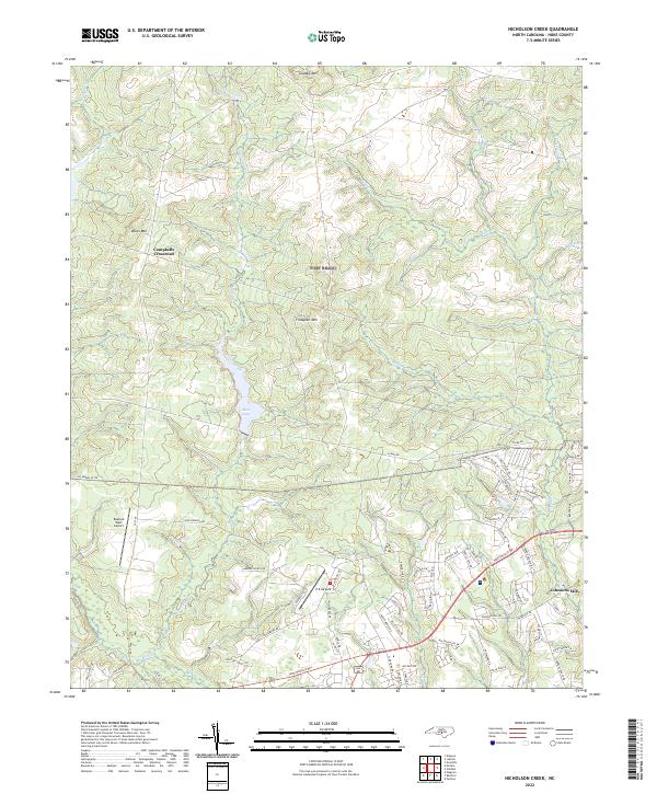 2022 Nicholson Creek2022 Print · USGSHoke County in the 2020s shows a landscape of rising ridges and aviation hubs defined by the drainage of Nicholson Creek. Researchers can trace old routes near Campbells Crossroad, find Johnsons Mill, and locate Mott Lake.
 - 2022 Map of Overhills, 2022 Print
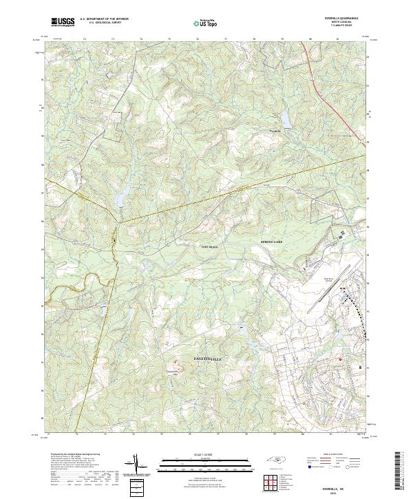 2022 Overhills2022 Print · USGSThe crossroads where Cumberland, Harnett, Hoke, and Moore counties meet are captured here during a period of steady military and suburban growth. Researchers can trace family names along McRae Ridge Rd or explore the hydrography of McFayden Pond and Pope Army Airfield.
 - 2022 Map of Olivia, 2022 Print
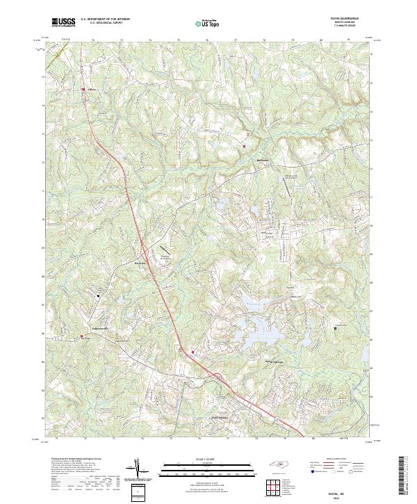 2022 Olivia2022 Print · USGSHarnett County enters the 2020s with a mix of established rural settlements and modern aviation hubs. Genealogists and local historians can trace the foundations of the area through sites like Old Church Cem, the Armstrong Cemetery, and the crossroads at Johnsonville and Spout Springs.
 - 2022 Map of Niagara, 2022 Print
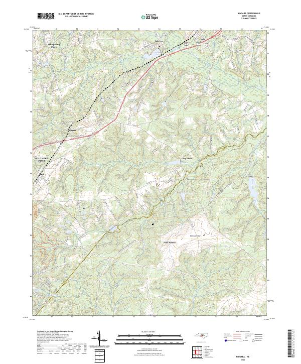 2022 Niagara2022 Print · USGSThe Moore County Sandhills come into focus here in the early 2020s, showing a landscape defined by golf-adjacent residential growth and traditional southern hamlets. Genealogists and researchers can trace the area surrounding Goins Cem or follow the rail-aligned history of Niagara and Manly.
 - 2022 Map of Lobelia, 2022 Print
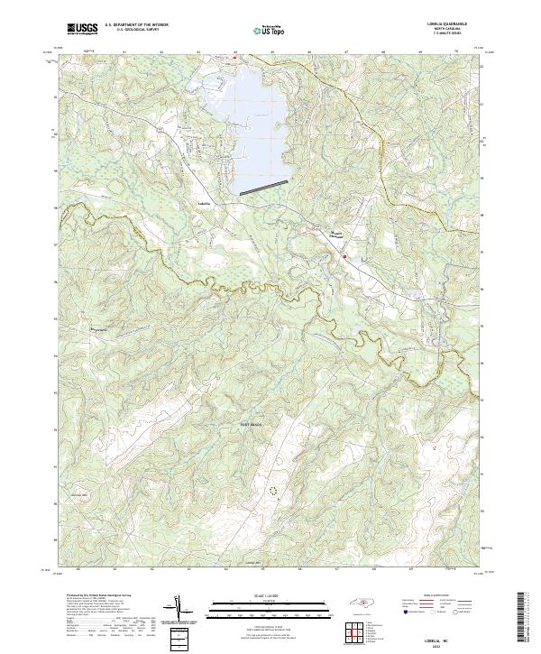 2022 Lobelia2022 Print · USGSThe rural Sandhills country at the meeting of Moore, Harnett, and Hoke counties comes into focus in this early twenty-first-century survey. Genealogists and researchers can trace local family landholdings along Lobelia Rd and near Lake Surf or the banks of the Little River.
 - 2022 Map of Pinebluff, 2022 Print
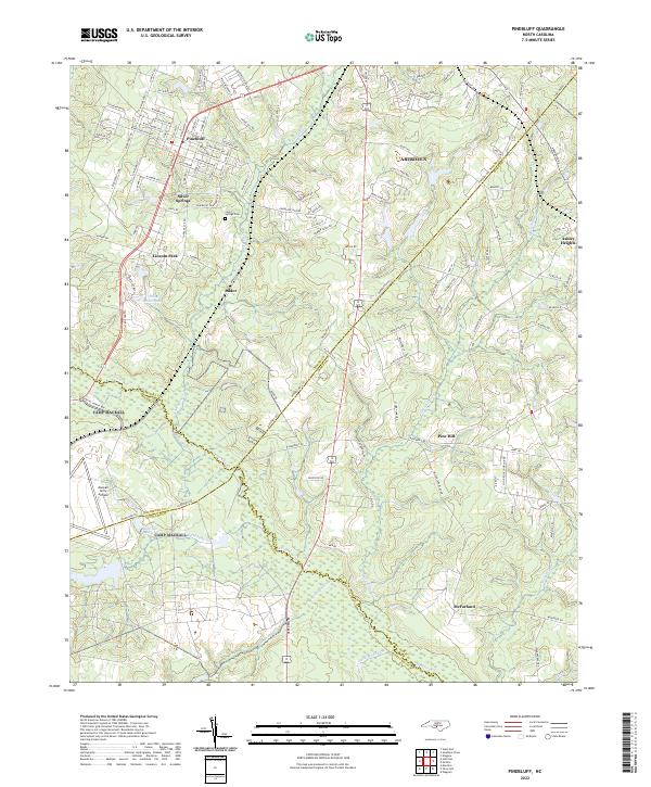 2022 Pinebluff2022 Print · USGSThe Sandhills region at the Moore and Richmond county line comes into focus in the early 2020s. Genealogists can locate family sites near Silver Springs Cem or trace the rural reach of Addor and McFarland along the banks of Drowning Cr.
 - 2022 Map of McCain, 2022 Print
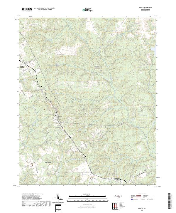 2022 McCain2022 Print · USGSHoke County in the early 2020s remains a landscape of traditional crossroads and flowing creeks south of the sandhills. Researchers can trace the development of Ashley Heights, the residential layout of Montrose, and landmarks like Viking Airport.
 - 2022 Map of Clifdale, 2022 Print
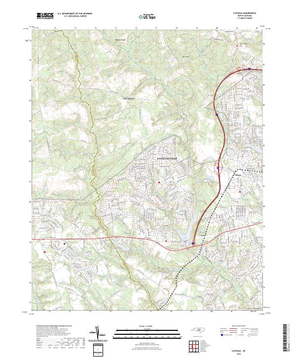 2022 Clifdale2022 Print · USGSCumberland County and Hoke County see significant suburban expansion in the early twenty-first century as modern neighborhoods press against the Atlantic Coastal Plain. Researchers can trace local development around Clifdale, locate Galatia Ch, and follow the historic Bones Ford crossing.
 - 2022 Map of Fayetteville, 2022 Print
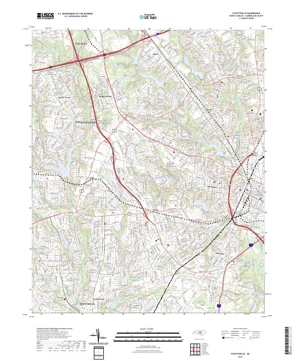 2022 Fayetteville2022 Print · USGSFayetteville and its southern neighbor Hope Mills appear at a moment of significant 21st-century growth and urban density. Researchers can trace local landmarks from the Cumberland County Courthouse to the historic grounds of Cumberland Cem and Bonnie Doone Lake.
End of results
Showing maps 1-10 of 10
Top cities near Fort Liberty
- Fayetteville historical maps
- Linden Oaks historical maps
- Southern Pines historical maps
- Hope Mills historical maps
- Spring Lake historical maps
- Aberdeen historical maps
See more
Top neighborhoods of Fort Liberty
- Biazza Ridge historical maps
- Ardennes/Bataan historical maps
- Hammond Hills historical maps
- Saint Mere Eglise historical maps
- Hammond Hills historical maps
- Overhills historical maps
See more
Frequently asked questions
- What are the different types of historical maps available for Fort Liberty?
- What is the oldest map of Fort Liberty?
- Where can I purchase historical maps of Fort Liberty for my home or office?
- Where can I download high-res historical maps of Fort Liberty?
- Are there historical topographic maps available for Fort Liberty?
- Is there historical aerial imagery available for Fort Liberty?
- Where are historical maps of Fort Liberty sourced from?