2000s (21st Century) Maps of Tryon, North Carolina
Explore 6 historic maps of Tryon from the 2000s (21st Century). These maps offer a rare glimpse into what life looked like during the 2000s — showing old roads, neighborhoods, homes, and landmarks that have changed or disappeared over time.
Whether you're researching your family's past, planning a metal detecting trip, or studying how Tryon's landscape evolved across the 2000s, these high-resolution maps are a powerful tool for exploring the history of this region.
- Focus on a specific era: All maps on this page are from the 2000s, giving you a focused view of this time period.
- See what’s changed: Compare century-old streets, trails, and buildings to today's modern landscape using overlays and satellite layers.
- Research with precision: Use these maps for genealogy, historical research, land use analysis, or educational projects.
- View, download, or print: Maps are fully viewable online in high resolution, and can be downloaded or printed for your own records.
Start exploring Tryon's history through authentic maps from the 2000s. This is your window into the past.
Tryon, NC maps
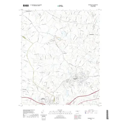
(6)- 2002 Map of Bessemer City, 2003 Print
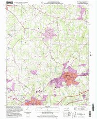 2002 Bessemer City2003 Print · USGSBessemer City and the industrial corridor of Gaston County are captured here at the turn of the millennium. Researchers can trace the footprint of active Mines and Tailings Ponds alongside landmarks like Ebenezer Ch and Chestnut Ridge.
 - 2010 Map of Bessemer City, 2010 Print
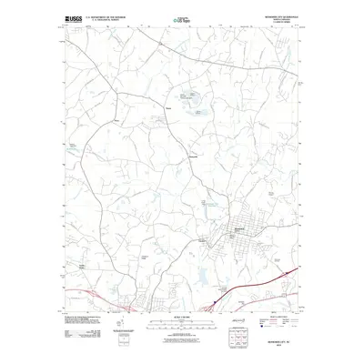 2010 Bessemer City2010 Print · USGSCovers Tryon, including Gastonia, Kings Mountain, and other nearby areas
 - 2013 Map of Bessemer City, 2013 Print
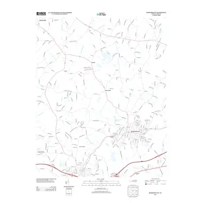 2013 Bessemer City2013 Print · USGSCovers Tryon, including Gastonia, Kings Mountain, and other nearby areas
 - 2016 Map of Bessemer City, 2016 Print
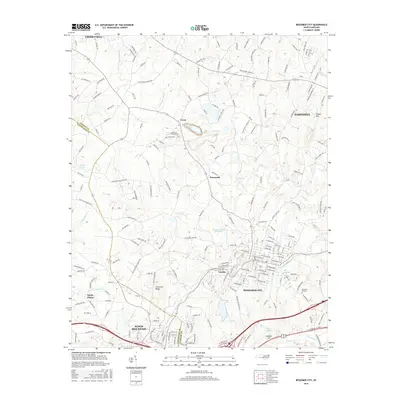 2016 Bessemer City2016 Print · USGSCovers Tryon, including Gastonia, Kings Mountain, and other nearby areas
 - 2019 Map of Bessemer City, 2019 Print
 2019 Bessemer City2019 Print · USGSCovers Tryon, including Gastonia, Kings Mountain, and other nearby areas
 - 2022 Map of Bessemer City, 2022 Print
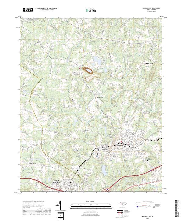 2022 Bessemer City2022 Print · USGSBessemer City and its neighbors in Gaston and Cleveland Counties are captured here during a period of modern regional growth. Researchers can trace the boundaries of Bessemer City and Kings Mountain, or locate sites like Westview Gardens Cem and Tryon.
End of results
Showing maps 1-6 of 6
Top cities near Tryon
- Gastonia historical maps
- Shelby historical maps
- Lincolnton historical maps
- Kings Mountain historical maps
- Cherryville historical maps
- Bessemer City historical maps
See more
Frequently asked questions
- What are the different types of historical maps available for Tryon?
- What is the oldest map of Tryon?
- Where can I purchase historical maps of Tryon for my home or office?
- Where can I download high-res historical maps of Tryon?
- Are there historical topographic maps available for Tryon?
- Is there historical aerial imagery available for Tryon?
- Where are historical maps of Tryon sourced from?