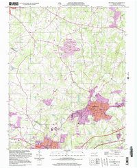
2002 Map of Bessemer City
USGS Topo · Published 2003About this map
Bessemer City anchors this 2002 snapshot of the Gaston County landscape, where the urban grid of the city meets an intensive industrial and mining corridor. Large Tailings Ponds and active Mines dominate the central terrain, signaling the area's deep ties to mineral extraction between Vantine and Sunnyside. The map details the transition from these heavy industry sites to established residential neighborhoods, featuring a concentrated municipal center with the City Hall, Library, and Bessemer City High Sch.
Find a feature on this map
68 named features on this map. Tap any name to fly to it.
Don’t see what you’re looking for? This feature index may not catch every label — zoom into the map to look around manually.
Map Details
Editions of this 2002 Bessemer City Map
This is the sole edition of this map. No revisions or reprints were ever made.
Other maps of this area

1906 · Kings Mountain
USGS Topo · 1:62,500

1908 · Kings Mountain
USGS Topo · 1:62,500

1909 · Lincolnton
USGS Topo · 1:62,500

1911 · Lincolnton
USGS Topo · 1:62,500

1914 · Gastonia
USGS Topo · 1:48,000

1916 · Gastonia
USGS Topo · 1:62,500

1947 · Clover
USGS Topo · 1:62,500

1949 · Clover
USGS Topo · 1:62,500

1953 · Charlotte
USGS Topo · 1:250,000

1954 · Charlotte
USGS Topo · 1:250,000