Old Maps of Rymers Ferry, North Carolina for Academic Research
Study the evolution of Rymers Ferry with 16 high-resolution historic maps. Whether you're teaching, researching, or modeling changes in land use, these maps provide essential visual documentation of urban, environmental, and geographic change.
- Analyze long-term change: Track patterns in development, transportation, and natural features.
- Ideal for environmental or urban studies: Support academic projects with primary historical map data.
- Use in the classroom or lab: Educators and researchers rely on these maps to bring historical context to life.
These maps are a powerful tool for teaching, research, and visualizing how Rymers Ferry has changed over the decades.
Rymers Ferry, NC maps
(16)- 1935 Map of Fontana
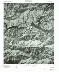
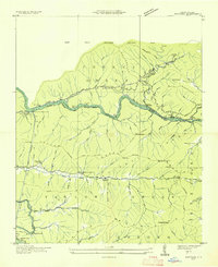 1935 Fontana1935 Print · USGSGraham County and the Little Tennessee River valley are shown here just prior to the massive Tennessee Valley Authority dam projects of the late 1930s. Researchers can trace the original river course and rail lines, locating the Fontana Copper Mine, Rymers Ferry, and the Yellow Creek Cem.
 - 1940 Map of Fontana, 1956 Print
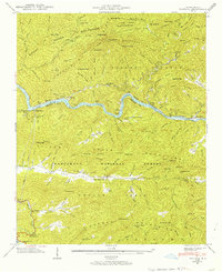 1940 Fontana1956 Print · USGSThe Great Smoky Mountains and Nantahala National Forest meet here just before the era of massive dam projects changed the valley forever. Researchers can trace the Appalachian Trail through the ridges or find the Fontana Copper Mine and Rymer Ferry.2 unique versions available
 - 1941 Map of Fontana
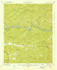 1941 Fontana1941 Print · USGSThe North Carolina mountains meet the Tennessee Valley in this early wartime survey of Graham County and the Smokies. Genealogists and hikers can trace the Appalachian Trail, locate the Fontana Copper Mine, and find the Yellow Creek Cem.
 - 1955 Map of Knoxville
 1955 Knoxville1955 Print · USGSThe Southern Appalachians and the Smoky Mountains are shown here at a peak of mid-century development and conservation. Genealogists and historians can trace the early road networks connecting Gatlinburg, Waynesville, and the Cherokee Indian Reservation across the high ridges.
 - 1957 Map of Knoxville, 1966 Print
 1957 Knoxville1966 Print · USGSThe Southern Appalachians of Tennessee and North Carolina are mapped here during the mid-twentieth century as new highways reached the high country. Genealogists and historians can trace the topography between Knoxville and Asheville, locating family landmarks near Fontana Lake or along the Blue Ridge Parkway.4 unique versions available
 - 1960 Map of Knoxville
 1960 Knoxville1960 Print · USGSThe Southern Appalachians come alive in the 1950s, showing the intersection of new national park tourism and deep-rooted mountain industry. Trace old rail lines like the Clinchfield RR and find high-altitude landmarks from Mt Le Conte to the Cherokee Indian Reservation.2 unique versions available
 - 1961 Map of Fontana Dam, 1964 Print
 1961 Fontana Dam1964 Print · USGSIn the early sixties, the rugged border of the Great Smokies and Nantahala National Forest shows a landscape shaped by water and timber. Genealogists can locate family burial sites at Proctor Field Gap Cem and Fontana Cem or trace the early Appalachian Trail.4 unique versions available
 - 1964 Map of Knoxville
 1964 Knoxville1964 Print · USGSThe Southern Appalachians and Great Smokies are captured here during the mid-sixties, showing the rugged borderlands of Tennessee and North Carolina. Researchers can trace historic mountain routes like U S 441, the expanse of Pisgah National Forest, and the growing footprints of Asheville and Knoxville.
 - 1976 Map of Fontana Dam, 1978 Print
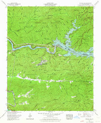
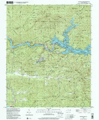
 1976 Fontana Dam1978 Print · USGSGraham County and the southern Appalachian landscape are captured in this mid-seventies aerial survey just south of the Great Smoky Mountains. Researchers can trace the layout of Fontana Village and the massive infrastructure of Fontana Dam along the Little Tennessee River.
 - 1983 Map of Fontana Lake
 1983 Fontana Lake1983 Print · USGSWestern North Carolina's high peaks and reservoir-carved valleys are documented here during the early eighties. Genealogists and local historians can trace the mountain communities of Bryson City and Franklin or explore the boundaries of the Qualla Boundary.2 unique versions available
 - 2000 Map of Fontana Dam, 2001 Print
 2000 Fontana Dam2001 Print · USGSThe Great Smoky Mountains and the massive Tennessee Valley Authority hydro-projects define this Graham County landscape at the start of the millennium. Researchers can trace the Appalachian Trail, locate family sites at Payne Cem, or find the Fontana Copper Mine.
 - 2011 Map of Fontana Dam, 2011 Print
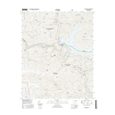
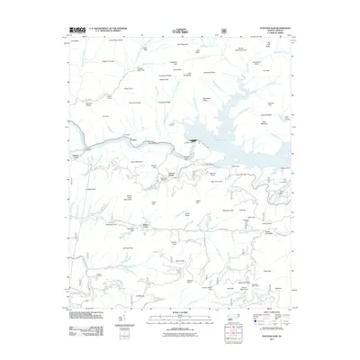 2011 Fontana Dam2011 Print · USGSCovers Rymers Ferry, including Fontana Dam, Yellow Creek, and other nearby areas
 - 2013 Map of Fontana Dam, 2013 Print
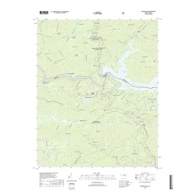
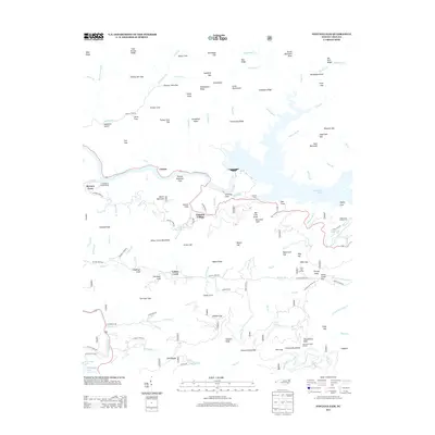 2013 Fontana Dam2013 Print · USGSCovers Rymers Ferry, including Fontana Dam, Yellow Creek, and other nearby areas
 - 2016 Map of Fontana Dam, 2016 Print
 2016 Fontana Dam2016 Print · USGSCovers Rymers Ferry, including Fontana Dam, Yellow Creek, and other nearby areas
 - 2019 Map of Fontana Dam, 2019 Print
 2019 Fontana Dam2019 Print · USGSCovers Rymers Ferry, including Fontana Dam, Yellow Creek, and other nearby areas
 - 2022 Map of Fontana Dam, 2022 Print
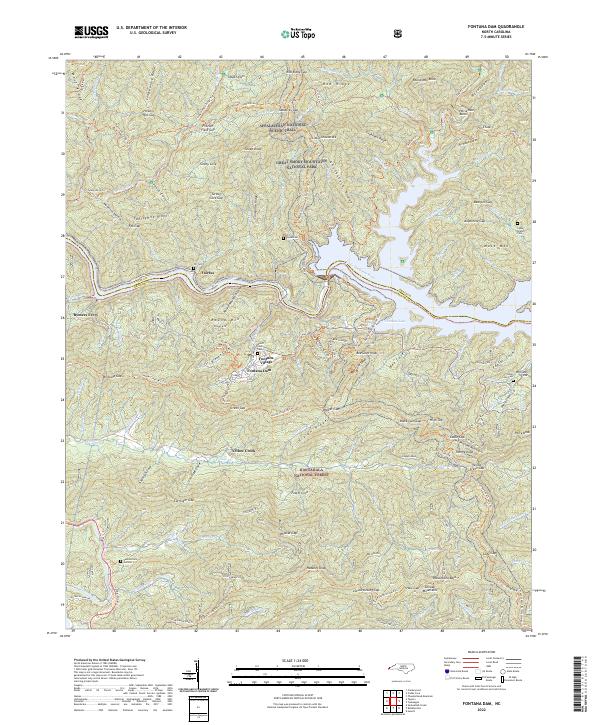 2022 Fontana Dam2022 Print · USGSThe North Carolina mountains come into focus in this recent survey showing the massive hydroelectric infrastructure and preserved wilderness areas. Researchers can trace family history at Welch Cove Cem or locate the historic river crossing at Rymers Ferry.
End of results
Showing maps 1-16 of 16
Top cities near Rymers Ferry
- Robbinsville historical maps
- Townsend historical maps
- Lake Santeetlah historical maps
- Fontana Dam historical maps
Frequently asked questions
- What are the different types of historical maps available for Rymers Ferry?
- What is the oldest map of Rymers Ferry?
- Where can I purchase historical maps of Rymers Ferry for my home or office?
- Where can I download high-res historical maps of Rymers Ferry?
- Are there historical topographic maps available for Rymers Ferry?
- Is there historical aerial imagery available for Rymers Ferry?
- Where are historical maps of Rymers Ferry sourced from?