2020s Maps of Granville County, North Carolina
Explore 17 historic maps of Granville County from the 2020s. These maps offer a rare glimpse into what life looked like during the 2020s — showing old roads, neighborhoods, homes, and landmarks that have changed or disappeared over time.
Whether you're researching your family's past, planning a metal detecting trip, or studying how Granville County's landscape evolved across the 2020s, these high-resolution maps are a powerful tool for exploring the history of this region.
- Focus on a specific era: All maps on this page are from the 2020s, giving you a focused view of this time period.
- See what’s changed: Compare century-old streets, trails, and buildings to today's modern landscape using overlays and satellite layers.
- Research with precision: Use these maps for genealogy, historical research, land use analysis, or educational projects.
- View, download, or print: Maps are fully viewable online in high resolution, and can be downloaded or printed for your own records.
Start exploring Granville County's history through authentic maps from the 2020s. This is your window into the past.
Granville County, NC maps
(17)- 2022 Map of Oxford, 2022 Print
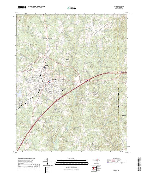 2022 Oxford2022 Print · USGSOxford and its surrounding Granville County communities appear here in fine detail during the early 2020s. Genealogists and local historians can trace the town grid from the Granville County Courthouse out to rural landmarks like Crews Family Cem and Elmwood Cem.
 - 2022 Map of Grissom, 2022 Print
 2022 Grissom2022 Print · USGSThe intersection of Granville, Wake, and Franklin counties comes into focus in this contemporary survey of the North Carolina Piedmont. Researchers can trace the rural character of Grissom and Pocomoke alongside the waters of New Light Creek.
 - 2022 Map of Satterwhite, 2022 Print
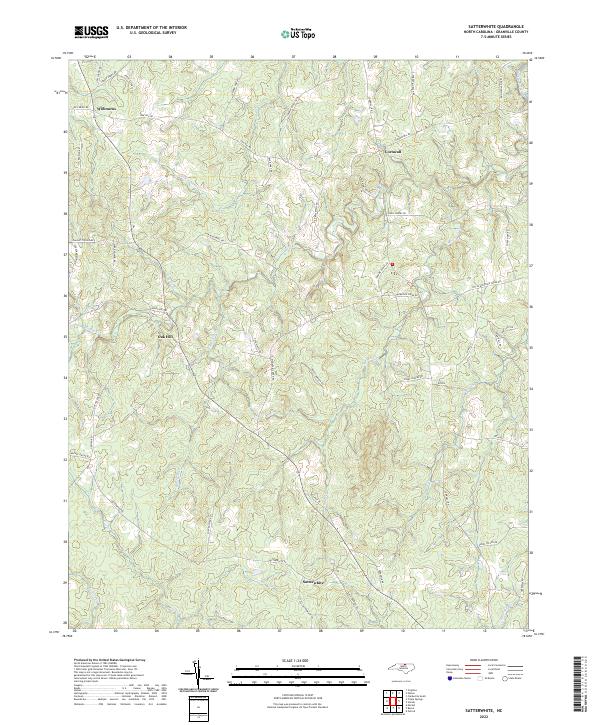 2022 Satterwhite2022 Print · USGSGranville County’s rural crossroads are captured here in the early twenty-first century, showing the enduring settlement patterns of northern North Carolina. Researchers can trace family-named lands and legacy routes like Dick Blackwell Rd near Oak Hill and Satterwhite.
 - 2022 Map of Berea, 2022 Print
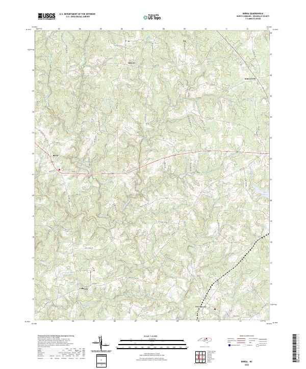 2022 Berea2022 Print · USGSGranville County maintains its rural North Carolina character in the early 2020s, centered on the historic crossroads of Berea and Hebron. Researchers can trace family holdings along Bodie Currin Rd or explore the drainage of the Tar River and Lake Devin.
 - 2022 Map of Wilton, 2022 Print
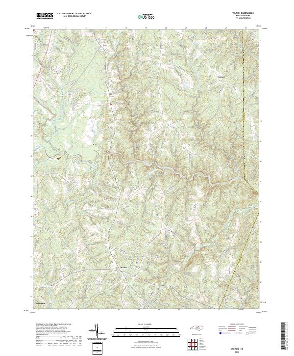 2022 Wilton2022 Print · USGSGranville County at the start of the 2020s shows a landscape woven with historic road networks and winding waterways. Genealogists and researchers can trace local routes like Old Franklinton Rd and locate settlements at Wilton, Clay, and Fairport.
 - 2022 Map of Kittrell, 2022 Print
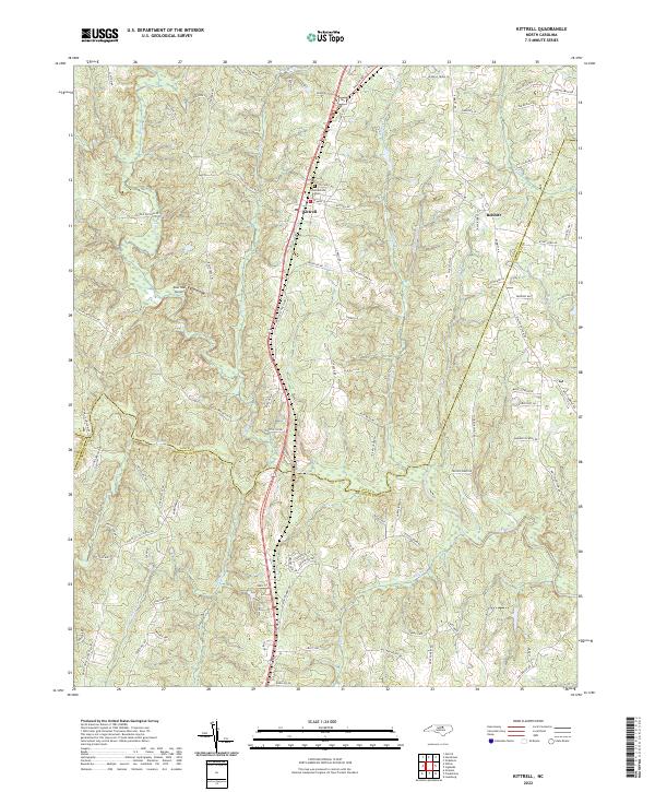 2022 Kittrell2022 Print · USGSThe borderlands of Vance and Franklin counties are captured here in the early twenty-first century as the CSX railroad continues to shape the local geography. Researchers can trace family-named landmarks and historical sites like the Confederate Cem and the community of Bobbitt.
 - 2022 Map of Tungsten, 2022 Print
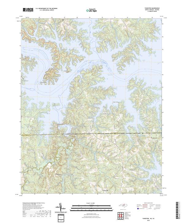 2022 Tungsten2022 Print · USGSThe North Carolina-Virginia borderlands are captured here in the early twenty-first century, centered on the expansive waters of the John H. Kerr Reservoir. Researchers can trace local history through the settlement of Tungsten, the Fields Cem, and the rural community of Woodworth.
 - 2022 Map of Creedmoor, 2022 Print
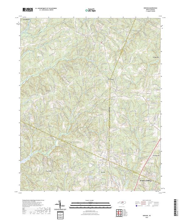
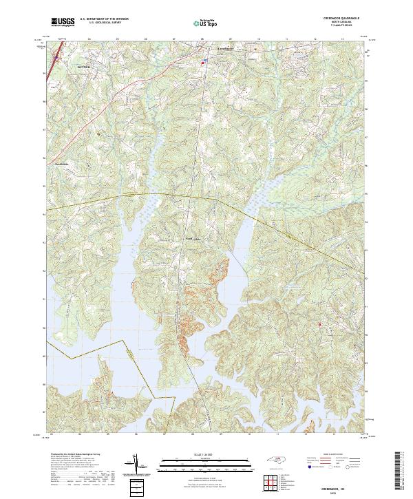 2022 Creedmoor2022 Print · USGSGranville County and northern Wake County appear here in the early 2020s, showing a landscape shaped by the vast waters of Falls Lake. Trace the modern expansion of Creedmoor and Butner alongside older rural sites like Sandy Plain and North Side.
 - 2022 Map of Northeast Durham, 2022 Print
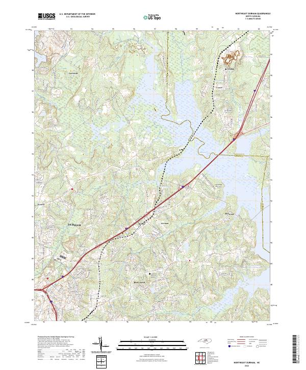 2022 Northeast Durham2022 Print · USGSNortheast Durham is shown here at the start of the 2020s, where the Eno River forms below the meeting of the Flat River and Little River. Researchers can trace the modern development of communities like Gorman, Fairntosh, and Redwood alongside the Lake Ridge Aero Park.
 - 2022 Map of Stovall, 2022 Print
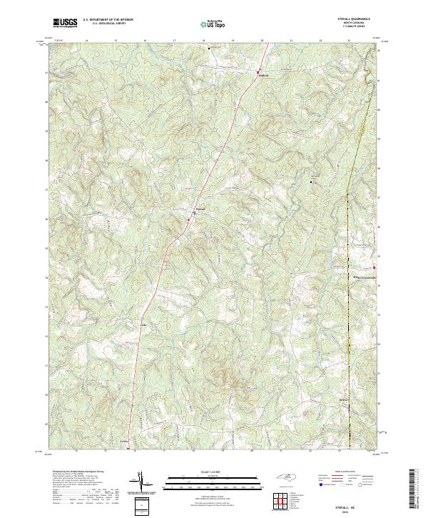 2022 Stovall2022 Print · USGSGranville County at the dawn of the 2020s remains a landscape of quiet crossroads and historic family sites along the Virginia border. Researchers can pinpoint John Penns Grave and trace the rural reaches of Stovall and Hicks Crossroads via a dense network of local roads.
 - 2022 Map of Stem, 2022 Print
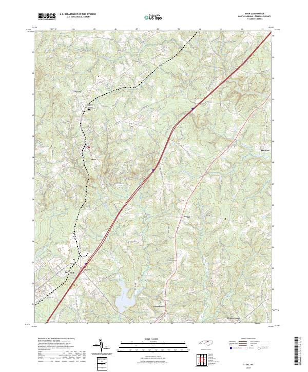 2022 Stem2022 Print · USGSGranville County settlement patterns are clearly visible in this 2022 survey of the corridor between Stem and Creedmoor. Genealogists and local historians can trace the landscape from the Butner residential grid to rural landmarks like Mount Energy and Caldmont Lake.
 - 2022 Map of Triple Springs, 2022 Print
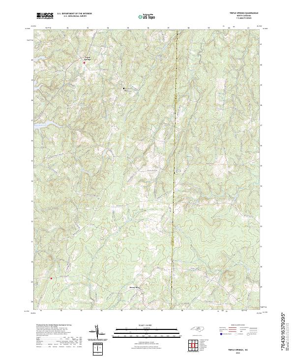 2022 Triple Springs2022 Print · USGSPerson and Granville counties appear in this modern survey, capturing the rural landscape where the Tar River originates. Genealogists and historians can trace family road names and local landmarks like Olive Branch Baptist Church Cem or the mining history indicated by Dirgie Mine Rd.
 - 2022 Map of Lake Michie, 2022 Print
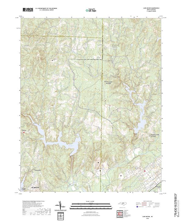 2022 Lake Michie2022 Print · USGSNear the intersection of three counties in the early 2020s, this area shows a landscape defined by the Flat River and local rural centers. Researchers can trace family history at Carrington Cem or explore the developed grids of Willardville and Butner.
 - 2022 Map of Moriah, 2022 Print
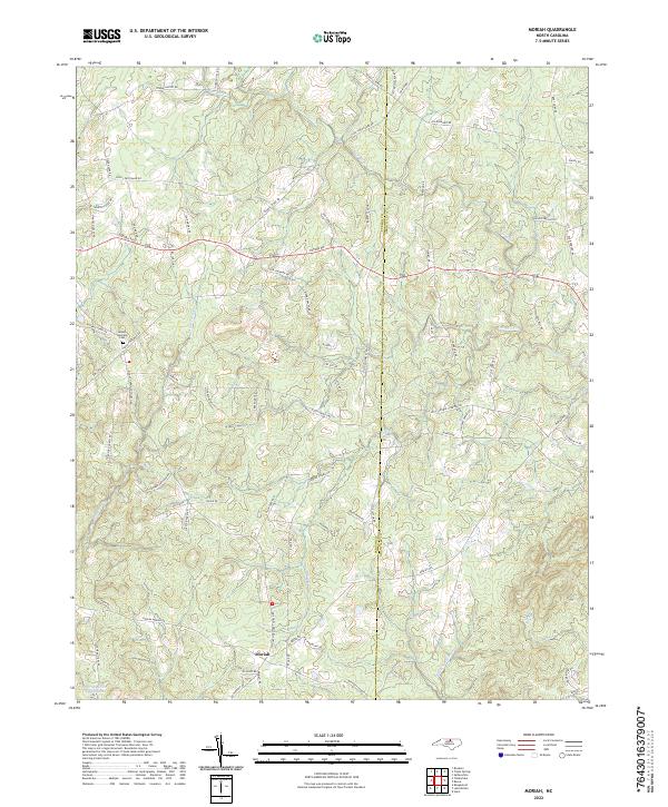 2022 Moriah2022 Print · USGSThe rural borderlands between Person and Granville counties come to life in this recent survey. Researchers can locate family landmarks like the Mount Harmony Cem and trace the industrial footprint of the Pyrophyllite Mine near the banks of the Tar River.
 - 2022 Map of Clarksville South, 2022 Print
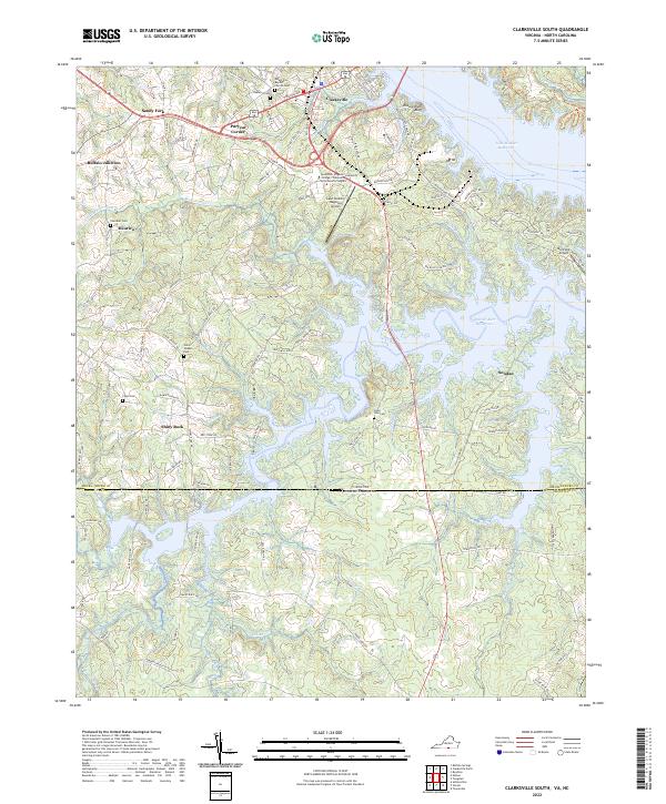 2022 Clarksville South2022 Print · USGSMecklenburg County, Virginia, and Granville County, North Carolina, meet along the sprawling fingers of the John H. Kerr Reservoir in this modern survey. Genealogists can trace family footprints across several rural burial grounds, including State Line Cem, Chandler Cem, and Union Chapel Cem.
 - 2022 Map of Nelson, 2022 Print
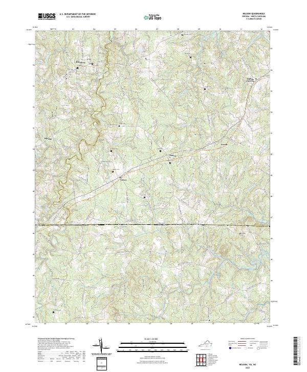 2022 Nelson2022 Print · USGSMecklenburg County and the North Carolina borderlands come into focus in the early 2020s, showcasing a landscape of legacy family farms. You can trace generations of local history through family burial sites like Hite Family Cem and crossroads such as Nelson and Buffalo Junction.
 - 2022 Map of Virgilina, 2022 Print
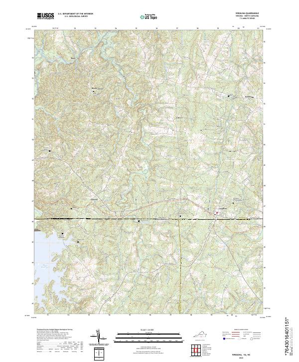 2022 Virgilina2022 Print · USGSVirgilina and the Virginia-North Carolina borderlands appear in the early 2020s, showing a landscape of traditional crossroads and reservoir waters. Researchers can trace ancestral sites at Shady Grove Cem, Mayo Chapel Cem, and the First Black Baptist Church of Virgilina Cem.
End of results
Showing maps 1-17 of 17
Top cities of Granville County
- Oxford historical maps
- Butner historical maps
- Creedmoor historical maps
- Stovall historical maps
- Stem historical maps
Frequently asked questions
- What are the different types of historical maps available for Granville County?
- What is the oldest map of Granville County?
- Where can I purchase historical maps of Granville County for my home or office?
- Where can I download high-res historical maps of Granville County?
- Are there historical topographic maps available for Granville County?
- Is there historical aerial imagery available for Granville County?
- Where are historical maps of Granville County sourced from?