1900s (20th Century) Maps of Guilford County, North Carolina
Explore 51 historic maps of Guilford County from the 1900s (20th Century). These maps offer a rare glimpse into what life looked like during the 1900s — showing old roads, neighborhoods, homes, and landmarks that have changed or disappeared over time.
Whether you're researching your family's past, planning a metal detecting trip, or studying how Guilford County's landscape evolved across the 1900s, these high-resolution maps are a powerful tool for exploring the history of this region.
- Focus on a specific era: All maps on this page are from the 1900s, giving you a focused view of this time period.
- See what’s changed: Compare century-old streets, trails, and buildings to today's modern landscape using overlays and satellite layers.
- Research with precision: Use these maps for genealogy, historical research, land use analysis, or educational projects.
- View, download, or print: Maps are fully viewable online in high resolution, and can be downloaded or printed for your own records.
Start exploring Guilford County's history through authentic maps from the 1900s. This is your window into the past.
Guilford County, NC maps
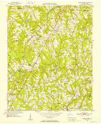
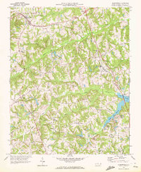
(51)- 1949 Map of High Point West, 1952 Print
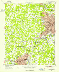 1949 High Point West1952 Print · USGSCovers Guilford County, including High Point, Thomasville, and other nearby areas2 unique versions available
 - 1950 Map of High Point East, 1964 Print
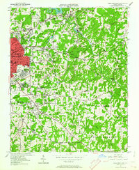 1950 High Point East1964 Print · USGSCovers Guilford County, including Greensboro, High Point, and other nearby areas3 unique versions available
 - 1951 Map of High Point East
 1951 High Point East1951 Print · USGSCovers Guilford County, including Greensboro, High Point, and other nearby areas
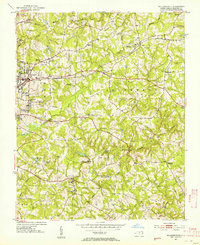
 - 1951 Map of Guilford, 1952 Print
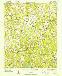 1951 Guilford1952 Print · USGSCovers Guilford County, including Greensboro, High Point, and other nearby areas5 unique versions available
 - 1951 Map of Lake Brandt, 1952 Print
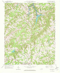
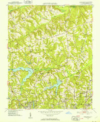 1951 Lake Brandt1952 Print · USGSCovers Guilford County, including Greensboro, Summerfield, and other nearby areas4 unique versions available
 - 1951 Map of Browns Summit, 1952 Print
 1951 Browns Summit1952 Print · USGSCovers Guilford County, including Greensboro, Lakewood, and other nearby areas5 unique versions available
 - 1951 Map of Greensboro, 1953 Print
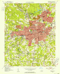 1951 Greensboro1953 Print · USGSCovers Guilford County, including Greensboro, Sedgefield Park, and other nearby areas5 unique versions available
 - 1952 Map of Mc Leansville, 1953 Print
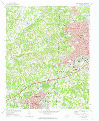
 1952 Mc Leansville1953 Print · USGSCovers Guilford County, including Greensboro, Sedalia, and other nearby areas3 unique versions available
 - 1953 Map of Raleigh, 1965 Print
 1953 Raleigh1965 Print · USGSCovers Guilford County, including Raleigh, Greensboro, and other nearby areas4 unique versions available
 - 1953 Map of Charlotte, 1968 Print
 1953 Charlotte1968 Print · USGSCovers Guilford County, including Charlotte, Winston-Salem, and other nearby areas3 unique versions available
 - 1953 Map of Winston-Salem, 1974 Print
 1953 Winston-Salem1974 Print · USGSCovers Guilford County, including Greensboro, Winston-Salem, and other nearby areas2 unique versions available
 - 1953 Map of Greensboro, 1981 Print
 1953 Greensboro1981 Print · USGSCovers Guilford County, including Greensboro, Durham, and other nearby areas
 - 1954 Map of Greensboro
 1954 Greensboro1954 Print · USGSCovers Guilford County, including Greensboro, Durham, and other nearby areas
 - 1954 Map of Charlotte
 1954 Charlotte1954 Print · USGSCovers Guilford County, including Charlotte, Winston-Salem, and other nearby areas2 unique versions available
 - 1954 Map of Raleigh
 1954 Raleigh1954 Print · USGSCovers Guilford County, including Raleigh, Greensboro, and other nearby areas
 - 1955 Map of Winston-Salem
 1955 Winston-Salem1955 Print · USGSCovers Guilford County, including Greensboro, Winston-Salem, and other nearby areas
 - 1960 Map of Charlotte
 1960 Charlotte1960 Print · USGSCovers Guilford County, including Charlotte, Winston-Salem, and other nearby areas2 unique versions available
 - 1962 Map of Winston-Salem
 1962 Winston-Salem1962 Print · USGSCovers Guilford County, including Greensboro, Winston-Salem, and other nearby areas
 - 1962 Map of Charlotte
 1962 Charlotte1962 Print · USGSCovers Guilford County, including Charlotte, Winston-Salem, and other nearby areas
 - 1962 Map of Greensboro
 1962 Greensboro1962 Print · USGSCovers Guilford County, including Greensboro, Durham, and other nearby areas
 - 1966 Map of Greensboro
 1966 Greensboro1966 Print · USGSCovers Guilford County, including Greensboro, Durham, and other nearby areas
 - 1969 Map of Kernersville, 1972 Print
 1969 Kernersville1972 Print · USGSCovers Guilford County, including Greensboro, Winston-Salem, and other nearby areas3 unique versions available
 - 1969 Map of Summerfield, 1972 Print
 1969 Summerfield1972 Print · USGSCovers Guilford County, including Greensboro, Summerfield, and other nearby areas2 unique versions available
 - 1969 Map of Belews Creek, 1972 Print
 1969 Belews Creek1972 Print · USGSCovers Guilford County, including Kernersville, Oak Ridge, and other nearby areas3 unique versions available
 - 1969 Map of High Point West, 1973 Print
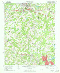
 1969 High Point West1973 Print · USGSCovers Guilford County, including High Point, Thomasville, and other nearby areas2 unique versions available
Showing maps 1-25 of 51
Top cities of Guilford County
- Greensboro historical maps
- High Point historical maps
- Summerfield historical maps
- Pleasant Garden historical maps
- Oak Ridge historical maps
- Jamestown historical maps
See more
Frequently asked questions
- What are the different types of historical maps available for Guilford County?
- What is the oldest map of Guilford County?
- Where can I purchase historical maps of Guilford County for my home or office?
- Where can I download high-res historical maps of Guilford County?
- Are there historical topographic maps available for Guilford County?
- Is there historical aerial imagery available for Guilford County?
- Where are historical maps of Guilford County sourced from?