1970s Maps of Guilford County, North Carolina
Explore 16 historic maps of Guilford County from the 1970s. These maps offer a rare glimpse into what life looked like during the 1970s — showing old roads, neighborhoods, homes, and landmarks that have changed or disappeared over time.
Whether you're researching your family's past, planning a metal detecting trip, or studying how Guilford County's landscape evolved across the 1970s, these high-resolution maps are a powerful tool for exploring the history of this region.
- Focus on a specific era: All maps on this page are from the 1970s, giving you a focused view of this time period.
- See what’s changed: Compare century-old streets, trails, and buildings to today's modern landscape using overlays and satellite layers.
- Research with precision: Use these maps for genealogy, historical research, land use analysis, or educational projects.
- View, download, or print: Maps are fully viewable online in high resolution, and can be downloaded or printed for your own records.
Start exploring Guilford County's history through authentic maps from the 1970s. This is your window into the past.
Guilford County, NC maps
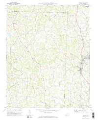
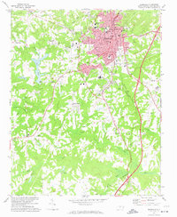
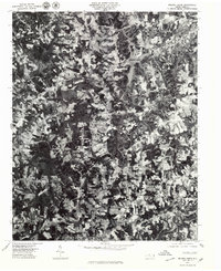
(16)- 1970 Map of Gibsonville, 1973 Print
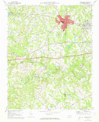 1970 Gibsonville1973 Print · USGSThe Guilford and Alamance county line meets at the height of the Vietnam era, capturing the development of Gibsonville and Elon College. Researchers can trace rural community roots through numerous landmarks like Brick Ch, St Marks Ch, and Whitsett.2 unique versions available
 - 1970 Map of Kimesville, 1973 Print
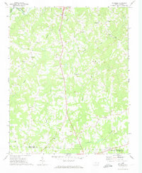
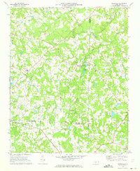 1970 Kimesville1973 Print · USGSThe rural tri-county border area of Guilford, Alamance, and Randolph was a landscape of small churches and local airfields in the early 1970s. Researchers can trace family sites like Greene Sch and the Hornaday Pleasant Union Ch Cem or locate Causey Airfield.2 unique versions available
 - 1970 Map of Pleasant Garden, 1973 Print
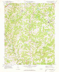 1970 Pleasant Garden1973 Print · USGSThe Piedmont countryside of Guilford and Randolph Counties is captured here in the early seventies as rural life and new growth intersected. Local historians can trace old homesteads near Burnetts Chapel, the railroad tracks through Pleasant Garden, and the winding Deep River.2 unique versions available
 - 1970 Map of Climax, 1973 Print
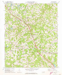 1970 Climax1973 Print · USGSThe North Carolina Piedmont south of Greensboro was undergoing significant growth in the 1970s. Researchers can trace the rural roots of Climax and Julian while locating family landmarks like the Love Ch Cem, Bethel Ch Cem, and Shiloh Ch.2 unique versions available
 - 1970 Map of Ossipee, 1973 Print
 1970 Ossipee1973 Print · USGSThe borderlands of Alamance and Guilford Counties come into focus in the early 1970s as the Haw River winds past small rural hubs. Researchers can trace local heritage through numerous landmarks like Altamahaw-Ossipee Sch, Apples Chapel Cem, and Friedens Ch.
 - 1971 Map of Belews Lake, 1973 Print
 1971 Belews Lake1973 Print · USGSThe rural borderlands of Stokes and Rockingham counties are captured here in the early 1970s as the landscape transformed around Belews Lake. Researchers can trace old family sites near Pine Hall, Camp Vaughn, and country landmarks like Sycamore Ch.3 unique versions available
 - 1971 Map of Ellisboro, 1974 Print
 1971 Ellisboro1974 Print · USGSRockingham County in the early seventies was a landscape of quiet rural settlements and small-town hubs linked by the Dan River and the rail. Researchers can trace local roots through numerous country landmarks like Comers Chapel, Hayes Chapel, and the Woodland Cem.2 unique versions available
 - 1971 Map of Bethany, 1974 Print
 1971 Bethany1974 Print · USGSRockingham County in the early seventies is a landscape of rural crossroads and historic congregations. Genealogists and local historians can trace family locations through numerous sites like Bakers Crossroads, Wittys Crossroads, and the St Mariahs Ch cemetery.
 - 1972 Map of Reidsville, 1974 Print
 1972 Reidsville1974 Print · USGSReidsville and its surrounding Rockingham County rural districts are shown here during the early seventies, capturing the city's established residential and industrial core. Genealogists and local historians can trace family locations near Reidsville Cem, Wesley Chapel, or the outlying community of Monroeton.2 unique versions available
 - 1977 Map of Greensboro, 1979 Print
 1977 Greensboro1979 Print · USGSGreensboro is documented here in the late seventies during a period of significant suburban infill. Researchers can trace the mid-century development of neighborhoods like Hamilton Lakes, Edgeville, and the southern settlement of Vandalia.
 - 1977 Map of Kernersville, 1979 Print
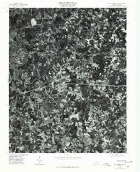
 1977 Kernersville1979 Print · USGSIn the late seventies, the Piedmont landscape around Kernersville was undergoing a significant transformation from rural fields to suburban outskirts. Genealogists and local historians can trace family-named locations such as Beeson Crossroads, Horneytown, and Union Cross.
 - 1977 Map of Belews Lake, 1979 Print
 1977 Belews Lake1979 Print · USGSThe Dan River and its surrounding Piedmont landscapes are captured in detail in the late seventies. Researchers can trace the sprawling shoreline of Belews Lake or locate the historic settlement of Pine Hall along the Dan River.
 - 1977 Map of Belews Creek, 1979 Print
 1977 Belews Creek1979 Print · USGSNorth Carolina's central Piedmont is captured here during the late 1970s, showcasing the rural character and emerging development of Forsyth County. Researchers can trace the exact 1977 land-use patterns around Kernersville and the expansive shoreline of Belews Lake.
 - 1977 Map of Mc Leansville, 1979 Print
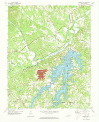
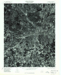
 1977 Mc Leansville1979 Print · USGSGuilford County appears at a moment of suburban transition in the late seventies, captured through detailed aerial photography. Trace property lines and land use patterns around Mc Leansville, Sedalia, and Greesons Crossroads.
 - 1977 Map of High Point West, 1979 Print
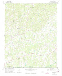
 1977 High Point West1979 Print · USGSThe Piedmont's industrial heart comes into focus in the late 1970s, showcasing the urban expansion between High Point and Thomasville. Researchers can trace old property lines and the early residential footprint of Oakview near the banks of Abbotts Creek.
 - 1977 Map of Guilford, 1979 Print
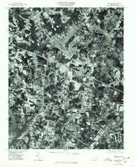 1977 Guilford1979 Print · USGSGuilford County underwent rapid transformation in the late seventies as residential neighborhoods expanded into the Piedmont countryside. Genealogists and historians can trace the precise development of Friendship, Sandy Ridge, and the Sedgefield area through this detailed aerial photography.
End of results
Showing maps 1-16 of 16
Top cities of Guilford County
- Greensboro historical maps
- High Point historical maps
- Summerfield historical maps
- Pleasant Garden historical maps
- Oak Ridge historical maps
- Jamestown historical maps
See more
Frequently asked questions
- What are the different types of historical maps available for Guilford County?
- What is the oldest map of Guilford County?
- Where can I purchase historical maps of Guilford County for my home or office?
- Where can I download high-res historical maps of Guilford County?
- Are there historical topographic maps available for Guilford County?
- Is there historical aerial imagery available for Guilford County?
- Where are historical maps of Guilford County sourced from?