Old Maps of High Point, North Carolina for Academic Research
Study the evolution of High Point with 50 high-resolution historic maps. Whether you're teaching, researching, or modeling changes in land use, these maps provide essential visual documentation of urban, environmental, and geographic change.
- Analyze long-term change: Track patterns in development, transportation, and natural features.
- Ideal for environmental or urban studies: Support academic projects with primary historical map data.
- Use in the classroom or lab: Educators and researchers rely on these maps to bring historical context to life.
These maps are a powerful tool for teaching, research, and visualizing how High Point has changed over the decades.
High Point, NC maps
(50)- 1949 Map of High Point West, 1952 Print
 1949 High Point West1952 Print · USGSMid-century development connects High Point and Thomasville as the Southern railroad drives industrial and residential growth. Researchers can find many family-named landmarks and local schools like Ada Blair Sch, Finch Field, and the Conrad Memorial Ch Cem.2 unique versions available
 - 1950 Map of High Point East, 1964 Print
 1950 High Point East1964 Print · USGSHigh Point and its surrounding townships show a mix of rapid post-war urban growth and rural heritage during the early 1950s. Genealogists and historians can trace family-named crossroads like Kirkman Crossroads or locate early institutions such as the County Sanatorium and High Point College.3 unique versions available
 - 1951 Map of High Point East
 1951 High Point East1951 Print · USGSGuilford and Randolph counties show a maturing Piedmont landscape in the early fifties, where textile-town growth meets established rural communities. Researchers can trace family sites at Green Hill Cemetery and Hickory Chapel, or locate industrial history near Freeman Mill and the Southern rail line.
 - 1951 Map of Guilford, 1952 Print
 1951 Guilford1952 Print · USGSGuilford County at the start of the 1950s was a landscape defined by traditional river-milling roots and the rise of aviation. Researchers can trace the legacy of Guilford College and local family sites like Whites Mill, Sandy Ridge, and New Salem Tabernacle.5 unique versions available
 - 1953 Map of Raleigh, 1965 Print
 1953 Raleigh1965 Print · USGSCentral North Carolina in the early sixties shows a landscape of growing towns and military hubs before the full expansion of the interstate system. Genealogists can trace family footprints across the Piedmont through Wake Forest, Siler City, and the large Fort Bragg Military Reservation.4 unique versions available
 - 1953 Map of Charlotte, 1968 Print
 1953 Charlotte1968 Print · USGSThe North Carolina Piedmont and South Carolina borderlands are shown in detail during a period of significant growth and reservoir development. Trace the rail corridors of the Southern Railway or find family roots in towns like China Grove, Misenheimer, and Lincolnton.3 unique versions available
 - 1953 Map of Winston-Salem, 1974 Print
 1953 Winston-Salem1974 Print · USGSThe North Carolina Piedmont and Virginia highlands meet in the mid-1950s, a landscape defined by the tobacco and textile hubs of the Blue Ridge foothills. Researchers can trace the rail-and-river geography connecting Winston-Salem to mountain towns like Mount Airy and Galax.2 unique versions available
 - 1953 Map of Greensboro, 1981 Print
 1953 Greensboro1981 Print · USGSThe Piedmont borderlands of North Carolina and Virginia show a landscape defined by new reservoirs and old rail lines. Trace family roots and the changing river geography through Elon College, the John H Kerr Reservoir, and South Boston.
 - 1954 Map of Greensboro
 1954 Greensboro1954 Print · USGSThe Piedmont borderlands of North Carolina and Virginia come alive in this mid-fifties study of a region defined by its rivers and rails. Researchers can trace the growing Buggs Island Lake or follow the paths of the Southern Ry and Seaboard Air Line RR through towns like Oxford and Reidsville.
 - 1954 Map of Charlotte
 1954 Charlotte1954 Print · USGSThe North Carolina Piedmont in the mid-1950s shows a region of rapid growth and industrial expansion centered around Charlotte. Trace the era's infrastructure through the Southern railroad lines and locate significant landmarks like the Charlotte Naval Ammunition Depot and Lake Norman.2 unique versions available
 - 1954 Map of Raleigh
 1954 Raleigh1954 Print · USGSThe North Carolina Piedmont and Sandhills are captured in the mid-fifties during a period of steady regional growth. Genealogists and historians can trace the development of towns like Siler City or locate landmarks such as Falls of Neuse and Camp Mackall.
 - 1955 Map of Winston-Salem
 1955 Winston-Salem1955 Print · USGSThe Central Blue Ridge and Piedmont transition are captured here in the mid-fifties, from the industrial hub of Winston-Salem to the high peaks of Southwest Virginia. Genealogists can trace family landmarks like Richmond Hill Ch, Siloam Ch, and the old rail stops along the Southern Railway.
 - 1960 Map of Charlotte
 1960 Charlotte1960 Print · USGSMid-century North Carolina and South Carolina meet in this 1960 survey of the Piedmont's industrial and textile heartland. Trace the growth of Charlotte alongside historic landmarks like Kings Mountain National Military Park and the Charlotte Naval Ammunition Depot.2 unique versions available
 - 1962 Map of Winston-Salem
 1962 Winston-Salem1962 Print · USGSThe North Carolina Piedmont meets the Virginia highlands in the early sixties, showing the rail corridors and mountain gaps of the southern Appalachians. Researchers can trace the Blue Ridge Parkway or locate family sites near Winston-Salem, Mount Airy, and Hanging Rock Mountain.
 - 1962 Map of Charlotte
 1962 Charlotte1962 Print · USGSThe North Carolina Piedmont in the early sixties showcases a landscape transformed by massive reservoirs and industrial growth. Researchers can trace the development of Lake Norman, locate the Charlotte Naval Ammunition Depot, or find family landmarks like Wesley Chapel and Brown & Norcott Mills.
 - 1962 Map of Greensboro
 1962 Greensboro1962 Print · USGSThe Piedmont region along the Virginia and North Carolina border comes alive in the early 1960s, showing a landscape defined by industry and new reservoirs. Trace the path of the Virginian RR or explore the early development of Greensboro and Durham.
 - 1966 Map of Greensboro
 1966 Greensboro1966 Print · USGSThe North Carolina and Virginia Piedmont thrives during the mid-sixties, showcasing a landscape of textile hubs and expanding river reservoirs. Researchers can trace the rail corridors of the Southern Railway, find local landmarks like Elon College, or locate the extensive Camp Butner Military Reservation.
 - 1969 Map of Kernersville, 1972 Print
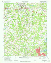 1969 Kernersville1972 Print · USGSThe Piedmont Triad takes shape in the late sixties as Kernersville and High Point begin to grow together. Genealogists and historians can trace the foundations of local communities at Beeson Crossroads, Southern Pilgrim College, and Union Cross.3 unique versions available
 - 1969 Map of High Point West, 1973 Print
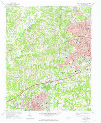 1969 High Point West1973 Print · USGSThe industrial corridor between High Point and Thomasville is captured here in the late sixties as urban growth began to bridge the county lines. Genealogists and local historians can locate legacy institutions like Zion Ch, Oakwood Cem, and the specialized High Point Thomasville and Denton RR.2 unique versions available
 - 1977 Map of Kernersville, 1979 Print
 1977 Kernersville1979 Print · USGSIn the late seventies, the Piedmont landscape around Kernersville was undergoing a significant transformation from rural fields to suburban outskirts. Genealogists and local historians can trace family-named locations such as Beeson Crossroads, Horneytown, and Union Cross.
 - 1977 Map of High Point West, 1979 Print
 1977 High Point West1979 Print · USGSThe Piedmont's industrial heart comes into focus in the late 1970s, showcasing the urban expansion between High Point and Thomasville. Researchers can trace old property lines and the early residential footprint of Oakview near the banks of Abbotts Creek.
 - 1977 Map of Guilford, 1979 Print
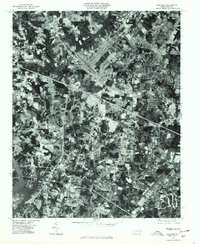 1977 Guilford1979 Print · USGSGuilford County underwent rapid transformation in the late seventies as residential neighborhoods expanded into the Piedmont countryside. Genealogists and historians can trace the precise development of Friendship, Sandy Ridge, and the Sedgefield area through this detailed aerial photography.
 - 1984 Map of Greensboro
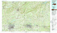 1984 Greensboro1984 Print · USGSThe North Carolina Piedmont in the mid-eighties shows a region of growing urban centers and vital water resources. Local historians can trace the development of Greensboro, locate the Elon College campus, or explore the grounds of Guilford Courthouse National Military Park.
 - 1984 Map of Winston-Salem, 1985 Print
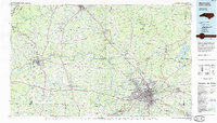 1984 Winston-Salem1985 Print · USGSThe North Carolina Piedmont in the mid-1980s shows the growth of Winston-Salem and the busy rail corridors of the Southern Railway. Genealogists and local historians can trace family-named lands and rural communities from Yadkinville to Mount Airy.2 unique versions available
 - 1984 Map of Chapel Hill, 1985 Print
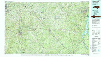 1984 Chapel Hill1985 Print · USGSNorth Carolina’s Piedmont and the northern reaches of the Uwharrie Mountains are captured here in the mid-eighties. Genealogists can trace family roots through rural landmarks like Union Chapel or locate old rail stops along the Seaboard line.
Showing maps 1-25 of 50
Top cities near High Point
- Greensboro historical maps
- Winston-Salem historical maps
- Thomasville historical maps
- Asheboro historical maps
- Kernersville historical maps
- Archdale historical maps
See more
Top neighborhoods of High Point
- Oak Hollow Lake historical maps
- Allen Jay historical maps
- Bakertown historical maps
- Springfield historical maps
- Oakview historical maps
- Melborne Heights historical maps
See more
Frequently asked questions
- What are the different types of historical maps available for High Point?
- What is the oldest map of High Point?
- Where can I purchase historical maps of High Point for my home or office?
- Where can I download high-res historical maps of High Point?
- Are there historical topographic maps available for High Point?
- Is there historical aerial imagery available for High Point?
- Where are historical maps of High Point sourced from?