Old Maps of Halifax County, North Carolina for Genealogy
Trace your family roots with 167 historic maps of Halifax County. These high-res maps reveal old neighborhoods, homesites, landmarks, and streets — helping you uncover where your ancestors lived and how the area evolved over time.
- Explore historic neighborhoods: Identify where your relatives may have lived in the 1800s or 1900s.
- Compare maps over time: Trace the changes in streets, buildings, and landmarks for multi-generational research.
- Perfect for genealogy & ancestry research: Used by family historians and researchers to map out lineage and migration.
These maps are an incredible resource for exploring your personal connection to Halifax County's past.
Halifax County, NC maps
(167)- 1919 Map of White Plains
 1919 White Plains1919 Print · USGSSouthern Virginia and the North Carolina borderlands are captured here at the close of the Great War. Genealogists can trace early twentieth-century communities through family-named landmarks like Vincents Store, Hicks Mill, and Holly Springs Church.
 - 1920 Map of White Plains
 1920 White Plains1920 Print · USGSThe Virginia and North Carolina borderlands come to life in this 1920 survey of the Meherrin and Roanoke river basins. Genealogists can trace family names at Drumgoole Store and Phipps Store, or locate old schoolhouse sites like Meherrin School and Webb School.4 unique versions available
 - 1953 Map of Norfolk, 1954 Print
 1953 Norfolk1954 Print · USGSCoastal Virginia and northeastern North Carolina appear here during the post-war industrial boom, showing the critical rail-and-sea connections of Hampton Roads. Genealogists can trace family roots through rural landmarks like Gethsemane Ch, the Caledonia State Prison Farm, and the vast interior of the Dismal Swamp.4 unique versions available
 - 1953 Map of Greensboro, 1981 Print
 1953 Greensboro1981 Print · USGSThe Piedmont borderlands of North Carolina and Virginia show a landscape defined by new reservoirs and old rail lines. Trace family roots and the changing river geography through Elon College, the John H Kerr Reservoir, and South Boston.
 - 1954 Map of Greensboro
 1954 Greensboro1954 Print · USGSThe Piedmont borderlands of North Carolina and Virginia come alive in this mid-fifties study of a region defined by its rivers and rails. Researchers can trace the growing Buggs Island Lake or follow the paths of the Southern Ry and Seaboard Air Line RR through towns like Oxford and Reidsville.
 - 1960 Map of Dawson Crossroads, 1964 Print
 1960 Dawson Crossroads1964 Print · USGSCoastal plain wetlands and rural crossroads define this Halifax County landscape in the early sixties. Researchers can trace family history through several small burial grounds and churches, including Westray Cem, Whitaker Chapel, and Crowells Ch.
 - 1960 Map of Draughn, 1964 Print
 1960 Draughn1964 Print · USGSThe borderlands of Halifax and Edgecombe counties appear here in the early 1960s, a landscape defined by the winding course of Fishing Creek. Researchers can locate family landmarks like O'Neal Cem and local centers including Bethlehem Ch.
 - 1961 Map of Whitakers, 1964 Print
 1961 Whitakers1964 Print · USGSCoastal Plain agriculture and rail travel define the Nash-Edgecombe borderlands during the early sixties. Researchers can trace family history through a network of small churches and crossroads like Jerusalem Ch, Speight Chapel, and Taylor Crossroads.2 unique versions available
 - 1961 Map of Enfield, 1964 Print
 1961 Enfield1964 Print · USGSEnfield was a bustling railroad hub in the early 1960s, centered on the intersection of the Atlantic Coast Line and local routes. Genealogists can trace family names through landmarks like Pittman Cem and Overstreet Cem or locate the Inborden Sch and Bricks settlement.
 - 1962 Map of Greensboro
 1962 Greensboro1962 Print · USGSThe Piedmont region along the Virginia and North Carolina border comes alive in the early 1960s, showing a landscape defined by industry and new reservoirs. Trace the path of the Virginian RR or explore the early development of Greensboro and Durham.
 - 1962 Map of Palmyra, 1964 Print
 1962 Palmyra1964 Print · USGSCoastal plain farming and river bottomlands meet along the Roanoke River in the early sixties. Genealogists can locate family-named sites like Stephenson Cem and Mizell Cem or trace the rural route of the Atlantic Coast Line.
 - 1962 Map of Scotland Neck, 1964 Print
 1962 Scotland Neck1964 Print · USGSCoastal plain agriculture and rail-side commerce define this corner of Halifax County in the early sixties. Researchers can trace family history through numerous landmarks like Tillery Chapel Sch, Madry Cemetery, and the Atlantic Coast Line rail corridor.
 - 1962 Map of Norfleet, 1964 Print
 1962 Norfleet1964 Print · USGSCoastal North Carolina at the start of the sixties reveals a landscape shaped by its riverbanks and rail lines. Genealogists can trace family roots through numerous sites like William Chapel, Rea Cems, and the riverside community of Norfleet.
 - 1962 Map of Hobgood, 1964 Print
 1962 Hobgood1964 Print · USGSThe rural landscape of Halifax and Edgecombe counties is captured here in the early sixties, centered on the railroad town of Hobgood. Researchers can trace old family sites and rural landmarks like the Leggett House Cem, Shield Sch, and Kehukee Ch.2 unique versions available
 - 1963 Map of Ringwood, 1964 Print
 1963 Ringwood1964 Print · USGSHalifax County is captured here in the early sixties, showing a landscape defined by traditional crossroads like Ringwood and Glenview. Researchers can trace old family burial sites and rural institutions, from Knight Cem to the Eastman Sch near the swampy lowlands.
 - 1963 Map of Essex, 1964 Print
 1963 Essex1964 Print · USGSCoastal plain farmland and tangled creek bottoms define this North Carolina borderland in the early sixties. Genealogists can trace family names at Lynch Cem and Silver Cem, or locate rural landmarks like Aventon and the local Brickyards.2 unique versions available
 - 1963 Map of Gasburg, 1964 Print
 1963 Gasburg1964 Print · USGSThe Virginia and North Carolina borderlands appear in transition during the early sixties as the newly formed Lake Gaston reshapes the landscape. Local historians can trace family roots through numerous sites like Ebony, St Pauls Chapel, and Kirkland Cem.4 unique versions available
 - 1963 Map of Valentines, 1964 Print
 1963 Valentines1964 Print · USGSThe Virginia and North Carolina borderlands are captured in the early sixties as the reservoirs of Lake Gaston and Roanoke Rapids Lake shape the landscape. Researchers can trace rural community life through sites like Little Bethel Ch, Vultare, and the Old Railroad Grade.4 unique versions available
 - 1966 Map of Greensboro
 1966 Greensboro1966 Print · USGSThe North Carolina and Virginia Piedmont thrives during the mid-sixties, showcasing a landscape of textile hubs and expanding river reservoirs. Researchers can trace the rail corridors of the Southern Railway, find local landmarks like Elon College, or locate the extensive Camp Butner Military Reservation.
 - 1972 Map of Woodville, 1976 Print
 1972 Woodville1976 Print · USGSBertie County in the early 1970s is a landscape of expansive wetlands and small railroad towns. Genealogists and historians can trace the footprint of rural communities through sites like Bond Sch, Spring Hill Ch, and the SCL RR rail line.
 - 1973 Map of Aurelian Springs, 1977 Print
 1973 Aurelian Springs1977 Print · USGSHalifax County, North Carolina, is depicted here in the early 1970s as a landscape of rural crossroads and extensive wetlands. Genealogists can trace family roots through numerous country churches like Tabor Ch, Antioch Ch, and the community at Heathsville.
 - 1973 Map of Hollister, 1977 Print
 1973 Hollister1977 Print · USGSThe rural borderlands of Halifax and Warren Counties come into focus in the early 1970s, showing a landscape defined by creeks and country roads. Genealogists can locate family landmarks like White Rock Ch, Lees Chapel, and the timber-era remnants of the Porter Grade.
 - 1973 Map of Thelma, 1977 Print
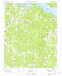 1973 Thelma1977 Print · USGSHalifax County is seen here in the 1970s as the Roanoke River reservoir system shaped the local landscape. Family historians can trace small rural communities like Summit and Gretna Green or locate churches such as Hawkins Chapel and Babbitts Chapel.2 unique versions available
 - 1973 Map of Littleton, 1977 Print
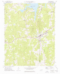 1973 Littleton1977 Print · USGSThe border of Warren and Halifax Counties in the early 1970s is captured here as the Seaboard Coast Line passes through several rural communities. Researchers can trace the layout of Littleton, find Panacea Springs, and locate country churches like Ashley Grove Ch.
 - 1974 Map of Halifax, 1977 Print
 1974 Halifax1977 Print · USGSCoastal plain life in the mid-1970s is centered on the river bend and rail lines of the Roanoke valley. Genealogists and historians can trace local landmarks like Little Zion Ch, the settlement at Mud Castle, and the sprawling Occoneechee Neck.
Showing maps 1-25 of 167
Top cities of Halifax County
- Roanoke Rapids historical maps
- South Rosemary historical maps
- Enfield historical maps
- Scotland Neck historical maps
- Weldon historical maps
- South Weldon historical maps
See more
Frequently asked questions
- What are the different types of historical maps available for Halifax County?
- What is the oldest map of Halifax County?
- Where can I purchase historical maps of Halifax County for my home or office?
- Where can I download high-res historical maps of Halifax County?
- Are there historical topographic maps available for Halifax County?
- Is there historical aerial imagery available for Halifax County?
- Where are historical maps of Halifax County sourced from?