Old Maps of Dellwood, Maggie Valley for Genealogy
Trace your family roots with 16 historic maps of Dellwood. These high-res maps reveal old neighborhoods, homesites, landmarks, and streets — helping you uncover where your ancestors lived and how the area evolved over time.
- Explore historic neighborhoods: Identify where your relatives may have lived in the 1800s or 1900s.
- Compare maps over time: Trace the changes in streets, buildings, and landmarks for multi-generational research.
- Perfect for genealogy & ancestry research: Used by family historians and researchers to map out lineage and migration.
These maps are an incredible resource for exploring your personal connection to Dellwood's past.
Dellwood, Maggie Valley maps
(16)- 1893 Map of Mt Guyot
 1893 Mt Guyot1893 Print · USGSThe Tennessee and North Carolina borderlands are captured here in the 1890s, when isolated mountain coves and river towns relied on the Virginia and Georgia Railroad. Researchers can trace old family sites and transport routes through Fair Garden, Jones Cove, and along the Elliot Ferry Road.3 unique versions available
 - 1912 Map of Mt Guyot
 1912 Mt Guyot1912 Print · USGSThe Tennessee and North Carolina borderlands come into focus in the early twentieth century, prior to the creation of the Great Smoky Mountains National Park. Trace ancestral locations like Cataloochee and Smokemont or follow the Southern RR to Newport.5 unique versions available
 - 1935 Map of Dellwood
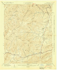
 1935 Dellwood1935 Print · USGSHaywood County in the mid-1930s is a landscape of high mountain coves and valley settlements at the edge of the Smokies. Genealogists can trace early family sites at Yarbrough Cem and Suttontown Sch or locate the community at Maggie.
 - 1941 Map of Dellwood
 1941 Dellwood1941 Print · USGSHaywood County’s high valleys appear here in the early 1940s, showing a landscape of small creek-side settlements and national forest boundaries. Researchers can locate family landmarks like Howell Cem, rural institutions such as Rock Hill Sch, and the scattered homes of Suttontown.7 unique versions available
 - 1955 Map of Knoxville
 1955 Knoxville1955 Print · USGSThe Southern Appalachians and the Smoky Mountains are shown here at a peak of mid-century development and conservation. Genealogists and historians can trace the early road networks connecting Gatlinburg, Waynesville, and the Cherokee Indian Reservation across the high ridges.
 - 1957 Map of Knoxville, 1966 Print
 1957 Knoxville1966 Print · USGSThe Southern Appalachians of Tennessee and North Carolina are mapped here during the mid-twentieth century as new highways reached the high country. Genealogists and historians can trace the topography between Knoxville and Asheville, locating family landmarks near Fontana Lake or along the Blue Ridge Parkway.4 unique versions available
 - 1960 Map of Knoxville
 1960 Knoxville1960 Print · USGSThe Southern Appalachians come alive in the 1950s, showing the intersection of new national park tourism and deep-rooted mountain industry. Trace old rail lines like the Clinchfield RR and find high-altitude landmarks from Mt Le Conte to the Cherokee Indian Reservation.2 unique versions available
 - 1964 Map of Knoxville
 1964 Knoxville1964 Print · USGSThe Southern Appalachians and Great Smokies are captured here during the mid-sixties, showing the rugged borderlands of Tennessee and North Carolina. Researchers can trace historic mountain routes like U S 441, the expanse of Pisgah National Forest, and the growing footprints of Asheville and Knoxville.
 - 1976 Map of Dellwood, 1979 Print
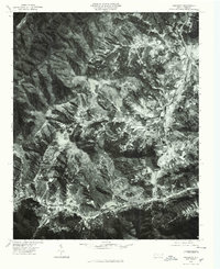 1976 Dellwood1979 Print · USGSMid-century mountain life in western North Carolina comes into focus through this 1970s aerial survey. You can trace the valley settlements of Maggie and Dellwood alongside the forested heights of Moody Top and Cataloochee.
 - 1983 Map of Knoxville, 1984 Print
 1983 Knoxville1984 Print · USGSThe Tennessee valley and the rising Smokies are captured here in the early eighties, showing the region as the tourism and transit hub of the Southern Appalachians. Researchers can trace the layout of the University of Tennessee or locate rural landmarks like Shady Grove Ch and Pleasant Hill Cem.
 - 1997 Map of Dellwood, 2001 Print
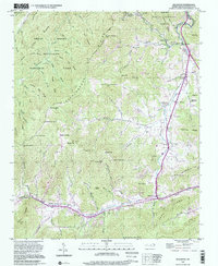 1997 Dellwood2001 Print · USGSThe Blue Ridge high country is captured here during its late-twentieth-century transition between traditional mountain life and seasonal tourism. Genealogists can trace family heritage through landmarks like Davis Cem, Rock Hill Sch, and the community of Beantown.
 - 2011 Map of Dellwood, 2011 Print
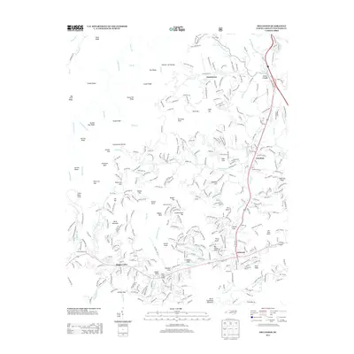
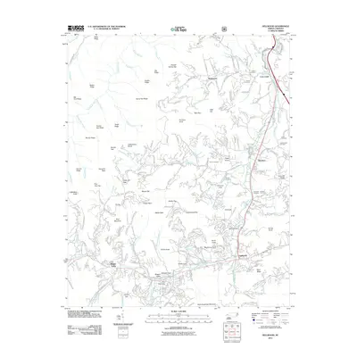 2011 Dellwood2011 Print · USGSCovers Dellwood, including Waynesville, Maggie Valley, and other nearby areas
 - 2013 Map of Dellwood, 2013 Print
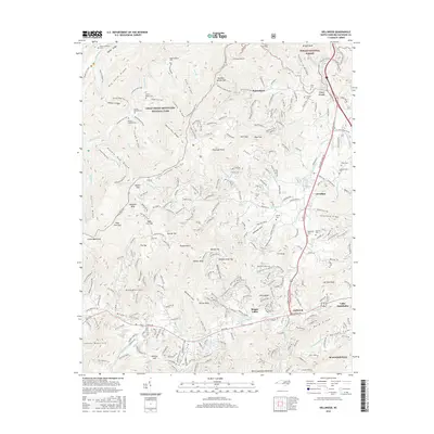
 2013 Dellwood2013 Print · USGSCovers Dellwood, including Waynesville, Maggie Valley, and other nearby areas
 - 2016 Map of Dellwood, 2016 Print
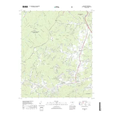
 2016 Dellwood2016 Print · USGSCovers Dellwood, including Waynesville, Maggie Valley, and other nearby areas
 - 2019 Map of Dellwood, 2019 Print
 2019 Dellwood2019 Print · USGSCovers Dellwood, including Waynesville, Maggie Valley, and other nearby areas
 - 2022 Map of Dellwood, 2022 Print
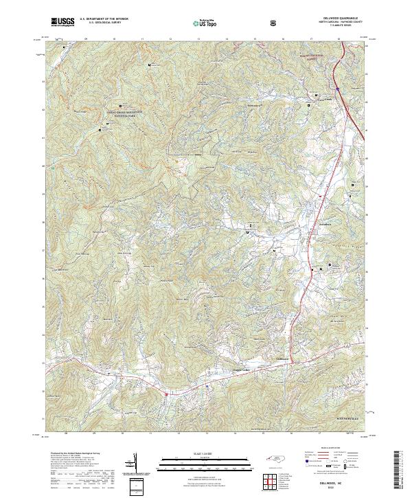 2022 Dellwood2022 Print · USGSThe Great Smoky Mountains meet the Pisgah National Forest in these Haywood County highlands during the early 2020s. Researchers can trace deep family roots at the Sutton-Caldwell Family Cem or the Old Brown Cem near Maggie Valley.
End of results
Showing maps 1-16 of 16
Top cities near Dellwood
- Waynesville historical maps
- Cullowhee historical maps
- Canton historical maps
- Sylva historical maps
- Clyde historical maps
- Maggie Valley historical maps
See more
Frequently asked questions
- What are the different types of historical maps available for Dellwood?
- What is the oldest map of Dellwood?
- Where can I purchase historical maps of Dellwood for my home or office?
- Where can I download high-res historical maps of Dellwood?
- Are there historical topographic maps available for Dellwood?
- Is there historical aerial imagery available for Dellwood?
- Where are historical maps of Dellwood sourced from?