Old Maps of Henderson County, North Carolina for Metal Detecting
Plan your next treasure hunt with 124 historic maps of Henderson County. Find old homesites, ghost towns, trails, and gathering spots that may be lost to time — perfect for identifying promising metal detecting locations.
- Locate forgotten sites: Uncover places like long-lost settlements, abandoned rail lines, or gathering spots.
- Plan better hunts: Use map overlays combined with LiDAR or satellite views to narrow in on historically rich areas.
- Made for detectorists: Thousands of hobbyists use these maps to discover relics, coins, and hidden history.
Use these historic maps to boost your research and find new opportunities beneath the surface of Henderson County.
Henderson County, NC maps
(124)- 1900 Map of Mount Mitchell, 1963 Print
 1900 Mount Mitchell1963 Print · USGSWestern North Carolina at the turn of the century shows a landscape of high peaks and isolated river settlements before the arrival of modern highways. Genealogists and mountain historians can trace early homesteads along the Cane River or follow the Southern RR through Old Fort and Black Mountain.3 unique versions available
 - 1902 Map of Mount Mitchell, 1937 Print
 1902 Mount Mitchell1937 Print · USGSThe high peaks of Western North Carolina are captured here at the start of the twentieth century, showing the rail and river corridors that shaped the region. Trace early settlements like Burnsville, Montreat, and the winding Southern Railway.3 unique versions available
 - 1905 Map of Pisgah, 1956 Print
 1905 Pisgah1956 Print · USGSThe North Carolina high country around the turn of the century reveals a land of timber tracts and emerging mountain retreats. Genealogists and hikers can trace early routes to Buck Spring Lodge, follow the Southern RR tracks, and locate vanished settlements like Angeline and Calhoun.
 - 1906 Map of Pisgah, 1934 Print
 1906 Pisgah1934 Print · USGSThe Blue Ridge highlands at the turn of the century reveal a landscape of mountain river valleys and early timber frontiers. Genealogists and historians can trace family-named bridges and crossings like Graham Bridge or locate vanished settlements such as Grange and Retreat.2 unique versions available
 - 1907 Map of Saluda
 1907 Saluda1907 Print · USGSNorth Carolina's mountain frontier meets the South Carolina foothills in this 1900s survey of the Blue Ridge. Genealogists and researchers can trace the early rail network through Saluda and locate old landmarks like Rockcliff PO and Pleasant Grove Church.3 unique versions available
 - 1935 Map of Standingstone Mtn.
 1935 Standingstone Mtn.1935 Print · USGSThe Blue Ridge mountain borderlands are captured here in the mid-1930s as modern utility lines began to cross the wilderness. Genealogists and hikers can trace the original paths to Holly Springs Ch, the waters of Triple Falls, and the high ridges of Standingstone Mtn.
 - 1935 Map of Horse Shoe
 1935 Horse Shoe1935 Print · USGSWestern North Carolina's river valleys and mountain ridges are documented here in the mid-1930s as the Southern Railroad winds along the French Broad River. Researchers can trace old family sites and rural infrastructure including Prison Camp No 511, Oakdale Cem, and the historic Sewell House.
 - 1935 Map of Batcave
 1935 Batcave1935 Print · USGSThe Henderson County highlands come into focus in the mid-1930s as mountain communities like Edneyville organized around small rural hubs. Local researchers can trace family roots through landmarks like Edneyville Cem or search for old homesteads near Blue Ridge Ch and Raven Rock.
 - 1935 Map of Hendersonville
 1935 Hendersonville1935 Print · USGSHenderson County is captured in the mid-1930s as a bustling crossroads of rail transit and mountain agriculture. Genealogists and historians can trace the foundations of Hendersonville along the Southern Railway, locating the Military Academy, the Orphanage, and old family burial sites like Jones Cem.
 - 1935 Map of Black Mountain
 1935 Black Mountain1935 Print · USGSBuncombe County in the mid-1930s reveals a landscape shaped by mountain transit and social institutions. Genealogists can locate family landmarks like Tabernacle Ch, Pleasant Grove Sch, and the remote Mountain Orphanage along the rail-and-river corridor.
 - 1935 Map of Fishtop
 1935 Fishtop1935 Print · USGSHenderson County settlement is centered around the mountain gaps and valley creeks in the mid-1930s. Genealogists and local historians can trace rural family sites near Refuge Cem, Edith Grove Ch, and the small community of Dana.
 - 1935 Map of Zirconia
 1935 Zirconia1935 Print · USGSHenderson County in the mid-1930s is shown here in an early aerial-photograph survey of the high ridge lines. Genealogists and hikers can trace old mountain trails near Mt Olivet Ch, the peaks of McAlpine Mtn, and the community at Gem.
 - 1935 Map of Pisgah Forest
 1935 Pisgah Forest1935 Print · USGSThe headwaters of the French Broad River valley are shown in the mid-1930s as the national forest system expanded. Trace old family landmarks like Davidson River Cem and community hubs including Turkey Creek Ch and Penrose Sch.
 - 1936 Map of Skyland
 1936 Skyland1936 Print · USGSWestern North Carolina during the mid-thirties reveals a landscape of high ridges and developing river valleys. Genealogists and historians can trace local community roots through landmarks like Arden School, CCC Camp No 5, and Brickton Ch.
 - 1936 Map of Fruitland
 1936 Fruitland1936 Print · USGSThe Blue Ridge foothills of Henderson and Buncombe Counties come alive in the mid-1930s. Genealogists can trace family roots through the Fruitland Institute, Mountain Sanitarium, and rural sites like Tweed Chapel or Patty Chapel.
 - 1936 Map of Dunsmore Mountain
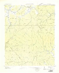 1936 Dunsmore Mountain1936 Print · USGSThe Pisgah National Forest region comes alive in the mid-1930s, showing a landscape of remote mountain churches and early forest management. Genealogists can trace family landmarks like Kelly Cem, Stony Fork Sch, and the high-elevation Buck Spring Lodge.
 - 1941 Map of Black Mountain, 1957 Print
 1941 Black Mountain1957 Print · USGSThe Swannanoa Valley and the Blue Ridge crest come alive in this early 1940s survey. Genealogists can trace the institutional history of the State Hospital or locate family landmarks like Tabernacle Ch and Curteys Chapel.6 unique versions available
 - 1942 Map of Fruitland
 1942 Fruitland1942 Print · USGSHenderson and Buncombe Counties are shown here just as the mountain landscape was being shaped by modern infrastructure in the early 1940s. Genealogists and historians can locate family landmarks such as Fruitland Cem, Christ Sch, and the Mountain Sanitarium.4 unique versions available
 - 1942 Map of Horse Shoe
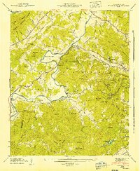 1942 Horse Shoe1942 Print · USGSThe French Broad River valley is captured here in the early 1940s as a thriving network of rail-side settlements and mountain gaps. Genealogists and historians can trace family landmarks like Mc Carson Cem, Oak Forest Ch, and the old Southern Railway line.2 unique versions available
 - 1942 Map of Skyland, 1956 Print
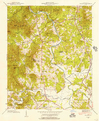 1942 Skyland1956 Print · USGSIn the early 1940s, the mountain communities of Buncombe and Henderson counties were oriented around the French Broad River and the Southern railroad. Researchers can locate family landmarks like the Britton Cem, St Johns Ch, and the old Brickton Sch.2 unique versions available
 - 1942 Map of Dunsmore Mountain, 1957 Print
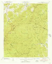 1942 Dunsmore Mountain1957 Print · USGSThe high peaks and deep coves of the Pisgah National Forest are meticulously mapped here in the early 1940s. Genealogists and local historians can locate early landmarks such as Buck Spring Lodge, the Kelly Cem, and Pisgah Ch.2 unique versions available
 - 1943 Map of Black Mountain
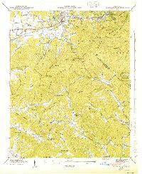 1943 Black Mountain1943 Print · USGSThe Black Mountain area in the early 1940s served as a critical hub for mountain institutions, from religious retreats to state health facilities. Researchers can trace the path of the Southern Railway through the Swannanoa Gap or locate family-named landmarks like Isinglass Ridge and Garren Mountain.
 - 1943 Map of Dunsmore Mountain
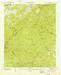 1943 Dunsmore Mountain1943 Print · USGSThe high peaks of the Blue Ridge were a focus of federal forest management and early recreation during the early 1940s. Genealogists and hikers can trace the geography of Buck Spring Lodge, The Pink Beds, and the Kelly Cem.
 - 1943 Map of Skyland
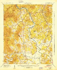 1943 Skyland1943 Print · USGSHenderson and Buncombe County communities thrive along the river valleys and rail lines in the early 1940s. Genealogists and local historians can trace family locations near Fanning Chapel, Britton Cem, and the historic school at Valley Springs Sch.
 - 1945 Map of Pisgah Forest, 1957 Print
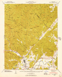 1945 Pisgah Forest1957 Print · USGSTransylvania and Henderson counties are captured here at the end of the war, where mountain industry and wilderness meet. Researchers can trace the legacy of Ecusta, find family burial sites at Davidson River Cem, and locate rural landmarks like English Chapel.2 unique versions available
Showing maps 1-25 of 124
Top cities of Henderson County
- Hendersonville historical maps
- Fletcher historical maps
- Mills River historical maps
- Flat Rock historical maps
- Laurel Park historical maps
- Balfour historical maps
Frequently asked questions
- What are the different types of historical maps available for Henderson County?
- What is the oldest map of Henderson County?
- Where can I purchase historical maps of Henderson County for my home or office?
- Where can I download high-res historical maps of Henderson County?
- Are there historical topographic maps available for Henderson County?
- Is there historical aerial imagery available for Henderson County?
- Where are historical maps of Henderson County sourced from?