Old Maps of Smithfield, North Carolina
Explore 16 old maps of Smithfield, spanning from 1906 to today. These high-resolution historic maps reveal how streets, neighborhoods, landmarks, and natural features evolved over time — perfect for genealogy, metal detecting, research, and local history exploration.
What you can do with these maps:
- See how Smithfield changed over time: Compare historical maps to modern-day views to trace roads, homesites, rail lines & more.
- View detailed metadata: Each map includes creators, publishers, year, scale, and archive source.
- Overlay maps with satellite & LiDAR: Visualize the past alongside modern tools to explore terrain & human change.
- Trusted historical sources: Maps sourced from the USGS, Library of Congress, and other archives.
- Access maps your way: View online, download high-res files, or order prints for personal or research use.
Start exploring old maps of Smithfield to uncover forgotten places, hidden landmarks, and the deep history beneath your feet.
Smithfield, NC maps
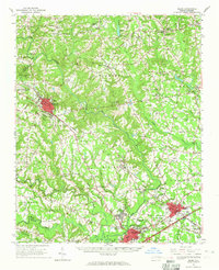
(16)- 1906 Map of Four Oaks
 1906 Four Oaks1906 Print · USGSCovers Smithfield, including Four Oaks, Pine Level, and other nearby areas
 - 1908 Map of Four Oaks
 1908 Four Oaks1908 Print · USGSCovers Smithfield, including Four Oaks, Pine Level, and other nearby areas3 unique versions available
 - 1953 Map of Raleigh, 1965 Print
 1953 Raleigh1965 Print · USGSCovers Smithfield, including Raleigh, Greensboro, and other nearby areas4 unique versions available
 - 1954 Map of Raleigh
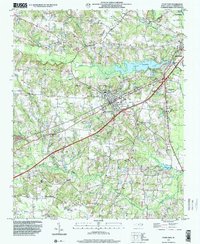
 1954 Raleigh1954 Print · USGSCovers Smithfield, including Raleigh, Greensboro, and other nearby areas
 - 1964 Map of Selma, 1965 Print
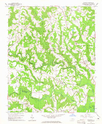
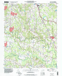
 1964 Selma1965 Print · USGSCovers Smithfield, including Clayton, Selma, and other nearby areas
 - 1964 Map of Powhatan, 1965 Print
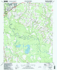
 1964 Powhatan1965 Print · USGSCovers Smithfield, including Clayton, Whitley Heights, and other nearby areas3 unique versions available
 - 1964 Map of Selma, 1965 Print
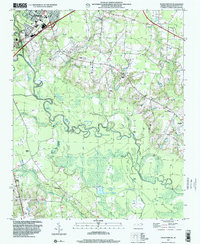
 1964 Selma1965 Print · USGSCovers Smithfield, including Selma, Wilson's Mills, and other nearby areas3 unique versions available
 - 1984 Map of Raleigh, 1985 Print
 1984 Raleigh1985 Print · USGSCovers Smithfield, including Raleigh, Durham, and other nearby areas
 - 1986 Map of Four Oaks
 1986 Four Oaks1986 Print · USGSCovers Smithfield, including Four Oaks, Allens Crossroads, and other nearby areas
 - 1986 Map of Four Oaks NE
 1986 Four Oaks NE1986 Print · USGSCovers Smithfield, including Pine Level, Whitley Place, and other nearby areas
 - 1986 Map of Fayetteville
 1986 Fayetteville1986 Print · USGSCovers Smithfield, including Fayetteville, Goldsboro, and other nearby areas2 unique versions available
 - 1990 Map of Raleigh, 1991 Print
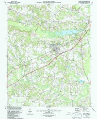
 1990 Raleigh1991 Print · USGSCovers Smithfield, including Raleigh, Durham, and other nearby areas2 unique versions available
 - 1993 Map of Powhatan, 1999 Print
 1993 Powhatan1999 Print · USGSCovers Smithfield, including Clayton, Whitley Heights, and other nearby areas
 - 1997 Map of Four Oaks NE, 2000 Print
 1997 Four Oaks NE2000 Print · USGSCovers Smithfield, including Pine Level, Whitley Place, and other nearby areas
 - 1997 Map of Four Oaks, 2000 Print
 1997 Four Oaks2000 Print · USGSCovers Smithfield, including Four Oaks, Allens Crossroads, and other nearby areas
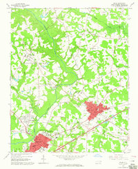
 - 1998 Map of Selma, 2000 Print
 1998 Selma2000 Print · USGSCovers Smithfield, including Selma, Wilson's Mills, and other nearby areas
End of results
Showing maps 1-16 of 16
Top cities near Smithfield
- Raleigh historical maps
- Clayton historical maps
- Garner historical maps
- Dunn historical maps
- Selma historical maps
- Benson historical maps
See more
Top neighborhoods of Smithfield
- West Smithfield historical maps
- Westview historical maps
- Castlehaven historical maps
- Fairfield historical maps
- Laurelwood Hills historical maps
- Sunrise Acres historical maps
See more
Frequently asked questions
- What are the different types of historical maps available for Smithfield?
- What is the oldest map of Smithfield?
- Where can I purchase historical maps of Smithfield for my home or office?
- Where can I download high-res historical maps of Smithfield?
- Are there historical topographic maps available for Smithfield?
- Is there historical aerial imagery available for Smithfield?
- Where are historical maps of Smithfield sourced from?