1970s Maps of Lincolnton, North Carolina
Explore 5 historic maps of Lincolnton from the 1970s. These maps offer a rare glimpse into what life looked like during the 1970s — showing old roads, neighborhoods, homes, and landmarks that have changed or disappeared over time.
Whether you're researching your family's past, planning a metal detecting trip, or studying how Lincolnton's landscape evolved across the 1970s, these high-resolution maps are a powerful tool for exploring the history of this region.
- Focus on a specific era: All maps on this page are from the 1970s, giving you a focused view of this time period.
- See what’s changed: Compare century-old streets, trails, and buildings to today's modern landscape using overlays and satellite layers.
- Research with precision: Use these maps for genealogy, historical research, land use analysis, or educational projects.
- View, download, or print: Maps are fully viewable online in high resolution, and can be downloaded or printed for your own records.
Start exploring Lincolnton's history through authentic maps from the 1970s. This is your window into the past.
Lincolnton, NC maps
(5)- 1970 Map of Lincolnton East, 1972 Print
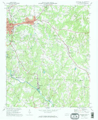 1970 Lincolnton East1972 Print · USGSEastern Lincoln County at the start of the 1970s shows a landscape of textile towns and busy rail corridors. Researchers can trace family roots through City Memorial Gardens, locate old neighborhood schools like Asbury Sch, or map the industrial reach of the SOUTHERN railroad.2 unique versions available
 - 1970 Map of Maiden, 1972 Print
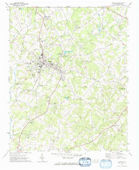 1970 Maiden1972 Print · USGSMaiden and its surrounding Catawba County countryside appear in the early seventies as a thriving rail-centered community. Genealogists and local historians can trace family roots through numerous landmarks like Ivey Memorial Ch, Pumpkin Center, and the Providence Mill.2 unique versions available
 - 1970 Map of Reepsville, 1973 Print
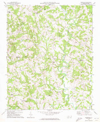 1970 Reepsville1973 Print · USGSCatawba and Lincoln Counties appear here in the early seventies, showing a landscape of established rural communities and winding Piedmont waterways. Genealogists can trace family roots through numerous sites like Wesleyan Chapel, Union Sch, and the settlement of Reepsville.
 - 1973 Map of Lincolnton West, 1976 Print
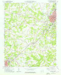 1973 Lincolnton West1976 Print · USGSThe Piedmont landscape of the mid-1970s comes to life here, centered on the historic textile and rail hub of Lincolnton. Genealogists can trace local landmarks like Bethphage Ch, Love Memorial Sch, and the riverside community of Laboratory.
 - 1976 Map of Lincolnton West, 1978 Print
 1976 Lincolnton West1978 Print · USGSLincoln County is shown in the mid-seventies through detailed aerial imagery that captures the era's rural and industrial patterns. Genealogists and historians can trace the precise footprints of Lincolnton, Laboratory, and Crouse as they appeared decades ago.
End of results
Showing maps 1-5 of 5
Top cities near Lincolnton
- Gastonia historical maps
- Hickory historical maps
- Shelby historical maps
- Mount Holly historical maps
- Newton historical maps
- Kings Mountain historical maps
See more
Top neighborhoods of Lincolnton
- South Lincolnton historical maps
- Lithia Springs historical maps
- Boger City historical maps
- Goodsonville historical maps
- Polkadot historical maps
Frequently asked questions
- What are the different types of historical maps available for Lincolnton?
- What is the oldest map of Lincolnton?
- Where can I purchase historical maps of Lincolnton for my home or office?
- Where can I download high-res historical maps of Lincolnton?
- Are there historical topographic maps available for Lincolnton?
- Is there historical aerial imagery available for Lincolnton?
- Where are historical maps of Lincolnton sourced from?