1970s Maps of Huntersville, North Carolina
Explore 5 historic maps of Huntersville from the 1970s. These maps offer a rare glimpse into what life looked like during the 1970s — showing old roads, neighborhoods, homes, and landmarks that have changed or disappeared over time.
Whether you're researching your family's past, planning a metal detecting trip, or studying how Huntersville's landscape evolved across the 1970s, these high-resolution maps are a powerful tool for exploring the history of this region.
- Focus on a specific era: All maps on this page are from the 1970s, giving you a focused view of this time period.
- See what’s changed: Compare century-old streets, trails, and buildings to today's modern landscape using overlays and satellite layers.
- Research with precision: Use these maps for genealogy, historical research, land use analysis, or educational projects.
- View, download, or print: Maps are fully viewable online in high resolution, and can be downloaded or printed for your own records.
Start exploring Huntersville's history through authentic maps from the 1970s. This is your window into the past.
Huntersville, NC maps
(5)- 1970 Map of Lake Norman South, 1972 Print
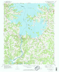 1970 Lake Norman South1972 Print · USGSMecklenburg County enters the seventies as a newly created lakeside community following the damming of the Catawba River. Genealogists and historians can trace the local landscape through landmarks like Triangle Sch, the Seaboard Coast Line rail, and Allison Ferry.2 unique versions available
 - 1970 Map of Cornelius, 1972 Print
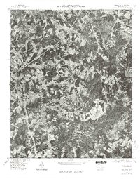
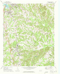 1970 Cornelius1972 Print · USGSMecklenburg County enters a new era in the early seventies as Lake Norman emerges alongside established rail towns. Local historians can trace old community hubs like Smithville and Caldwell or locate family sites at Mt Zion Ch Cem and Ramah Ch.2 unique versions available
 - 1972 Map of Derita, 1973 Print
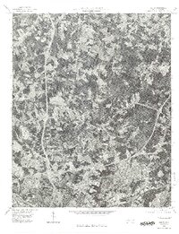
 1972 Derita1973 Print · USGSNorth Mecklenburg County was undergoing a suburban transition in the early seventies as Charlotte pushed northward. Researchers can trace local heritage through the Metrolina Fairgrounds, Brockenbrough Airport, and several old country churches like Oak Grove Ch.
 - 1976 Map of Derita, 1978 Print
 1976 Derita1978 Print · USGSNorth Charlotte and its surrounding Mecklenburg County suburbs are frozen in a moment of rapid mid-seventies growth. Local historians and genealogists can trace the early footprints of modern neighborhoods near Derita, Croft, and the northern edge of Charlotte.
 - 1976 Map of Cornelius, 1978 Print
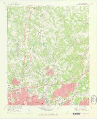
 1976 Cornelius1978 Print · USGSMecklenburg County towns appear in their mid-1970s landscape before the era of rapid suburban growth. Genealogists and local historians can trace the early footprints of Davidson, Cornelius, and Huntersville alongside the banks of Lake Norman.
End of results
Showing maps 1-5 of 5
Top cities near Huntersville
- Charlotte historical maps
- Concord historical maps
- Kannapolis historical maps
- Mooresville historical maps
- Cornelius historical maps
- Mint Hill historical maps
See more
Top neighborhoods of Huntersville
- Rosedale historical maps
- Hicks Crossroads historical maps
- Downtown historical maps
- Birkdale historical maps
- NorthStone historical maps
- Centennial at Historic Huntersville historical maps
See more
Frequently asked questions
- What are the different types of historical maps available for Huntersville?
- What is the oldest map of Huntersville?
- Where can I purchase historical maps of Huntersville for my home or office?
- Where can I download high-res historical maps of Huntersville?
- Are there historical topographic maps available for Huntersville?
- Is there historical aerial imagery available for Huntersville?
- Where are historical maps of Huntersville sourced from?