1990s Maps of Huntersville, North Carolina
Explore 5 historic maps of Huntersville from the 1990s. These maps offer a rare glimpse into what life looked like during the 1990s — showing old roads, neighborhoods, homes, and landmarks that have changed or disappeared over time.
Whether you're researching your family's past, planning a metal detecting trip, or studying how Huntersville's landscape evolved across the 1990s, these high-resolution maps are a powerful tool for exploring the history of this region.
- Focus on a specific era: All maps on this page are from the 1990s, giving you a focused view of this time period.
- See what’s changed: Compare century-old streets, trails, and buildings to today's modern landscape using overlays and satellite layers.
- Research with precision: Use these maps for genealogy, historical research, land use analysis, or educational projects.
- View, download, or print: Maps are fully viewable online in high resolution, and can be downloaded or printed for your own records.
Start exploring Huntersville's history through authentic maps from the 1990s. This is your window into the past.
Huntersville, NC maps
(5)- 1993 Map of Cornelius, 1996 Print
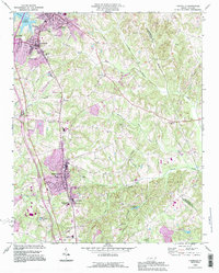 1993 Cornelius1996 Print · USGSNorthern Mecklenburg County witnessed significant growth in the early nineties, as seen in the expanding street grids of Cornelius and Huntersville. Researchers can locate old family landmarks like Bethel Cem and the campus of Davidson College.
 - 1993 Map of Derita, 1996 Print
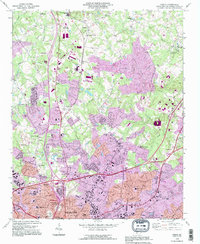 1993 Derita1996 Print · USGSNorthern Mecklenburg County enters a period of intense suburban growth in the early nineties as the Charlotte city limits expand. Genealogists and local historians can trace legacy sites like the Sugar Creek Burying Ground, Derita Mineral Spring, and the Metrolina Fairgrounds.
 - 1993 Map of Mountain Island Lake, 1996 Print
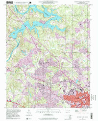
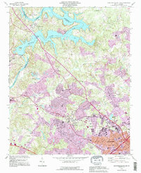 1993 Mountain Island Lake1996 Print · USGSMecklenburg County enters a period of significant growth in the 1990s as the suburbs of Charlotte reach toward the Catawba River. Researchers can trace rural roots at Shuffletown or find family history at Forest Lawn Cemetery and Riverbend Ch.
 - 1993 Map of Lake Norman South, 1996 Print
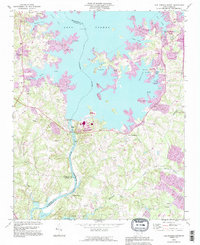 1993 Lake Norman South1996 Print · USGSThe Catawba River valley transitioned into a major recreation hub during the 1990s as suburban growth expanded near the Mecklenburg and Lincoln county lines. Genealogists can locate legacy sites like Ebenezer Cem and Marthas Chapel alongside newer landmarks like Ramsey Creek County Park.
 - 1997 Map of Mountain Island Lake, 1999 Print
 1997 Mountain Island Lake1999 Print · USGSThe Catawba River northwest of Charlotte appears here in the late nineties as a landscape defined by utility reservoirs and suburban growth. Researchers can trace family roots through numerous rural landmarks like Hopewell Ch, Riverbend Cem, and the old settlement of Shuffletown.
End of results
Showing maps 1-5 of 5
Top cities near Huntersville
- Charlotte historical maps
- Concord historical maps
- Kannapolis historical maps
- Mooresville historical maps
- Cornelius historical maps
- Mint Hill historical maps
See more
Top neighborhoods of Huntersville
- Rosedale historical maps
- Hicks Crossroads historical maps
- Downtown historical maps
- Birkdale historical maps
- NorthStone historical maps
- Centennial at Historic Huntersville historical maps
See more
Frequently asked questions
- What are the different types of historical maps available for Huntersville?
- What is the oldest map of Huntersville?
- Where can I purchase historical maps of Huntersville for my home or office?
- Where can I download high-res historical maps of Huntersville?
- Are there historical topographic maps available for Huntersville?
- Is there historical aerial imagery available for Huntersville?
- Where are historical maps of Huntersville sourced from?