Old Maps of Rogers Crossroads, North Carolina for Genealogy
Trace your family roots with 12 historic maps of Rogers Crossroads. These high-res maps reveal old neighborhoods, homesites, landmarks, and streets — helping you uncover where your ancestors lived and how the area evolved over time.
- Explore historic neighborhoods: Identify where your relatives may have lived in the 1800s or 1900s.
- Compare maps over time: Trace the changes in streets, buildings, and landmarks for multi-generational research.
- Perfect for genealogy & ancestry research: Used by family historians and researchers to map out lineage and migration.
These maps are an incredible resource for exploring your personal connection to Rogers Crossroads's past.
Rogers Crossroads, NC maps
(12)- 1902 Map of Spring Hope, 1965 Print
 1902 Spring Hope1965 Print · USGSNash and Franklin Counties are seen here at the turn of the century as a landscape of river-bend settlements and railroad progress. Researchers can trace ancestral roots through family-named landmarks like Lamm Crossroads, Lee Chapel, and Pine Ridge Schoolhouse.
 - 1904 Map of Springhope, 1942 Print
 1904 Springhope1942 Print · USGSNash County at the turn of the century shows a rural landscape connected by the Atlantic Coast Line R. R. and the winding Tar River. Researchers can trace ancestral locations at Lamm Crossroads, Whiteoak Church, and the Pine Ridge Schoolhouse.
 - 1953 Map of Raleigh, 1965 Print
 1953 Raleigh1965 Print · USGSCentral North Carolina in the early sixties shows a landscape of growing towns and military hubs before the full expansion of the interstate system. Genealogists can trace family footprints across the Piedmont through Wake Forest, Siler City, and the large Fort Bragg Military Reservation.4 unique versions available
 - 1954 Map of Raleigh
 1954 Raleigh1954 Print · USGSThe North Carolina Piedmont and Sandhills are captured in the mid-fifties during a period of steady regional growth. Genealogists and historians can trace the development of towns like Siler City or locate landmarks such as Falls of Neuse and Camp Mackall.
 - 1978 Map of Middlesex
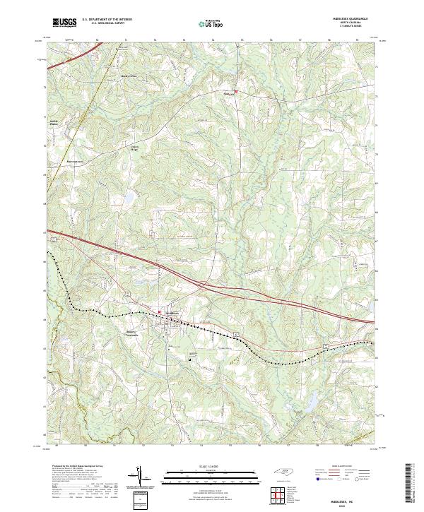
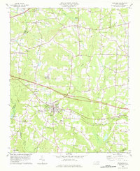 1978 Middlesex1978 Print · USGSCoastal plain farmland and tobacco-country crossroads define this corner of Nash County in the late 1970s. Trace family roots and local history through numerous country churches like St Bethel Church and community centers like Social Plains or Middlesex.
 - 1984 Map of Raleigh, 1985 Print
 1984 Raleigh1985 Print · USGSThe North Carolina Research Triangle is shown during a decade of rapid growth, from the sprawl of Raleigh to the expanding waters of Falls Lake. Genealogists and historians can trace rail lines like the Seaboard Coast Line or locate landmark sites like Dorothea Dix State Hospital and Fuquay-Varina.
 - 1990 Map of Raleigh, 1991 Print
 1990 Raleigh1991 Print · USGSGreater Raleigh and the Research Triangle entered a period of significant suburban growth during the 1990s. Researchers can trace the development of towns like Fuquay-Varina and Wake Forest or locate landmarks such as the State Prison and Harris Reservoir.2 unique versions available
 - 2010 Map of Middlesex, 2010 Print
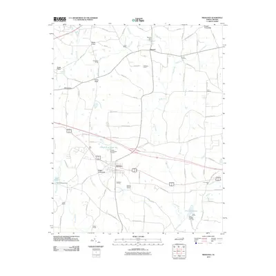 2010 Middlesex2010 Print · USGSCovers Rogers Crossroads, including Middlesex, Murraytown, and other nearby areas
 - 2013 Map of Middlesex, 2013 Print
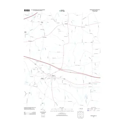 2013 Middlesex2013 Print · USGSCovers Rogers Crossroads, including Middlesex, Murraytown, and other nearby areas
 - 2016 Map of Middlesex, 2016 Print
 2016 Middlesex2016 Print · USGSCovers Rogers Crossroads, including Middlesex, Murraytown, and other nearby areas
 - 2019 Map of Middlesex, 2019 Print
 2019 Middlesex2019 Print · USGSCovers Rogers Crossroads, including Middlesex, Murraytown, and other nearby areas
 - 2022 Map of Middlesex, 2022 Print
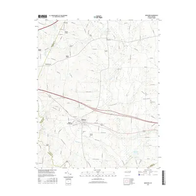
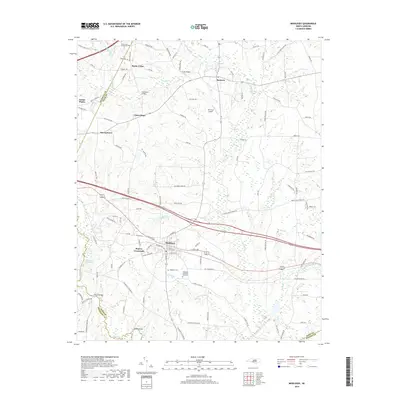
 2022 Middlesex2022 Print · USGSMiddlesex and its rural Nash County surroundings are shown here in the early 2020s, highlighting a landscape of dispersed settlements and family-named landmarks. Researchers can trace local history through the Rocky Cross Church Cem, Taylors Millpond, and the community of Rogers Crossroads.
End of results
Showing maps 1-12 of 12
Top cities near Rogers Crossroads
- Wilson historical maps
- Clayton historical maps
- Wendell historical maps
- Zebulon historical maps
- Selma historical maps
- Wilson's Mills historical maps
See more
Frequently asked questions
- What are the different types of historical maps available for Rogers Crossroads?
- What is the oldest map of Rogers Crossroads?
- Where can I purchase historical maps of Rogers Crossroads for my home or office?
- Where can I download high-res historical maps of Rogers Crossroads?
- Are there historical topographic maps available for Rogers Crossroads?
- Is there historical aerial imagery available for Rogers Crossroads?
- Where are historical maps of Rogers Crossroads sourced from?