2000s (21st Century) Maps of Fruitland, North Carolina
Explore 6 historic maps of Fruitland from the 2000s (21st Century). These maps offer a rare glimpse into what life looked like during the 2000s — showing old roads, neighborhoods, homes, and landmarks that have changed or disappeared over time.
Whether you're researching your family's past, planning a metal detecting trip, or studying how Fruitland's landscape evolved across the 2000s, these high-resolution maps are a powerful tool for exploring the history of this region.
- Focus on a specific era: All maps on this page are from the 2000s, giving you a focused view of this time period.
- See what’s changed: Compare century-old streets, trails, and buildings to today's modern landscape using overlays and satellite layers.
- Research with precision: Use these maps for genealogy, historical research, land use analysis, or educational projects.
- View, download, or print: Maps are fully viewable online in high resolution, and can be downloaded or printed for your own records.
Start exploring Fruitland's history through authentic maps from the 2000s. This is your window into the past.
Fruitland, NC maps
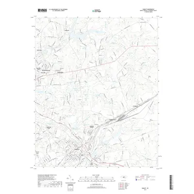
(6)- 2002 Map of Hamlet
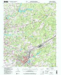 2002 Hamlet2002 Print · USGSHamlet and Rockingham are shown at a point of steady growth near the start of the millennium, with a landscape defined by rail lines and millponds. Researchers can trace family roots at Bear Branch Cemetery or locate historic rural landmarks like McDonald Church and Gibsons Millpond.
 - 2010 Map of Hamlet, 2010 Print
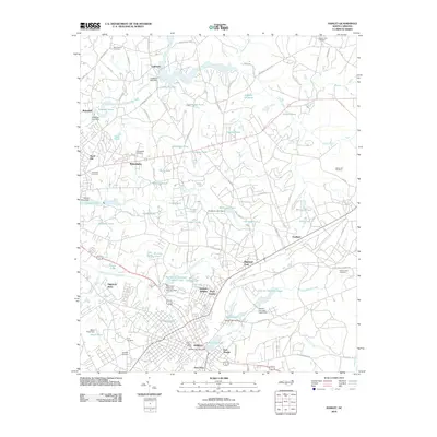 2010 Hamlet2010 Print · USGSCovers Fruitland, including Rockingham, Hamlet, and other nearby areas
 - 2013 Map of Hamlet, 2013 Print
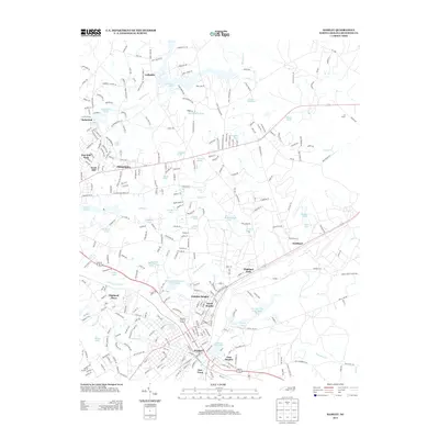 2013 Hamlet2013 Print · USGSCovers Fruitland, including Rockingham, Hamlet, and other nearby areas
 - 2016 Map of Hamlet, 2016 Print
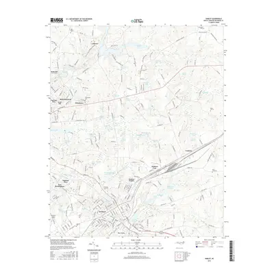 2016 Hamlet2016 Print · USGSCovers Fruitland, including Rockingham, Hamlet, and other nearby areas
 - 2019 Map of Hamlet, 2019 Print
 2019 Hamlet2019 Print · USGSCovers Fruitland, including Rockingham, Hamlet, and other nearby areas
 - 2022 Map of Hamlet, 2022 Print
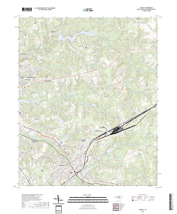 2022 Hamlet2022 Print · USGSHamlet and Rockingham are shown here as they appeared in the early 2020s, anchored by their deep railroad and milling heritage. Local researchers can trace family landmarks and transit routes near Hinson Lake, Dobbins Heights, and the historic Philadelphia Cem.
End of results
Showing maps 1-6 of 6
Top cities near Fruitland
- Laurinburg historical maps
- Southern Pines historical maps
- Rockingham historical maps
- Hamlet historical maps
- Aberdeen historical maps
- Cheraw historical maps
See more
Frequently asked questions
- What are the different types of historical maps available for Fruitland?
- What is the oldest map of Fruitland?
- Where can I purchase historical maps of Fruitland for my home or office?
- Where can I download high-res historical maps of Fruitland?
- Are there historical topographic maps available for Fruitland?
- Is there historical aerial imagery available for Fruitland?
- Where are historical maps of Fruitland sourced from?