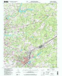
2002 Map of Hamlet
USGS Topo · Published 2002About this map
The railroad town of Hamlet and the neighboring city of Rockingham anchor this early 21st-century landscape, which remains deeply connected to its water resources. A complex system of ponds and creeks, such as Hitchcock Cr and Falling Creek, supported industrial and agricultural development, as evidenced by Gibsons Millpond and Ledbetter Lake. The residential expansion is visible in neighborhoods like Highland Pines, Knob Hill, and New Town, while the edges of the map transition into the protected environment of the Sandhills State Game Land.
Find a feature on this map
73 named features on this map. Tap any name to fly to it.
Don’t see what you’re looking for? This feature index may not catch every label — zoom into the map to look around manually.
Map Details
Editions of this 2002 Hamlet Map
This is the sole edition of this map. No revisions or reprints were ever made.
Other maps of this area

1942 · Troy
USGS Topo · 1:125,000

1942 · Rockingham
USGS Topo · 1:125,000

1949 · Gibson
USGS Topo · 1:24,000

1949 · Millstone Lake
USGS Topo · 1:24,000

1949 · Ghio
USGS Topo · 1:24,000

1949 · Hoffman
USGS Topo · 1:24,000

1949 · Marston
USGS Topo · 1:24,000

1949 · Hamlet
USGS Topo · 1:24,000

1949 · Hamlet
USGS Topo · 1:62,500

1949 · Jackson Springs
USGS Topo · 1:62,500