1970s Maps of Rockingham County, North Carolina
Explore 14 historic maps of Rockingham County from the 1970s. These maps offer a rare glimpse into what life looked like during the 1970s — showing old roads, neighborhoods, homes, and landmarks that have changed or disappeared over time.
Whether you're researching your family's past, planning a metal detecting trip, or studying how Rockingham County's landscape evolved across the 1970s, these high-resolution maps are a powerful tool for exploring the history of this region.
- Focus on a specific era: All maps on this page are from the 1970s, giving you a focused view of this time period.
- See what’s changed: Compare century-old streets, trails, and buildings to today's modern landscape using overlays and satellite layers.
- Research with precision: Use these maps for genealogy, historical research, land use analysis, or educational projects.
- View, download, or print: Maps are fully viewable online in high resolution, and can be downloaded or printed for your own records.
Start exploring Rockingham County's history through authentic maps from the 1970s. This is your window into the past.
Rockingham County, NC maps
(14)- 1970 Map of Ossipee, 1973 Print
 1970 Ossipee1973 Print · USGSThe borderlands of Alamance and Guilford Counties come into focus in the early 1970s as the Haw River winds past small rural hubs. Researchers can trace local heritage through numerous landmarks like Altamahaw-Ossipee Sch, Apples Chapel Cem, and Friedens Ch.
 - 1971 Map of Belews Lake, 1973 Print
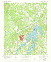 1971 Belews Lake1973 Print · USGSThe rural borderlands of Stokes and Rockingham counties are captured here in the early 1970s as the landscape transformed around Belews Lake. Researchers can trace old family sites near Pine Hall, Camp Vaughn, and country landmarks like Sycamore Ch.3 unique versions available
 - 1971 Map of Ayersville, 1973 Print
 1971 Ayersville1973 Print · USGSThe borderlands of Stokes and Rockingham counties are shown here in the early 1970s, as the rural landscape centered on the Dan River. Genealogists can trace family footprints near Ayersville, Dodgetown, and country churches like Oak Grove Ch or Wilson Ch.2 unique versions available
 - 1971 Map of Mayodan, 1974 Print
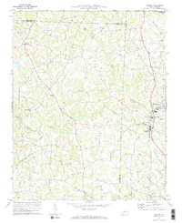
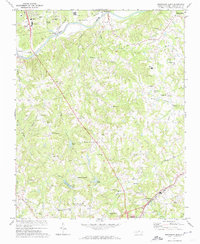
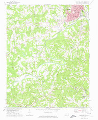
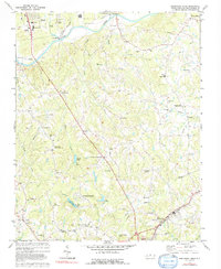
 1971 Mayodan1974 Print · USGSThe industrial and rail corridor of Rockingham County is captured here in the early seventies, centered on the riverfront towns of Madison and Mayodan. Researchers can trace family history through sites like Llewellyn Cem, Dan Valley Ch, and Stoneville Sch.
 - 1971 Map of Southeast Eden, 1974 Print
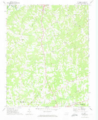
 1971 Southeast Eden1974 Print · USGSRockingham County in the early 1970s shows a landscape of rural crossroads and growing industry between the Dan River and REIDSVILLE. Genealogists can trace family landmarks like the Chinqua Penn Plantation, Slaydon Cem, and Oregon Hill.2 unique versions available
 - 1971 Map of Ruffin, 1974 Print
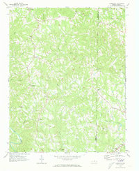
 1971 Ruffin1974 Print · USGSRockingham and Caswell counties come into focus in the early 1970s, showing a Piedmont landscape tied to the rail line. Local historians can trace family roots at Mullins-Stacy Cem or locate community hubs like Wolf Island Ch and the settlement of Ruffin.2 unique versions available
 - 1971 Map of Ellisboro, 1974 Print
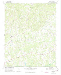
 1971 Ellisboro1974 Print · USGSRockingham County in the early seventies was a landscape of quiet rural settlements and small-town hubs linked by the Dan River and the rail. Researchers can trace local roots through numerous country landmarks like Comers Chapel, Hayes Chapel, and the Woodland Cem.2 unique versions available
 - 1971 Map of Bethany, 1974 Print
 1971 Bethany1974 Print · USGSRockingham County in the early seventies is a landscape of rural crossroads and historic congregations. Genealogists and local historians can trace family locations through numerous sites like Bakers Crossroads, Wittys Crossroads, and the St Mariahs Ch cemetery.
 - 1971 Map of Southwest Eden, 1974 Print
 1971 Southwest Eden1974 Print · USGSRockingham County in the early seventies shows a landscape where the industrial growth of Eden meets the quiet reaches of the Dan River. Researchers can trace local landmarks like Rockingham Community College, the Drive-in Theater, and historic rural sites such as Settles Bridge Ch.2 unique versions available
 - 1972 Map of Williamsburg, 1974 Print
 1972 Williamsburg1974 Print · USGSRockingham and Caswell counties in the early 1970s reveal a landscape of interconnected farm communities and country roads. Genealogists can trace family footprints at Williamsburg, Settle Cem, and numerous rural sanctuaries like Browns Arbor Ch.
 - 1972 Map of Reidsville, 1974 Print
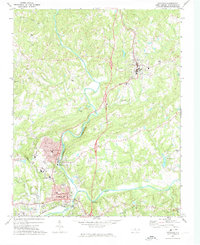
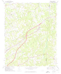
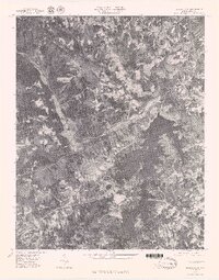
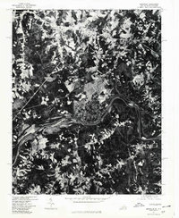
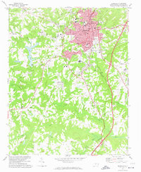 1972 Reidsville1974 Print · USGSReidsville and its surrounding Rockingham County rural districts are shown here during the early seventies, capturing the city's established residential and industrial core. Genealogists and local historians can trace family locations near Reidsville Cem, Wesley Chapel, or the outlying community of Monroeton.2 unique versions available
 - 1977 Map of Belews Lake, 1979 Print
 1977 Belews Lake1979 Print · USGSThe Dan River and its surrounding Piedmont landscapes are captured in detail in the late seventies. Researchers can trace the sprawling shoreline of Belews Lake or locate the historic settlement of Pine Hall along the Dan River.
 - 1977 Map of Brosville, 1979 Print
 1977 Brosville1979 Print · USGSThe Virginia and North Carolina borderlands are captured in the late seventies, showing the rural character of the region. Researchers can trace the winding Dan River and identify local homesteads near Brosville, Bachelors Hall, and Vandola.
 - 1977 Map of Southeast Eden, 1992 Print
 1977 Southeast Eden1992 Print · USGSNorth Carolina's Piedmont region in the 1970s shows the growth of settlements like Eden and Reidsville alongside rural farmsteads. Genealogists can trace family landmarks and local institutions like Lincoln Sch, Harrisons Crossroads, and the Chinqua Penn Plantation.
End of results
Showing maps 1-14 of 14
Top cities of Rockingham County
- Eden historical maps
- Reidsville historical maps
- Wentworth historical maps
- Mayodan historical maps
- Madison historical maps
- Stoneville historical maps
Frequently asked questions
- What are the different types of historical maps available for Rockingham County?
- What is the oldest map of Rockingham County?
- Where can I purchase historical maps of Rockingham County for my home or office?
- Where can I download high-res historical maps of Rockingham County?
- Are there historical topographic maps available for Rockingham County?
- Is there historical aerial imagery available for Rockingham County?
- Where are historical maps of Rockingham County sourced from?