Old Maps of Rockingham County, North Carolina for Metal Detecting
Plan your next treasure hunt with 135 historic maps of Rockingham County. Find old homesites, ghost towns, trails, and gathering spots that may be lost to time — perfect for identifying promising metal detecting locations.
- Locate forgotten sites: Uncover places like long-lost settlements, abandoned rail lines, or gathering spots.
- Plan better hunts: Use map overlays combined with LiDAR or satellite views to narrow in on historically rich areas.
- Made for detectorists: Thousands of hobbyists use these maps to discover relics, coins, and hidden history.
Use these historic maps to boost your research and find new opportunities beneath the surface of Rockingham County.
Rockingham County, NC maps
(135)- 1924 Map of Martinsville
 1924 Martinsville1924 Print · USGSHenry County is shown in the mid-twenties as a thriving industrial corridor along the Smith River. Genealogists can trace family roots through dozens of rural landmarks, from the Bough and Reilly Mill to the Mountain School and Rock Run Church.
 - 1924 Map of Draper
 1924 Draper1924 Print · USGSThe rural Piedmont of Southside Virginia is mapped here during the mid-twenties, showcasing a landscape of small tobacco farms and river-valley settlements. Researchers can trace family sites like Laceys Store, the Soapstone Quarry, and early depots at Leaksville Junction.
 - 1926 Map of Martinsville
 1926 Martinsville1926 Print · USGSHenry County and the Virginia-North Carolina border are captured in the mid-1920s, a period when the Smith River and twin rail lines drove local industry. Researchers can locate dozens of family-named landmarks and institutions like Rough and Ready Mill, Rangeleys Store, and Horse Pasture Church.2 unique versions available
 - 1926 Map of Critz
 1926 Critz1926 Print · USGSAcross the Virginia and North Carolina border in the mid-twenties, this mountain landscape reveals a self-sufficient network of mill seats and rural post offices. Researchers can trace family ties through dozens of landmarks like Blue Mountain School, Kogers Mill, and Patrick Springs Station.2 unique versions available
 - 1926 Map of Draper
 1926 Draper1926 Print · USGSThe Virginia and North Carolina borderlands come alive in the mid-1920s, showing a landscape of small tobacco farms and rail-dependent hamlets. Genealogists can trace family roots through numerous local landmarks like Swansonville, Bachelors Hall Church, and the Danville and Western rail line.3 unique versions available
 - 1927 Map of Martinsville, 1942 Print
 1927 Martinsville1942 Print · USGSHenry County and the Virginia-North Carolina border are captured here during the mid-twenties, when the textile and rail economy was transforming the Piedmont. Researchers can trace family sites among dozens of landmarks like Rough and Ready Mill, Fieldale, and Rock Run Church.2 unique versions available
 - 1928 Map of Critz
 1928 Critz1928 Print · USGSPatrick and Henry Counties appear here in the late twenties, showing a transition from the Blue Ridge heights to a valley economy defined by the Danville and Western rail line. Genealogists can trace early homesteads and community hubs like Penns Store, Patrick Springs Station, and Smith Chapel.3 unique versions available
 - 1944 Map of Martinsville
 1944 Martinsville1944 Print · USGSHenry County is captured in the mid-1940s as a thriving center of industry and agriculture along the Smith River. Genealogists and historians can trace family locations near dozens of rural landmarks like Rough and Ready Mill, Cedar Chappell, and the County Farm.
 - 1944 Map of Draper
 1944 Draper1944 Print · USGSThe Virginia and North Carolina borderlands come alive in the 1940s, showing the industrial and rail corridor stretching from Spray to Draper. Researchers can trace the Danville and Western Ry route through old stops like Cascade Station and discover dozens of rural community hubs like Stony Mill and Anderson Chapel.
 - 1951 Map of Browns Summit, 1952 Print
 1951 Browns Summit1952 Print · USGSGuilford County is captured here in the early fifties, showing a rural landscape defined by the Southern Railroad and small community hubs. Local historians can trace family roots at Phibbs Cem or locate community centers like Hines Chapel and Browns Summit Sch.5 unique versions available
 - 1953 Map of Winston-Salem, 1974 Print
 1953 Winston-Salem1974 Print · USGSThe North Carolina Piedmont and Virginia highlands meet in the mid-1950s, a landscape defined by the tobacco and textile hubs of the Blue Ridge foothills. Researchers can trace the rail-and-river geography connecting Winston-Salem to mountain towns like Mount Airy and Galax.2 unique versions available
 - 1953 Map of Greensboro, 1981 Print
 1953 Greensboro1981 Print · USGSThe Piedmont borderlands of North Carolina and Virginia show a landscape defined by new reservoirs and old rail lines. Trace family roots and the changing river geography through Elon College, the John H Kerr Reservoir, and South Boston.
 - 1954 Map of Greensboro
 1954 Greensboro1954 Print · USGSThe Piedmont borderlands of North Carolina and Virginia come alive in this mid-fifties study of a region defined by its rivers and rails. Researchers can trace the growing Buggs Island Lake or follow the paths of the Southern Ry and Seaboard Air Line RR through towns like Oxford and Reidsville.
 - 1955 Map of Winston-Salem
 1955 Winston-Salem1955 Print · USGSThe Central Blue Ridge and Piedmont transition are captured here in the mid-fifties, from the industrial hub of Winston-Salem to the high peaks of Southwest Virginia. Genealogists can trace family landmarks like Richmond Hill Ch, Siloam Ch, and the old rail stops along the Southern Railway.
 - 1962 Map of Winston-Salem
 1962 Winston-Salem1962 Print · USGSThe North Carolina Piedmont meets the Virginia highlands in the early sixties, showing the rail corridors and mountain gaps of the southern Appalachians. Researchers can trace the Blue Ridge Parkway or locate family sites near Winston-Salem, Mount Airy, and Hanging Rock Mountain.
 - 1962 Map of Greensboro
 1962 Greensboro1962 Print · USGSThe Piedmont region along the Virginia and North Carolina border comes alive in the early 1960s, showing a landscape defined by industry and new reservoirs. Trace the path of the Virginian RR or explore the early development of Greensboro and Durham.
 - 1964 Map of Spray, 1966 Print
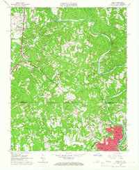 1964 Spray1966 Print · USGSThe Virginia and North Carolina border comes alive in the mid-sixties, centered on the industrial hub of the Smith River valley. Genealogists can trace family roots through numerous local landmarks like New Bethel Ch, Osborne Ch, and the streets of Leaksville.
 - 1964 Map of Price, 1966 Print
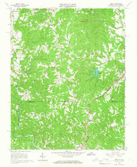 1964 Price1966 Print · USGSThe Virginia and North Carolina borderlands are captured here in the mid-1960s, showing the rural communities of Rockingham and Henry Counties. Genealogists and local historians can locate several rural landmarks like New Jerusalem Ch, the Prison Camp, and the Norfolk and Western rail line.2 unique versions available
 - 1965 Map of Brosville, 1966 Print
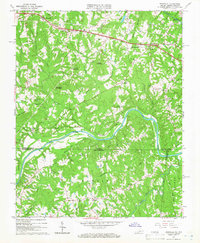 1965 Brosville1966 Print · USGSCrossing the Virginia and North Carolina border in the mid-sixties, this area shows a landscape defined by the loops of the Dan River. Genealogists can locate family landmarks like Judy Byrd Mountain and rural congregations at Piney Grove Ch or Vandola Ch.4 unique versions available
 - 1965 Map of Draper, 1966 Print
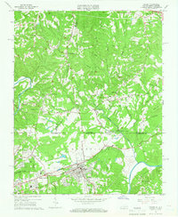 1965 Draper1966 Print · USGSNorth Carolina and Virginia meet along this industrial rail corridor during the mid-sixties, where the textile and transit hubs of the Piedmont were rapidly evolving. Researchers can trace family roots at Sunny Home Ch, locate the old Morgan Ford Bridge, or explore the rail sidings of Leaksville Junction.4 unique versions available
 - 1965 Map of Northwest Eden, 1978 Print
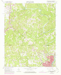 1965 Northwest Eden1978 Print · USGSThe borderlands of Rockingham County and Henry County come alive in this mid-century survey of the Smith River valley. Genealogists and local historians can trace the foundations of Leaksville and Spray or locate rural landmarks like New Bethel Ch and the Norfolk and Western tracks.2 unique versions available
 - 1966 Map of Greensboro
 1966 Greensboro1966 Print · USGSThe North Carolina and Virginia Piedmont thrives during the mid-sixties, showcasing a landscape of textile hubs and expanding river reservoirs. Researchers can trace the rail corridors of the Southern Railway, find local landmarks like Elon College, or locate the extensive Camp Butner Military Reservation.
 - 1967 Map of Spencer, 1968 Print
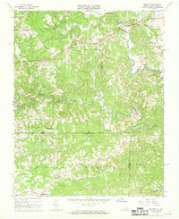 1967 Spencer1968 Print · USGSThe Virginia and North Carolina state line runs through this rural landscape in the late sixties, centered on the winding Mayo River forks. Genealogists and local historians can locate community landmarks like Penns Store, Sheppards Mill, and the Spencer-Penn Sch.2 unique versions available
 - 1970 Map of Ossipee, 1973 Print
 1970 Ossipee1973 Print · USGSThe borderlands of Alamance and Guilford Counties come into focus in the early 1970s as the Haw River winds past small rural hubs. Researchers can trace local heritage through numerous landmarks like Altamahaw-Ossipee Sch, Apples Chapel Cem, and Friedens Ch.
 - 1971 Map of Belews Lake, 1973 Print
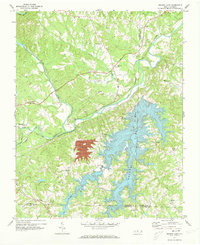 1971 Belews Lake1973 Print · USGSThe rural borderlands of Stokes and Rockingham counties are captured here in the early 1970s as the landscape transformed around Belews Lake. Researchers can trace old family sites near Pine Hall, Camp Vaughn, and country landmarks like Sycamore Ch.3 unique versions available
Showing maps 1-25 of 135
Top cities of Rockingham County
- Eden historical maps
- Reidsville historical maps
- Wentworth historical maps
- Mayodan historical maps
- Madison historical maps
- Stoneville historical maps
Frequently asked questions
- What are the different types of historical maps available for Rockingham County?
- What is the oldest map of Rockingham County?
- Where can I purchase historical maps of Rockingham County for my home or office?
- Where can I download high-res historical maps of Rockingham County?
- Are there historical topographic maps available for Rockingham County?
- Is there historical aerial imagery available for Rockingham County?
- Where are historical maps of Rockingham County sourced from?