2020s Maps of Scotland County, North Carolina
Explore 13 historic maps of Scotland County from the 2020s. These maps offer a rare glimpse into what life looked like during the 2020s — showing old roads, neighborhoods, homes, and landmarks that have changed or disappeared over time.
Whether you're researching your family's past, planning a metal detecting trip, or studying how Scotland County's landscape evolved across the 2020s, these high-resolution maps are a powerful tool for exploring the history of this region.
- Focus on a specific era: All maps on this page are from the 2020s, giving you a focused view of this time period.
- See what’s changed: Compare century-old streets, trails, and buildings to today's modern landscape using overlays and satellite layers.
- Research with precision: Use these maps for genealogy, historical research, land use analysis, or educational projects.
- View, download, or print: Maps are fully viewable online in high resolution, and can be downloaded or printed for your own records.
Start exploring Scotland County's history through authentic maps from the 2020s. This is your window into the past.
Scotland County, NC maps
(13)- 2020 Map of McColl, 2020 Print
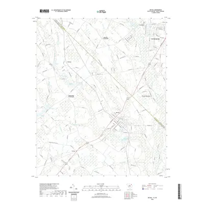 2020 McColl2020 Print · USGSCovers Scotland County, including Laurinburg, McColl, and other nearby areas
 - 2022 Map of Ghio, 2022 Print
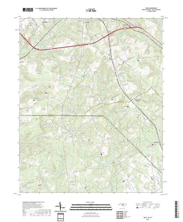 2022 Ghio2022 Print · USGSThe Carolina borderlands near the Richmond and Marlboro county lines are shown here as they appeared recently, centered on the crossroads of Ghio Scholl Station. Family historians can locate numerous rural burial sites and congregations such as Waymon Chapel Cem and Grace Chapel Church.
 - 2022 Map of Silver Hill, 2022 Print
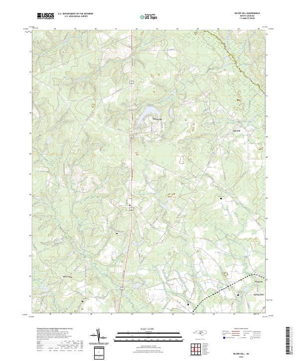 2022 Silver Hill2022 Print · USGSSettled along the border of Scotland and Hoke counties, this area reveals a landscape of family-named cemeteries and rural crossroads. Genealogists can trace family footprints at Wrights Cem or McNeill Cem near the banks of Drowning Creek.
 - 2022 Map of Maxton, 2022 Print
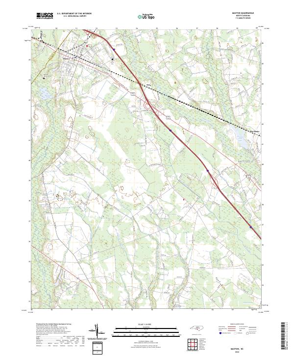 2022 Maxton2022 Print · USGSMaxton and the river lowlands of Robeson County are depicted here in contemporary detail. Researchers can trace family sites near Oak Grove Cem, navigate the winding course of the Lumber River, and locate rural settlements like Alma and Red Banks.
 - 2022 Map of Marston, 2022 Print
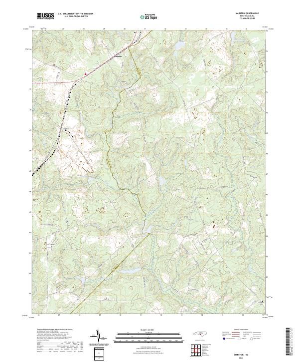 2022 Marston2022 Print · USGSThe borderlands of Richmond and Scotland counties appear here in the early 2020s, showing a landscape shaped by rural roads and expansive wetlands. Researchers can locate family landmarks such as Watson Cem and Livingston Cem or trace the waters of Gum Swamp Cr.
 - 2022 Map of Laurinburg, 2022 Print
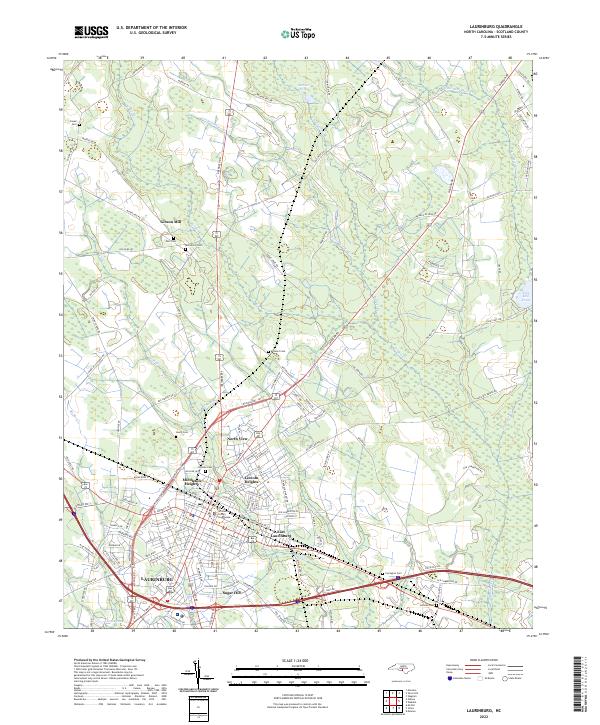 2022 Laurinburg2022 Print · USGSLaurinburg and the surrounding Scotland County landscape are captured here in the early 2020s, detailing the city's residential expansions and civic center. Researchers can trace local lineage through several family and community burial sites like Hillside Cem and Leach Cem, or locate the historic Scotland County Courthouse.
 - 2022 Map of Gibson, 2022 Print
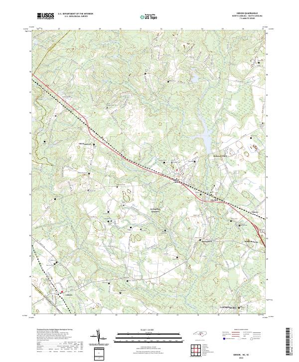 2022 Gibson2022 Print · USGSThe North Carolina borderlands around Gibson and LAURINBURG were shaped by a legacy of mills and family-run homesteads. Historians can trace early industry and kinship through Richmond Mill, Ida Mill, and numerous burial grounds like Old Hundred Cem and Saint Johns Cem.
 - 2022 Map of Hoffman, 2022 Print
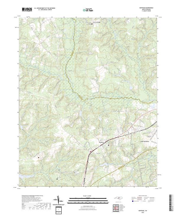 2022 Hoffman2022 Print · USGSIn the Sandhills of the early twenty-first century, the area around Hoffman remains a landscape of military aviation and quiet rural communities. Researchers can trace local lineage at Watson Cem or explore the hydrography of McKinney Lake and Drowning Cr.
 - 2022 Map of Wagram, 2022 Print
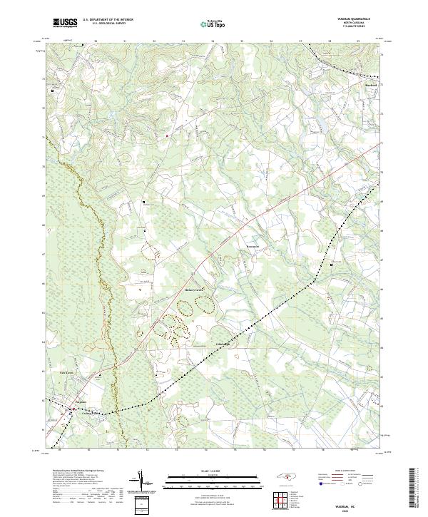 2022 Wagram2022 Print · USGSThe Scotland and Hoke County line follows the winding Lumber River in the early 2020s. Researchers can locate family landmarks such as Gilchrist Cem and McMillan Cem, or trace the rural routes connecting Wagram and Raeford.
 - 2022 Map of Wakulla, 2022 Print
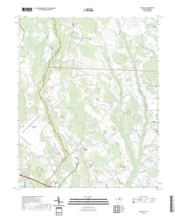 2022 Wakulla2022 Print · USGSRobeson and Scotland counties are surveyed here in the early 2020s, showing a rural landscape defined by the winding Lumber River. Genealogists and local historians can trace family burial sites like McPhatter Cem and Smith Cem near the historic grounds of Floral College.
 - 2022 Map of Johns, 2022 Print
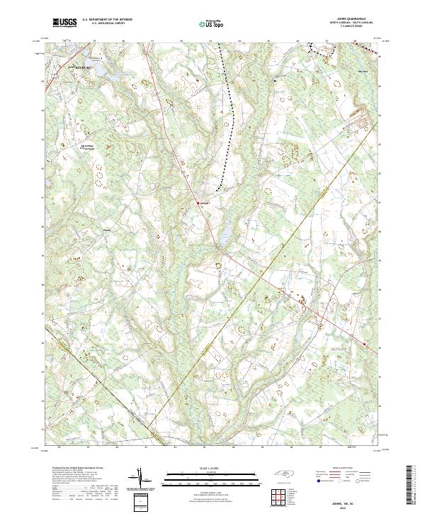 2022 Johns2022 Print · USGSThe North Carolina and South Carolina borderlands come into focus in this contemporary study of the Laurinburg and Johns area. Researchers can trace local heritage at Stewartsville Cem and explore community landmarks like Saint Andrews University and Johns Pond.
 - 2022 Map of Pinebluff, 2022 Print
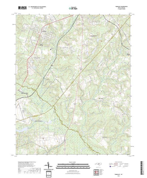 2022 Pinebluff2022 Print · USGSThe Sandhills region at the Moore and Richmond county line comes into focus in the early 2020s. Genealogists can locate family sites near Silver Springs Cem or trace the rural reach of Addor and McFarland along the banks of Drowning Cr.
 - 2024 Map of McColl, 2024 Print
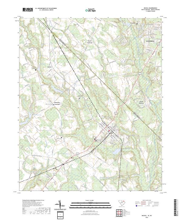 2024 McColl2024 Print · USGSThe borderlands of Marlboro County and Scotland County come into focus in this contemporary survey of the McColl and Tatum areas. Researchers can trace local lineage through numerous family burial sites like Manship Cem and Tatum Cem or explore the creek networks of Panther Creek and Gum Swamp Creek.
End of results
Showing maps 1-13 of 13
Top cities of Scotland County
- Laurinburg historical maps
- Laurel Hill historical maps
- Wagram historical maps
- Gibson historical maps
- East Laurinburg historical maps
- Old Hundred historical maps
Frequently asked questions
- What are the different types of historical maps available for Scotland County?
- What is the oldest map of Scotland County?
- Where can I purchase historical maps of Scotland County for my home or office?
- Where can I download high-res historical maps of Scotland County?
- Are there historical topographic maps available for Scotland County?
- Is there historical aerial imagery available for Scotland County?
- Where are historical maps of Scotland County sourced from?