Old Maps of Scotland County, North Carolina for Hiking & Exploration
Hike through history with 103 historic maps of Scotland County. Explore old trails, ghost towns, and forgotten backroads — perfect for outdoor adventurers and local explorers.
- Rediscover forgotten places: Map out old mining camps, roads, and footpaths that no longer exist on modern maps.
- Layer with modern tools: Combine with LiDAR or satellite views to plan hikes through historical terrain.
- Made for exploration: Popular among hikers, overlanders, and local history lovers.
Use these maps to find adventure and explore the hidden past of Scotland County.
Scotland County, NC maps
(103)- 1942 Map of Troy
 1942 Troy1942 Print · USGSMid-century central North Carolina comes alive through this 1940s survey of the rail-linked towns between the Uwharrie hills and the Sandhills. Trace the historic Norfolk Southern line through Troy, Star, and Biscoe, or locate the Morrison Training School and local springs.
 - 1942 Map of Rockingham, 1944 Print
 1942 Rockingham1944 Print · USGSThe North Carolina and South Carolina borderlands come alive in this wartime survey of the Pee Dee River valley. Researchers can trace historic mill sites like Burnt Factory Pond or locate family landmarks such as Roberdell and Old Sneedsboro.
 - 1948 Map of Southern Pines, 1954 Print
 1948 Southern Pines1954 Print · USGSThe North Carolina Sandhills were a hub of transit and military expansion just after the war. This survey allows researchers to trace family landmarks like St Mathews Ch and Taylor Town or map the early footprints of Fort Bragg and Camp Mackall.
 - 1948 Map of Pinebluff, 1972 Print
 1948 Pinebluff1972 Print · USGSThe Sand Hills of Moore and Richmond counties are shown here just after the war, where military expansions met rural North Carolina life. Genealogists and researchers can trace the Seaboard Air Line through Addor, find family roots at Silver Springs Cemetery, and locate the old McFarland Sch.3 unique versions available
 - 1949 Map of Gibson, 1953 Print
 1949 Gibson1953 Print · USGSThe North Carolina and South Carolina borderlands come alive in the late 1940s, centered on the rail hub of Gibson. Trace the heritage of mill settlements and family plots like Richmond Mill, Old Hundred, and the Pate Cem.3 unique versions available
 - 1949 Map of Ghio, 1953 Print
 1949 Ghio1953 Print · USGSThe Carolina borderlands come to life in this mid-century survey, capturing the rural communities of Richmond and Scotland counties. Genealogists can trace family landmarks like Morrison Grave Sch, Scholl Sta, and the Seal Cem along the Seaboard Air Line tracks.2 unique versions available
 - 1949 Map of Wagram, 1953 Print
 1949 Wagram1953 Print · USGSScotland and Hoke counties were defined by the confluence of the Lumber River and vital rail lines during the late nineteen-forties. Researchers can trace ancestral locations like Gaineys Place, Purcell Cem, and the historic Bowmore station.2 unique versions available
 - 1949 Map of Laurinburg, 1953 Print
 1949 Laurinburg1953 Print · USGSScotland County's rail hubs and rural townships are captured here at the peak of the post-war era. Researchers can identify family cemeteries and early local landmarks like Gibsons Mill, State Prison Camp No 610, and the Louisville Sch.
 - 1949 Map of Silver Hill, 1953 Print
 1949 Silver Hill1953 Print · USGSScotland County's agrarian and rail-centered landscape is captured here in the mid-twentieth century, centered on the Wagram community. Genealogists and local historians can locate several family cemeteries such as McNeill Cem and rural schools like the Nashville Sch.3 unique versions available
 - 1949 Map of Hoffman, 1953 Print
 1949 Hoffman1953 Print · USGSHoffman and the surrounding Sand Hills of Richmond County are captured here just after the war, showing the expansion of military and conservation lands. Researchers can trace the Seaboard Air Line railroad through the heart of town or locate rural landmarks like McNir Chapel and Watson Cem.3 unique versions available
 - 1949 Map of Marston, 1953 Print
 1949 Marston1953 Print · USGSNorth Carolina's Sandhills region is captured here just after the war, showing the rural crossroads of Richmond and Scotland counties. Genealogists can locate family landmarks like Watson Cem, Livingston Cem, and several country churches including Good Hope Ch.4 unique versions available
 - 1949 Map of Wakulla, 1953 Print
 1949 Wakulla1953 Print · USGSRobeson and Scotland counties appear here just after the war, where the Lumber River meets a network of lowland swamps. Genealogists can trace family names at Floral College, McPhatter Cem, and the rural Cherokee Sch.2 unique versions available
 - 1949 Map of Hamlet, 1954 Print
 1949 Hamlet1954 Print · USGSNorth Carolina's Sandhills come alive in the late 1940s, centered on the busy rail hub of Hamlet and its sprawling network of tracks. Researchers can trace numerous local schools and cemeteries, from Sneads Grove School to the Tabernacle Cemetery.2 unique versions available
 - 1949 Map of Jackson Springs, 1954 Print
 1949 Jackson Springs1954 Print · USGSThe North Carolina Sandhills were undergoing a transition in the late 1940s as military footprints expanded alongside rural farming communities. Genealogists and historians can trace the foundations of Camp Mackall and find local landmarks like the Morrison Training Sch and Jackson Springs.
 - 1949 Map of Laurinburg, 1954 Print
 1949 Laurinburg1954 Print · USGSThe mid-century landscape of Scotland County comes alive in this survey of a growing rail hub and its rural surroundings. Researchers can trace the lines of the Seaboard Air Line, locate historic institutions like Flora College, or find family landmarks such as McNeill Cem and Gaineys Place.
 - 1950 Map of Pine Bluff
 1950 Pine Bluff1950 Print · USGSThe North Carolina Sandhills are captured here at the start of the 1950s, showing a landscape defined by military training and the railroad. Genealogists and local historians can trace family sites like Silver Springs Cemetery, the McFarland Sch, and the wartime infrastructure of Camp Mackall.
 - 1953 Map of Florence, 1964 Print
 1953 Florence1964 Print · USGSThe Carolina borderlands in the mid-fifties were a landscape of vast river swamps and rising rail towns. Trace the legacy of the Seaboard Air Line through Florence or explore the wetlands surrounding Lake Waccamaw and the Green Swamp.3 unique versions available
 - 1953 Map of Raleigh, 1965 Print
 1953 Raleigh1965 Print · USGSCentral North Carolina in the early sixties shows a landscape of growing towns and military hubs before the full expansion of the interstate system. Genealogists can trace family footprints across the Piedmont through Wake Forest, Siler City, and the large Fort Bragg Military Reservation.4 unique versions available
 - 1954 Map of Florence
 1954 Florence1954 Print · USGSThe Carolinas borderlands come alive in the early fifties, showing the vital rail-and-river networks of the coastal plain. Genealogists can trace family footprints across the Green Swamp or through settlements like Red Springs, Chadbourn, and McColl.
 - 1954 Map of Raleigh
 1954 Raleigh1954 Print · USGSThe North Carolina Piedmont and Sandhills are captured in the mid-fifties during a period of steady regional growth. Genealogists and historians can trace the development of towns like Siler City or locate landmarks such as Falls of Neuse and Camp Mackall.
 - 1957 Map of Southern Pines, 1960 Print
 1957 Southern Pines1960 Print · USGSThe North Carolina Sand Hills come into focus in the late fifties, centered on the growing resorts and rail hubs of Moore County. Researchers can trace historic lineages through local landmarks like Old Notre Dame Academy, McCrimmons Chapel, and the Silver Spring Cem.
 - 1957 Map of Laurinburg, 1960 Print
 1957 Laurinburg1960 Print · USGSMid-century Scotland County centers on the rail hub of LAURINBURG, where the Seaboard Air Line and local short lines shaped the town's industrial footprint. Genealogists and local historians can trace family-named sites such as McFarland Cem, Gibson Mill, and Shaw High Sch.2 unique versions available
 - 1957 Map of Jackson Springs, 1961 Print
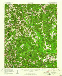 1957 Jackson Springs1961 Print · USGSMoore and Richmond counties in the late 1950s reflect a mix of military presence and quiet rural life. Researchers can trace families near Jackson Springs, locate the old Hoffman High Sch, or find rural landmarks like Marcus Grove Ch and Millstone Lake.
 - 1971 Map of Johns, 1975 Print
 1971 Johns1975 Print · USGSThe borderlands of North and South Carolina in the early seventies are captured here during a period of steady rural development. Genealogists and local historians can trace the foundations of St Andrews College or locate family sites near Stewartsville Cem and Zion Hill Ch.2 unique versions available
 - 1972 Map of Mc Coll, 1975 Print
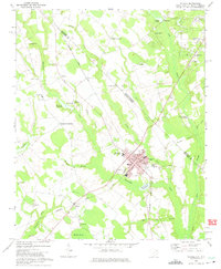 1972 Mc Coll1975 Print · USGSMarlboro County’s borderlands are shown here in the 1970s, centered on the railroad town of McColl and the agricultural hub of Tatum. Genealogists can trace family landmarks like Newton Cemetery, McLaurins Millpond, and Fletchers Chapel.2 unique versions available
Showing maps 1-25 of 103
Top cities of Scotland County
- Laurinburg historical maps
- Laurel Hill historical maps
- Wagram historical maps
- Gibson historical maps
- East Laurinburg historical maps
- Old Hundred historical maps
Frequently asked questions
- What are the different types of historical maps available for Scotland County?
- What is the oldest map of Scotland County?
- Where can I purchase historical maps of Scotland County for my home or office?
- Where can I download high-res historical maps of Scotland County?
- Are there historical topographic maps available for Scotland County?
- Is there historical aerial imagery available for Scotland County?
- Where are historical maps of Scotland County sourced from?