1900s (20th Century) Maps of Norwood, North Carolina
Explore 11 historic maps of Norwood from the 1900s (20th Century). These maps offer a rare glimpse into what life looked like during the 1900s — showing old roads, neighborhoods, homes, and landmarks that have changed or disappeared over time.
Whether you're researching your family's past, planning a metal detecting trip, or studying how Norwood's landscape evolved across the 1900s, these high-resolution maps are a powerful tool for exploring the history of this region.
- Focus on a specific era: All maps on this page are from the 1900s, giving you a focused view of this time period.
- See what’s changed: Compare century-old streets, trails, and buildings to today's modern landscape using overlays and satellite layers.
- Research with precision: Use these maps for genealogy, historical research, land use analysis, or educational projects.
- View, download, or print: Maps are fully viewable online in high resolution, and can be downloaded or printed for your own records.
Start exploring Norwood's history through authentic maps from the 1900s. This is your window into the past.
Norwood, NC maps
(11)- 1953 Map of Charlotte, 1968 Print
 1953 Charlotte1968 Print · USGSThe North Carolina Piedmont and South Carolina borderlands are shown in detail during a period of significant growth and reservoir development. Trace the rail corridors of the Southern Railway or find family roots in towns like China Grove, Misenheimer, and Lincolnton.3 unique versions available
 - 1954 Map of Charlotte
 1954 Charlotte1954 Print · USGSThe North Carolina Piedmont in the mid-1950s shows a region of rapid growth and industrial expansion centered around Charlotte. Trace the era's infrastructure through the Southern railroad lines and locate significant landmarks like the Charlotte Naval Ammunition Depot and Lake Norman.2 unique versions available
 - 1956 Map of Mount Gilead West, 1957 Print
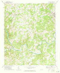
 1956 Mount Gilead West1957 Print · USGSThe area surrounding the Pee Dee and Rocky rivers shows a landscape of rail-connected towns and riverside power in the mid-1950s. Genealogists can trace family roots through numerous local parishes like Providence Ch and the rural community of Cedar Hill.3 unique versions available
 - 1957 Map of Albemarle, 1958 Print
 1957 Albemarle1958 Print · USGSThe Stanly County landscape in the mid-fifties is defined by the growing city of Albemarle and the newly formed reservoirs along the Yadkin River. Genealogists and historians can trace family locations near Bethel Ch, Goggins Mine, and the old Austins Mill.2 unique versions available
 - 1960 Map of Charlotte
 1960 Charlotte1960 Print · USGSMid-century North Carolina and South Carolina meet in this 1960 survey of the Piedmont's industrial and textile heartland. Trace the growth of Charlotte alongside historic landmarks like Kings Mountain National Military Park and the Charlotte Naval Ammunition Depot.2 unique versions available
 - 1962 Map of Charlotte
 1962 Charlotte1962 Print · USGSThe North Carolina Piedmont in the early sixties showcases a landscape transformed by massive reservoirs and industrial growth. Researchers can trace the development of Lake Norman, locate the Charlotte Naval Ammunition Depot, or find family landmarks like Wesley Chapel and Brown & Norcott Mills.
 - 1971 Map of Aquadale, 1973 Print
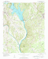
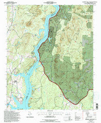
 1971 Aquadale1973 Print · USGSThe rural borderlands of Stanly and Anson Counties are revealed in this early 1970s survey of the Carolina Piedmont. Researchers can trace local genealogy through numerous landmarks including South Stanly High School, Bethlehem Ch, and the rail junction at Norwood.2 unique versions available
 - 1977 Map of Albemarle SE, 1979 Print
 1977 Albemarle SE1979 Print · USGSThe Montgomery County riverfront was evolving in the late seventies as residential life centered on the water. Researchers can trace the exact 1977 shoreline of Lake Tillery and find local settlements like River Haven and Pee Dee.
 - 1981 Map of Morrow Mountain
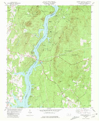 1981 Morrow Mountain1981 Print · USGSThe Stanly and Montgomery County borderlands are shown here in the early eighties as residential shores meet the deep woods of the Piedmont. Genealogists and hikers can trace historical sites like Stony Hill Ch, Mt Zion Ch, and the peaks of Morrow Mountain State Park.3 unique versions available
 - 1985 Map of Charlotte, 1986 Print
 1985 Charlotte1986 Print · USGSThe Piedmont region in the mid-eighties shows the rapid growth of the Charlotte metro area alongside established textile and college towns. Trace local heritage at the Reed Gold Mine or explore the rail corridors of the Southern Railway and Winston-Salem Southbound Railway.2 unique versions available
 - 1994 Map of Morrow Mountain, 1996 Print
 1994 Morrow Mountain1996 Print · USGSThe Montgomery and Stanly county borderlands appear in the mid-nineties as a blend of recreational forest and lakeside residential growth. Researchers can trace the development of Sugarloaf Shores or locate rural landmarks like Randall Ch and the White Clay Quarry.
End of results
Showing maps 1-11 of 11
Top cities near Norwood
- Albemarle historical maps
- Troy historical maps
- Polkton historical maps
- Mount Gilead historical maps
- Badin historical maps
- Oakboro historical maps
See more
Top neighborhoods of Norwood
Frequently asked questions
- What are the different types of historical maps available for Norwood?
- What is the oldest map of Norwood?
- Where can I purchase historical maps of Norwood for my home or office?
- Where can I download high-res historical maps of Norwood?
- Are there historical topographic maps available for Norwood?
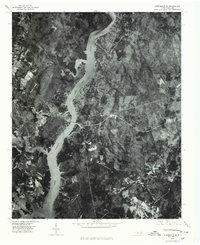
- Is there historical aerial imagery available for Norwood?
- Where are historical maps of Norwood sourced from?