2020s Maps of Norwood, North Carolina
Explore 3 historic maps of Norwood from the 2020s. These maps offer a rare glimpse into what life looked like during the 2020s — showing old roads, neighborhoods, homes, and landmarks that have changed or disappeared over time.
Whether you're researching your family's past, planning a metal detecting trip, or studying how Norwood's landscape evolved across the 2020s, these high-resolution maps are a powerful tool for exploring the history of this region.
- Focus on a specific era: All maps on this page are from the 2020s, giving you a focused view of this time period.
- See what’s changed: Compare century-old streets, trails, and buildings to today's modern landscape using overlays and satellite layers.
- Research with precision: Use these maps for genealogy, historical research, land use analysis, or educational projects.
- View, download, or print: Maps are fully viewable online in high resolution, and can be downloaded or printed for your own records.
Start exploring Norwood's history through authentic maps from the 2020s. This is your window into the past.
Norwood, NC maps
(3)- 2022 Map of Morrow Mountain, 2022 Print
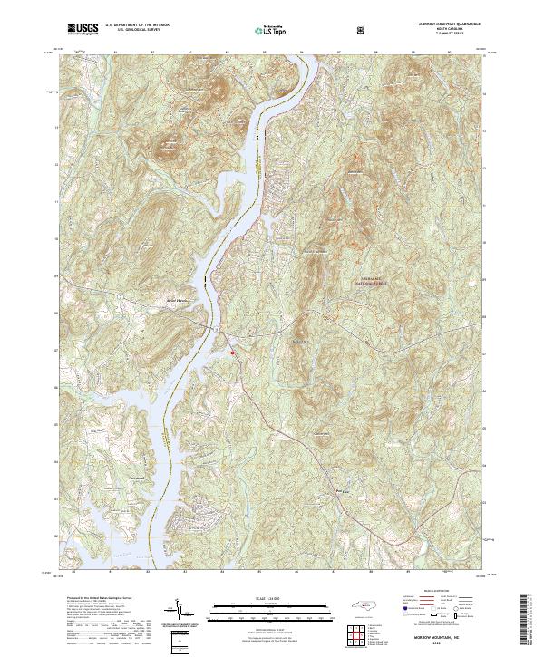 2022 Morrow Mountain2022 Print · USGSThe central Uwharrie Mountains meet the Pee Dee River in the early 2020s, showing a mix of protected forest and riverside growth. Trace family names and local landmarks from Morrow Mountain to settlements at Norwood and Pee Dee.
 - 2022 Map of Aquadale, 2022 Print
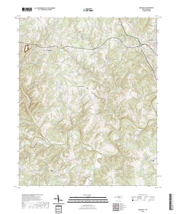 2022 Aquadale2022 Print · USGSThe rural borderlands of Stanly and Anson counties are meticulously detailed in the early twenty-first century. Researchers can trace historic family routes like Gaddy's Ferry Rd or locate ancestral burial sites at Concord-United Methodist Church Cem.
 - 2022 Map of Mount Gilead West, 2022 Print
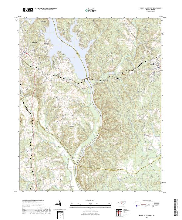 2022 Mount Gilead West2022 Print · USGSThe river borders of the North Carolina Piedmont come to life in this survey of the Stanly and Montgomery county lines. Genealogists and local historians can trace the rail corridor of the Winston-Salem Southbound RR or locate family sites near Fork Section and Norwood Cem.
End of results
Showing maps 1-3 of 3
Top cities near Norwood
- Albemarle historical maps
- Troy historical maps
- Polkton historical maps
- Mount Gilead historical maps
- Badin historical maps
- Oakboro historical maps
See more
Top neighborhoods of Norwood
Frequently asked questions
- What are the different types of historical maps available for Norwood?
- What is the oldest map of Norwood?
- Where can I purchase historical maps of Norwood for my home or office?
- Where can I download high-res historical maps of Norwood?
- Are there historical topographic maps available for Norwood?
- Is there historical aerial imagery available for Norwood?
- Where are historical maps of Norwood sourced from?