1900s (20th Century) Maps of Stokes County, North Carolina
Explore 28 historic maps of Stokes County from the 1900s (20th Century). These maps offer a rare glimpse into what life looked like during the 1900s — showing old roads, neighborhoods, homes, and landmarks that have changed or disappeared over time.
Whether you're researching your family's past, planning a metal detecting trip, or studying how Stokes County's landscape evolved across the 1900s, these high-resolution maps are a powerful tool for exploring the history of this region.
- Focus on a specific era: All maps on this page are from the 1900s, giving you a focused view of this time period.
- See what’s changed: Compare century-old streets, trails, and buildings to today's modern landscape using overlays and satellite layers.
- Research with precision: Use these maps for genealogy, historical research, land use analysis, or educational projects.
- View, download, or print: Maps are fully viewable online in high resolution, and can be downloaded or printed for your own records.
Start exploring Stokes County's history through authentic maps from the 1900s. This is your window into the past.
Stokes County, NC maps
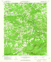
(28)- 1926 Map of Critz
 1926 Critz1926 Print · USGSAcross the Virginia and North Carolina border in the mid-twenties, this mountain landscape reveals a self-sufficient network of mill seats and rural post offices. Researchers can trace family ties through dozens of landmarks like Blue Mountain School, Kogers Mill, and Patrick Springs Station.2 unique versions available
 - 1928 Map of Stuart
 1928 Stuart1928 Print · USGSThe Blue Ridge foothills of the late twenties are captured here as a network of mountain settlements and river-powered industry. Genealogists can trace family roots through numerous country landmarks like Greaseys Chapel, Stonewall Jackson School, and Carters Mill.2 unique versions available
 - 1928 Map of Critz
 1928 Critz1928 Print · USGSPatrick and Henry Counties appear here in the late twenties, showing a transition from the Blue Ridge heights to a valley economy defined by the Danville and Western rail line. Genealogists can trace early homesteads and community hubs like Penns Store, Patrick Springs Station, and Smith Chapel.3 unique versions available
 - 1931 Map of Stuart
 1931 Stuart1931 Print · USGSThe Blue Ridge plateau meets the Piedmont in the late 1920s, showing a landscape of mountain farming and river-driven milling. Genealogists can trace family roots through numerous local landmarks like Meadows of Dan, Stonewall Jackson Sch, and Three Forks Mill.3 unique versions available
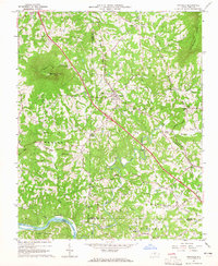
 - 1953 Map of Winston-Salem, 1974 Print
 1953 Winston-Salem1974 Print · USGSThe North Carolina Piedmont and Virginia highlands meet in the mid-1950s, a landscape defined by the tobacco and textile hubs of the Blue Ridge foothills. Researchers can trace the rail-and-river geography connecting Winston-Salem to mountain towns like Mount Airy and Galax.2 unique versions available
 - 1955 Map of Winston-Salem
 1955 Winston-Salem1955 Print · USGSThe Central Blue Ridge and Piedmont transition are captured here in the mid-fifties, from the industrial hub of Winston-Salem to the high peaks of Southwest Virginia. Genealogists can trace family landmarks like Richmond Hill Ch, Siloam Ch, and the old rail stops along the Southern Railway.
 - 1962 Map of Winston-Salem
 1962 Winston-Salem1962 Print · USGSThe North Carolina Piedmont meets the Virginia highlands in the early sixties, showing the rail corridors and mountain gaps of the southern Appalachians. Researchers can trace the Blue Ridge Parkway or locate family sites near Winston-Salem, Mount Airy, and Hanging Rock Mountain.
 - 1964 Map of Hanging Rock, 1965 Print
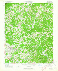
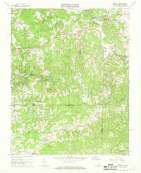
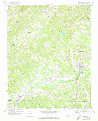
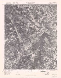
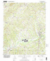
 1964 Hanging Rock1965 Print · USGSThe peaks of the Sauratown Mountains tower over Stokes County during the mid-sixties, before extensive modern development. Genealogists and local historians can trace family burial grounds like Flippin Cem and Lankford Cem or visit Vade Mecum.4 unique versions available
 - 1964 Map of Pinnacle, 1965 Print
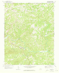
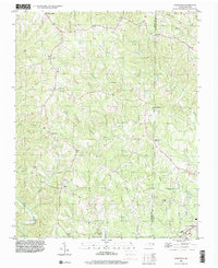
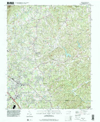
 1964 Pinnacle1965 Print · USGSStokes County at the mid-century shows a landscape defined by the towering Pilot Mountain and the Southern railroad. Trace family roots and local history at Pinnacle, Mt Moriah Ch, and the Wall Cem.4 unique versions available
 - 1964 Map of King, 1965 Print
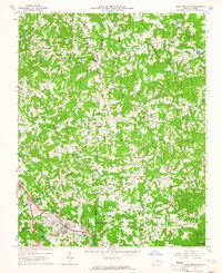
 1964 King1965 Print · USGSStokes County and the Piedmont plateau are captured here in the mid-sixties as small rural communities like Quaker Gap and Mountain View thrive. Genealogists can trace family landmarks and rural life through Jefferson Church, the King Airport, and numerous small cemeteries.3 unique versions available
 - 1964 Map of Pilot Mountain, 1965 Print
 1964 Pilot Mountain1965 Print · USGSSurry and Stokes counties meet here in the mid-sixties, anchored by the railroad town of Pilot Mountain. Genealogists and local historians can trace family lines through dozens of small cemeteries like Inman Cem and Durham Cem or visit rural landmarks like Westfield Ch.3 unique versions available
 - 1967 Map of Spencer, 1968 Print
 1967 Spencer1968 Print · USGSThe Virginia and North Carolina state line runs through this rural landscape in the late sixties, centered on the winding Mayo River forks. Genealogists and local historians can locate community landmarks like Penns Store, Sheppards Mill, and the Spencer-Penn Sch.2 unique versions available
 - 1967 Map of Nettleridge, 1968 Print
 1967 Nettleridge1968 Print · USGSThe Virginia and North Carolina borderlands come into focus in the late sixties, showing a landscape of rural general stores and country churches. Genealogists can trace family roots through landmarks like Moorefield Store, Tatum Macedonia Ch, and Coleville.3 unique versions available
 - 1968 Map of Stuart SE, 1970 Print
 1968 Stuart SE1970 Print · USGSPatrick County and the North Carolina borderlands are captured in the late sixties, showing a landscape of river-bottom mills and highland chapels. Genealogists can trace family names through landmarks like Jessup Mill, Francisco, and Creaseys Chapel.3 unique versions available
 - 1968 Map of Claudville, 1971 Print
 1968 Claudville1971 Print · USGSThe Virginia-North Carolina borderlands near Patrick County are captured here in the late sixties, showing a landscape defined by the winding Dan River. Genealogists can trace family landmarks like Hatcher Cem, Joyce Mill, and Carters Mill.3 unique versions available
 - 1971 Map of Walnut Cove, 1973 Print
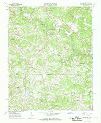
 1971 Walnut Cove1973 Print · USGSStokes County in the early seventies shows a landscape where rail lines and river valleys shaped the growth of communities like Walnut Cove. Researchers can trace local heritage through landmarks like Germanton, the Meadow Brook Airfield, and Palmyra Ch.3 unique versions available
 - 1971 Map of Belews Lake, 1973 Print
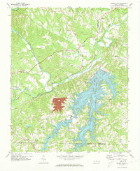 1971 Belews Lake1973 Print · USGSThe rural borderlands of Stokes and Rockingham counties are captured here in the early 1970s as the landscape transformed around Belews Lake. Researchers can trace old family sites near Pine Hall, Camp Vaughn, and country landmarks like Sycamore Ch.3 unique versions available
 - 1971 Map of Danbury, 1973 Print
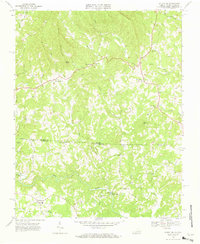
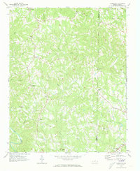
 1971 Danbury1973 Print · USGSStokes County settlements and the winding Dan River define this area during the early seventies. Genealogists can trace family landmarks and numerous rural congregations like North View Ch, Lawsonville Ch, and Davis Chapel.2 unique versions available
 - 1971 Map of Ayersville, 1973 Print
 1971 Ayersville1973 Print · USGSThe borderlands of Stokes and Rockingham counties are shown here in the early 1970s, as the rural landscape centered on the Dan River. Genealogists can trace family footprints near Ayersville, Dodgetown, and country churches like Oak Grove Ch or Wilson Ch.2 unique versions available
 - 1977 Map of Belews Lake, 1979 Print
 1977 Belews Lake1979 Print · USGSThe Dan River and its surrounding Piedmont landscapes are captured in detail in the late seventies. Researchers can trace the sprawling shoreline of Belews Lake or locate the historic settlement of Pine Hall along the Dan River.
 - 1984 Map of Winston-Salem, 1985 Print
 1984 Winston-Salem1985 Print · USGSThe North Carolina Piedmont in the mid-1980s shows the growth of Winston-Salem and the busy rail corridors of the Southern Railway. Genealogists and local historians can trace family-named lands and rural communities from Yadkinville to Mount Airy.2 unique versions available
 - 1986 Map of Galax
 1986 Galax1986 Print · USGSThe Virginia and North Carolina borderlands are captured here in the mid-1980s as the region balanced mountain agriculture with new recreational tourism. Researchers can locate remote family landmarks and rural institutions, from Ferrum Jr College and Siloam Ch to the Pinnacles Powerplant and Archies Mill.2 unique versions available
 - 1996 Map of Walnut Cove, 2001 Print
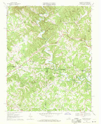
 1996 Walnut Cove2001 Print · USGSStokes County communities are captured here in the mid-1990s as they developed along the regional waterways. Researchers can locate specific family landmarks and local institutions like Germanton, the South Stokes High Sch, and Fulp Memorial Ch.
 - 1996 Map of Ayersville, 2001 Print
 1996 Ayersville2001 Print · USGSStokes and Rockingham Counties are shown in the mid-1990s as a landscape of rural crossroads and river-valley settlements. Researchers can trace family history through local landmarks like Mt Hermon Ch, Prestonville, and the small community of Dodgetown.
 - 1996 Map of King, 2001 Print
 1996 King2001 Print · USGSThe borderlands of Forsyth and Stokes County come alive in the late nineties, from the growing streets of King to the peaks of Sauratown Mtn. Genealogists and historians can trace family burial sites like Sizemore Cem and Old Mt Olive Cem near old crossroads like Capella.
Showing maps 1-25 of 28
Top cities of Stokes County
Frequently asked questions
- What are the different types of historical maps available for Stokes County?
- What is the oldest map of Stokes County?
- Where can I purchase historical maps of Stokes County for my home or office?
- Where can I download high-res historical maps of Stokes County?
- Are there historical topographic maps available for Stokes County?
- Is there historical aerial imagery available for Stokes County?
- Where are historical maps of Stokes County sourced from?