1970s Maps of Stokes County, North Carolina
Explore 5 historic maps of Stokes County from the 1970s. These maps offer a rare glimpse into what life looked like during the 1970s — showing old roads, neighborhoods, homes, and landmarks that have changed or disappeared over time.
Whether you're researching your family's past, planning a metal detecting trip, or studying how Stokes County's landscape evolved across the 1970s, these high-resolution maps are a powerful tool for exploring the history of this region.
- Focus on a specific era: All maps on this page are from the 1970s, giving you a focused view of this time period.
- See what’s changed: Compare century-old streets, trails, and buildings to today's modern landscape using overlays and satellite layers.
- Research with precision: Use these maps for genealogy, historical research, land use analysis, or educational projects.
- View, download, or print: Maps are fully viewable online in high resolution, and can be downloaded or printed for your own records.
Start exploring Stokes County's history through authentic maps from the 1970s. This is your window into the past.
Stokes County, NC maps
(5)- 1971 Map of Walnut Cove, 1973 Print
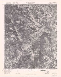
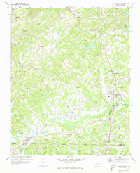 1971 Walnut Cove1973 Print · USGSStokes County in the early seventies shows a landscape where rail lines and river valleys shaped the growth of communities like Walnut Cove. Researchers can trace local heritage through landmarks like Germanton, the Meadow Brook Airfield, and Palmyra Ch.3 unique versions available
 - 1971 Map of Belews Lake, 1973 Print
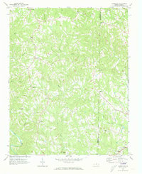
 1971 Belews Lake1973 Print · USGSThe rural borderlands of Stokes and Rockingham counties are captured here in the early 1970s as the landscape transformed around Belews Lake. Researchers can trace old family sites near Pine Hall, Camp Vaughn, and country landmarks like Sycamore Ch.3 unique versions available
 - 1971 Map of Danbury, 1973 Print
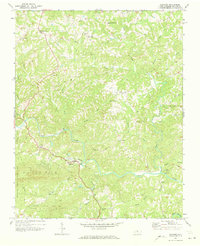 1971 Danbury1973 Print · USGSStokes County settlements and the winding Dan River define this area during the early seventies. Genealogists can trace family landmarks and numerous rural congregations like North View Ch, Lawsonville Ch, and Davis Chapel.2 unique versions available
 - 1971 Map of Ayersville, 1973 Print
 1971 Ayersville1973 Print · USGSThe borderlands of Stokes and Rockingham counties are shown here in the early 1970s, as the rural landscape centered on the Dan River. Genealogists can trace family footprints near Ayersville, Dodgetown, and country churches like Oak Grove Ch or Wilson Ch.2 unique versions available
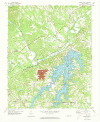
 - 1977 Map of Belews Lake, 1979 Print
 1977 Belews Lake1979 Print · USGSThe Dan River and its surrounding Piedmont landscapes are captured in detail in the late seventies. Researchers can trace the sprawling shoreline of Belews Lake or locate the historic settlement of Pine Hall along the Dan River.
End of results
Showing maps 1-5 of 5
Top cities of Stokes County
Frequently asked questions
- What are the different types of historical maps available for Stokes County?
- What is the oldest map of Stokes County?
- Where can I purchase historical maps of Stokes County for my home or office?
- Where can I download high-res historical maps of Stokes County?
- Are there historical topographic maps available for Stokes County?
- Is there historical aerial imagery available for Stokes County?
- Where are historical maps of Stokes County sourced from?