1960s Maps of Surry County, North Carolina
Explore 9 historic maps of Surry County from the 1960s. These maps offer a rare glimpse into what life looked like during the 1960s — showing old roads, neighborhoods, homes, and landmarks that have changed or disappeared over time.
Whether you're researching your family's past, planning a metal detecting trip, or studying how Surry County's landscape evolved across the 1960s, these high-resolution maps are a powerful tool for exploring the history of this region.
- Focus on a specific era: All maps on this page are from the 1960s, giving you a focused view of this time period.
- See what’s changed: Compare century-old streets, trails, and buildings to today's modern landscape using overlays and satellite layers.
- Research with precision: Use these maps for genealogy, historical research, land use analysis, or educational projects.
- View, download, or print: Maps are fully viewable online in high resolution, and can be downloaded or printed for your own records.
Start exploring Surry County's history through authentic maps from the 1960s. This is your window into the past.
Surry County, NC maps
(9)- 1962 Map of Winston-Salem
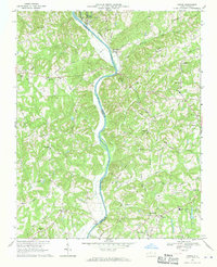
 1962 Winston-Salem1962 Print · USGSThe North Carolina Piedmont meets the Virginia highlands in the early sixties, showing the rail corridors and mountain gaps of the southern Appalachians. Researchers can trace the Blue Ridge Parkway or locate family sites near Winston-Salem, Mount Airy, and Hanging Rock Mountain.
 - 1964 Map of Pinnacle, 1965 Print
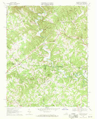
 1964 Pinnacle1965 Print · USGSStokes County at the mid-century shows a landscape defined by the towering Pilot Mountain and the Southern railroad. Trace family roots and local history at Pinnacle, Mt Moriah Ch, and the Wall Cem.4 unique versions available
 - 1964 Map of Pilot Mountain, 1965 Print
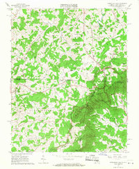
 1964 Pilot Mountain1965 Print · USGSSurry and Stokes counties meet here in the mid-sixties, anchored by the railroad town of Pilot Mountain. Genealogists and local historians can trace family lines through dozens of small cemeteries like Inman Cem and Durham Cem or visit rural landmarks like Westfield Ch.3 unique versions available
 - 1965 Map of Lambsburg, 1968 Print
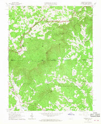 1965 Lambsburg1968 Print · USGSThe Blue Ridge mountain border between Virginia and North Carolina is captured here in the mid-1960s, showing a landscape of high ridges and deep gaps. Genealogists can trace family footprints around Lambsburg and Lowgap, or locate rural landmarks like Blue Ridge Mill and Chestnut Grove Ch.3 unique versions available
 - 1965 Map of Cumberland Knob, 1968 Print
 1965 Cumberland Knob1968 Print · USGSThe Virginia and North Carolina borderlands come alive in the mid-sixties, centered on the Cumberland Knob Recreation Area. Researchers can trace old family sites and mountain settlements like Edmonds, Delhart, and Ennice alongside McKnights Mill and Savannah Cem.2 unique versions available
 - 1968 Map of Vienna, 1970 Print
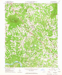
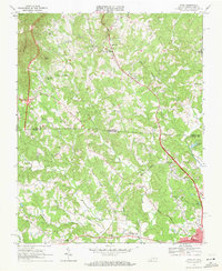
 1968 Vienna1970 Print · USGSThe Yadkin River valley in the late sixties reveals a landscape of rural congregations and small river-adjacent communities. Researchers can locate family landmarks like New Bethel Cem Ch or trace the early paths of the Southern railroad and the local Drag Strip.2 unique versions available
 - 1968 Map of Claudville, 1971 Print
 1968 Claudville1971 Print · USGSThe Virginia-North Carolina borderlands near Patrick County are captured here in the late sixties, showing a landscape defined by the winding Dan River. Genealogists can trace family landmarks like Hatcher Cem, Joyce Mill, and Carters Mill.3 unique versions available
 - 1968 Map of Cana, 1971 Print
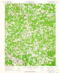
 1968 Cana1971 Print · USGSThe Virginia and North Carolina borderlands come alive in this late-sixties survey of the Piedmont foothills. Researchers can trace numerous family-named landmarks and rural institutions, from Mt View Ch and Sandy Ridge School to the communities of Cana and Toast.3 unique versions available
 - 1968 Map of Mount Airy North, 1971 Print
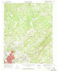 1968 Mount Airy North1971 Print · USGSThe foothills of the Blue Ridge along the Virginia and North Carolina border come into focus in this late 1960s survey. Genealogists can trace family roots through numerous mountain congregations like Ararat Ch, Willis Gap Ch, and Hunter Chapel.3 unique versions available
End of results
Showing maps 1-9 of 9
Top cities of Surry County
Frequently asked questions
- What are the different types of historical maps available for Surry County?
- What is the oldest map of Surry County?
- Where can I purchase historical maps of Surry County for my home or office?
- Where can I download high-res historical maps of Surry County?
- Are there historical topographic maps available for Surry County?
- Is there historical aerial imagery available for Surry County?
- Where are historical maps of Surry County sourced from?