Old Maps of Frying Pan, North Carolina for Academic Research
Study the evolution of Frying Pan with 11 high-resolution historic maps. Whether you're teaching, researching, or modeling changes in land use, these maps provide essential visual documentation of urban, environmental, and geographic change.
- Analyze long-term change: Track patterns in development, transportation, and natural features.
- Ideal for environmental or urban studies: Support academic projects with primary historical map data.
- Use in the classroom or lab: Educators and researchers rely on these maps to bring historical context to life.
These maps are a powerful tool for teaching, research, and visualizing how Frying Pan has changed over the decades.
Frying Pan, NC maps
(11)- 1943 Map of Columbia
 1943 Columbia1943 Print · USGSCoastal Tyrrell and Hyde Counties are captured in the early 1940s, showing a landscape defined by timber industry and federal land projects. Researchers can trace the industrial docks at the Richmond Cedar Works Lumber Mill or locate the rural Scuppernong Farms (F.S.A.).
 - 1953 Map of Frying Pan, 1956 Print
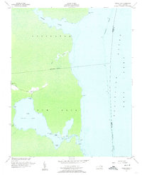 1953 Frying Pan1956 Print · USGSThe swampy peninsulas and river inlets of Tyrrell County are captured here in the mid-1950s. Genealogists and local historians can trace family locations near Frying Pan, Free Union Ch, and the landings along the Alligator River.3 unique versions available
 - 1953 Map of Rocky Mount, 1964 Print
 1953 Rocky Mount1964 Print · USGSEastern North Carolina in the mid-fifties is defined by its deep river basins and the vast wetlands of the Tidewater. Genealogists can trace family roots through hubs like Kinston and New Bern or explore the wilderness of Pettigrew State Park and Lake Mattamuskeet.4 unique versions available
 - 1954 Map of Rocky Mount
 1954 Rocky Mount1954 Print · USGSEastern North Carolina is mapped in the mid-fifties, showing a landscape of sounds, swamps, and steam-era rail lines. Genealogists can trace the rural road networks and rail spurs connecting towns like Tarboro, Greenville, and the remote Columbia.
 - 1985 Map of Plymouth
 1985 Plymouth1985 Print · USGSThe coastal plains of Washington and Beaufort counties come into focus in the mid-eighties as a region defined by large-scale conservation and water-bound trade. Researchers can trace the layout of small farming towns like Pantego and Creswell alongside the vast waters of Phelps Lake and Lake Mattamuskeet.2 unique versions available
 - 2002 Map of Frying Pan
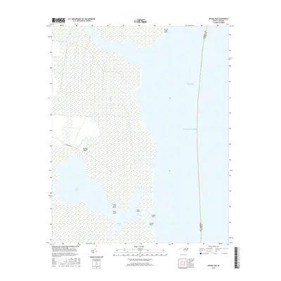
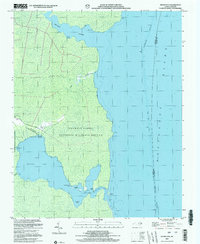 2002 Frying Pan2002 Print · USGSCoastal Tyrrell County is shown here at the turn of the millennium, where the land dissolves into the marshes of the Alligator River. Researchers can trace local landmarks like Frying Pan Landing, Free Union Ch, and the secluded waters of The Frying Pan.
 - 2010 Map of Frying Pan, 2010 Print
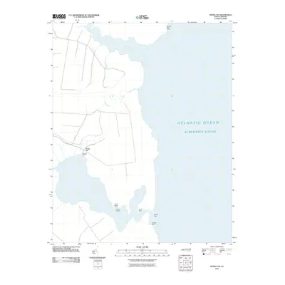 2010 Frying Pan2010 Print · USGSCovers Frying Pan, including Dare County, Tyrrell County, and other nearby areas
 - 2013 Map of Frying Pan, 2013 Print
 2013 Frying Pan2013 Print · USGSCovers Frying Pan, including Dare County, Tyrrell County, and other nearby areas
 - 2016 Map of Frying Pan, 2016 Print
 2016 Frying Pan2016 Print · USGSCovers Frying Pan, including Dare County, Tyrrell County, and other nearby areas
 - 2019 Map of Frying Pan, 2019 Print
 2019 Frying Pan2019 Print · USGSCovers Frying Pan, including Dare County, Tyrrell County, and other nearby areas
 - 2022 Map of Frying Pan, 2022 Print
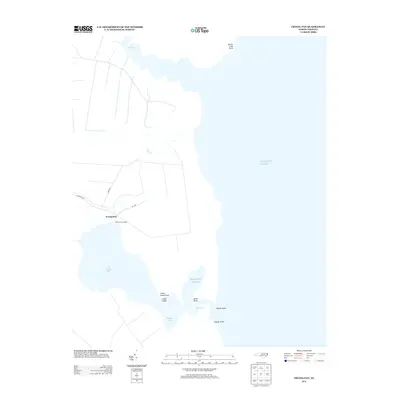
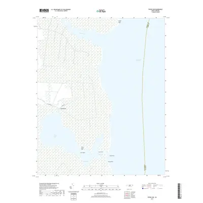
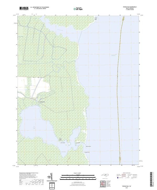 2022 Frying Pan2022 Print · USGSTyrrell County's coastal wetlands and the isolated settlement of Frying Pan are documented in this 2022 survey. Genealogists and historians can trace the shoreline of Babbitt Bay and landforms like Crane Island and Catfish Point.
End of results
Showing maps 1-11 of 11
Top cities near Frying Pan
Frequently asked questions
- What are the different types of historical maps available for Frying Pan?
- What is the oldest map of Frying Pan?
- Where can I purchase historical maps of Frying Pan for my home or office?
- Where can I download high-res historical maps of Frying Pan?
- Are there historical topographic maps available for Frying Pan?
- Is there historical aerial imagery available for Frying Pan?
- Where are historical maps of Frying Pan sourced from?