Old Maps of Vance County, North Carolina for Hiking & Exploration
Hike through history with 91 historic maps of Vance County. Explore old trails, ghost towns, and forgotten backroads — perfect for outdoor adventurers and local explorers.
- Rediscover forgotten places: Map out old mining camps, roads, and footpaths that no longer exist on modern maps.
- Layer with modern tools: Combine with LiDAR or satellite views to plan hikes through historical terrain.
- Made for exploration: Popular among hikers, overlanders, and local history lovers.
Use these maps to find adventure and explore the hidden past of Vance County.
Vance County, NC maps
(91)- 1941 Map of Clarksville
 1941 Clarksville1941 Print · USGSMecklenburg County and the Virginia-North Carolina border are captured here just before the Roanoke River valley was transformed by mid-century dam projects. Researchers can trace ancestral roots through dozens of local landmarks like Oakhurst Cem, Buffalo Junc, and Occaneechi Island.
 - 1943 Map of Clarksville
 1943 Clarksville1943 Print · USGSThe Clarksville region in the early 1940s was defined by its vibrant river life and deep-rooted rural communities. Genealogists and historians can trace the foundations of local society through Buffalo Springs, the Oakhurst Cem, and Prestwould.2 unique versions available
 - 1943 Map of Creedmoor, 1957 Print
 1943 Creedmoor1957 Print · USGSGranville and Wake counties are shown here during the transformative years of the early 1940s. Researchers can locate dozens of specific rural landmarks, from the sprawling Camp Butner Military Reservation to local centers like Creedmoor and Mt Energy.2 unique versions available
 - 1944 Map of Creedmoor
 1944 Creedmoor1944 Print · USGSGranville County during the Second World War shows the massive footprint of Camp Butner alongside traditional rail towns. Genealogists can trace family roots through numerous country landmarks like Lattice Ch, Mt Vernon Cem, and Providence Sch.
 - 1953 Map of Oxford
 1953 Oxford1953 Print · USGSGranville County during the mid-century shows a landscape of busy rail junctions and rural tobacco-country crossroads. Genealogists can trace family landmarks like John Penns Grave, Wilbourns Store, and the scattered schoolhouses of Huntsboro and Stovall.2 unique versions available
 - 1953 Map of Greensboro, 1981 Print
 1953 Greensboro1981 Print · USGSThe Piedmont borderlands of North Carolina and Virginia show a landscape defined by new reservoirs and old rail lines. Trace family roots and the changing river geography through Elon College, the John H Kerr Reservoir, and South Boston.
 - 1954 Map of Greensboro
 1954 Greensboro1954 Print · USGSThe Piedmont borderlands of North Carolina and Virginia come alive in this mid-fifties study of a region defined by its rivers and rails. Researchers can trace the growing Buggs Island Lake or follow the paths of the Southern Ry and Seaboard Air Line RR through towns like Oxford and Reidsville.
 - 1955 Map of Boydton, 1957 Print
 1955 Boydton1957 Print · USGSMecklenburg County and the Virginia-North Carolina border are shown here during the mid-fifties, just as the newly formed Kerr Reservoir reshaped the Roanoke River valley. Genealogists and local historians can trace family-named sites like Dodson Corner and Rogers Corner or locate vanished landmarks like Island Hill Sch.2 unique versions available
 - 1957 Map of Clarksville, 1959 Print
 1957 Clarksville1959 Print · USGSSouthern Mecklenburg County and the North Carolina borderlands are captured here in the late fifties, just as Kerr Reservoir reshaped the local geography. Family historians can trace ancestral sites like Siddon Hebron Ch, Wharton Memorial, and the West End High Sch.2 unique versions available
 - 1962 Map of Greensboro
 1962 Greensboro1962 Print · USGSThe Piedmont region along the Virginia and North Carolina border comes alive in the early 1960s, showing a landscape defined by industry and new reservoirs. Trace the path of the Virginian RR or explore the early development of Greensboro and Durham.
 - 1966 Map of Greensboro
 1966 Greensboro1966 Print · USGSThe North Carolina and Virginia Piedmont thrives during the mid-sixties, showcasing a landscape of textile hubs and expanding river reservoirs. Researchers can trace the rail corridors of the Southern Railway, find local landmarks like Elon College, or locate the extensive Camp Butner Military Reservation.
 - 1966 Map of Oxford
 1966 Oxford1966 Print · USGSGranville County at mid-century shows a landscape shaped by rural commerce and the intersection of the Southern Railway and Seaboard Railroad. Genealogists can locate family landmarks such as Wilbourns Store, Knotts Grove Ch, and Joe Tolers Sch.
 - 1968 Map of Tungsten, 1972 Print
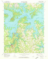 1968 Tungsten1972 Print · USGSThe Virginia-North Carolina border at the height of the Vietnam era shows a landscape shaped by mining and massive reservoirs. Researchers can find mining footprints at Tungsten and trace family roots at Antioch Ch or Island Hill Ch.2 unique versions available
 - 1968 Map of John H Kerr Dam, 1972 Print
 1968 John H Kerr Dam1972 Print · USGSThe Roanoke River valley is seen here just after the mid-century creation of major reservoirs along the Virginia and North Carolina border. Genealogists and local historians can trace the foundations of communities like Castle Heights and rural landmarks such as Lands Chapel and Jerusalem Ch.4 unique versions available
 - 1968 Map of Clarksville South, 1972 Print
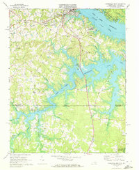 1968 Clarksville South1972 Print · USGSMecklenburg County at the end of the sixties reveals a landscape transformed by the waters of the John H Kerr Reservoir along the state line. Genealogists and local historians can trace rural communities like Buffalo Junction and Soudan, or locate old landmarks including Mt Ararat Ch and Hillcrest Sch.3 unique versions available
 - 1970 Map of Vicksboro, 1973 Print
 1970 Vicksboro1973 Print · USGSVance County in the early seventies was a land of small crossroads communities and family-named creek branches. Researchers can trace the legacy of rural life through landmarks like Weldons Mill, the Seaboard Coast Line rail route, and local churches such as Hughes Grove Ch.
 - 1970 Map of Middleburg, 1973 Print
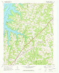 1970 Middleburg1973 Print · USGSVance and Warren counties are shown here in the early 1970s as the regional landscape adjusted to the reservoir shoreline and the development of Soul City. Researchers can trace local heritage through the Seaboard Coast Line rail stops and rural landmarks like Nutbush Sch and Morning Star Ch.2 unique versions available
 - 1970 Map of Townsville, 1973 Print
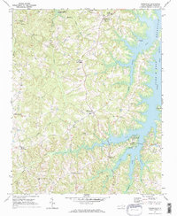 1970 Townsville1973 Print · USGSNorthern Vance County is seen here in the early seventies as the rising waters of the John H Kerr Reservoir reshaped the landscape. Researchers can trace old family footprints at Hicks Crossroads or locate rural congregations at St Johns Ch and Marrows Chapel.2 unique versions available
 - 1970 Map of Henderson, 1973 Print
 1970 Henderson1973 Print · USGSVance County is shown at a moment of significant infrastructure development in the 1970s, with Henderson anchored by its rail lines. Researchers can trace rural lineages through sites like Harris Chapel, Floytan Crossroads, and the Blacknall Cem.2 unique versions available
 - 1977 Map of Middleburg, 1978 Print
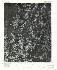 1977 Middleburg1978 Print · USGSThe North Carolina countryside appears in sharp detail in the late 1970s, showing the intersection of agricultural life and major transit lines. Researchers can trace the footprints of Middleburg, Manson, and Drewry alongside the John H Kerr Reservoir.
 - 1977 Map of Tungsten, 1978 Print
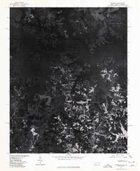 1977 Tungsten1978 Print · USGSThe shorelines of Vance County are captured in detail in the late seventies as the reservoir waters reach deep into the timberland. Researchers can trace the exact footprint of the settlement at Tungsten and follow the inlets of Island Creek.
 - 1977 Map of John H Kerr Dam, 1978 Print
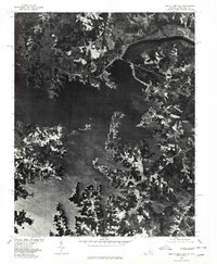 1977 John H Kerr Dam1978 Print · USGSThe Mecklenburg County borderlands appear in high-contrast aerial detail during the late seventies, showing the managed waters of the John H Kerr Reservoir. Researchers can trace the sprawling shoreline and rural tracts near Rose Hill and the massive John H Kerr Dam.
 - 1977 Map of Wilton, 1978 Print
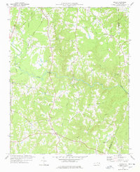 1977 Wilton1978 Print · USGSGranville County in the late seventies is a landscape of rural crossroads and river bottomlands. Researchers can trace family history through a high density of local landmarks including Hawkins Chapel, Synama Grove Ch, and the Seaboard Coast Line railroad.
 - 1977 Map of Clarksville South, 1979 Print
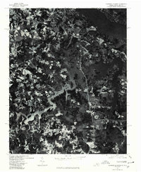 1977 Clarksville South1979 Print · USGSMecklenburg County and the Virginia-North Carolina border are captured during the late seventies, showing the landscape dominated by the reservoir. Trace the rural layout of Buffalo Junction and the shoreline near Shiny Rock.
 - 1979 Map of Kittrell
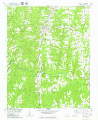 1979 Kittrell1979 Print · USGSVance and Franklin counties appear here in the late seventies as the rural landscape centered on the Seaboard Coast Line corridor. Genealogists can locate family landmarks like St Marys Ch, Kittrell Junior College, and the small settlement of Bobbitt.
Showing maps 1-25 of 91
Top cities of Vance County
Frequently asked questions
- What are the different types of historical maps available for Vance County?
- What is the oldest map of Vance County?
- Where can I purchase historical maps of Vance County for my home or office?
- Where can I download high-res historical maps of Vance County?
- Are there historical topographic maps available for Vance County?
- Is there historical aerial imagery available for Vance County?
- Where are historical maps of Vance County sourced from?