Old Maps of Wilkes County, North Carolina for Metal Detecting
Plan your next treasure hunt with 175 historic maps of Wilkes County. Find old homesites, ghost towns, trails, and gathering spots that may be lost to time — perfect for identifying promising metal detecting locations.
- Locate forgotten sites: Uncover places like long-lost settlements, abandoned rail lines, or gathering spots.
- Plan better hunts: Use map overlays combined with LiDAR or satellite views to narrow in on historically rich areas.
- Made for detectorists: Thousands of hobbyists use these maps to discover relics, coins, and hidden history.
Use these historic maps to boost your research and find new opportunities beneath the surface of Wilkes County.
Wilkes County, NC maps
(175)- 1889 Map of Wilkesboro, 1960 Print
 1889 Wilkesboro1960 Print · USGSWilkes and Ashe counties are shown here in the late 1880s as the region's mountain economy relied on river fords and valley mills. Researchers can trace ancestral locations from Jefferson to Wilkesboro, including landmarks like Lomax Store and Dunkirk Ch.
 - 1891 Map of Wilkesboro, 1940 Print
 1891 Wilkesboro1940 Print · USGSThe foothills and high ridges of Northwest North Carolina are seen here in the late nineteenth century before modern highway development. Local historians can locate early post offices at Brown P.O., the mining area of Ore Knob, and ancestral landmarks like Dunkirk Ch. and Hall Mills.
 - 1891 Map of Yadkinville, 1964 Print
 1891 Yadkinville1964 Print · USGSSurry and Yadkin counties are shown here in the late nineteenth century as the river-and-rail economy began to reshape the Piedmont. Genealogists can trace family landmarks and early crossings like Kapps Mill, Poindexter Ferry, and Cross Roads Church.
 - 1893 Map of Cranberry
 1893 Cranberry1893 Print · USGSThe high country of the Blue Ridge and Appalachians is captured here during the late 1800s, showing the early settlements and crossroads of Watauga and Johnson counties. Genealogists can trace family landmarks and early industry at Rhea Forge, Shulls Mill, and the many hamlets like Vilas and Sutherland.
 - 1893 Map of Yadkinville, 1944 Print
 1893 Yadkinville1944 Print · USGSNorthwest North Carolina at the close of the nineteenth century was a landscape of river-dependent commerce and mountain ridges. Researchers can trace the early industrial footprint of Kapps Mill, locate remote river crossings like Douglass Ford, and follow the progress of the Cape Fear and Yadkin Valley Railroad.
 - 1895 Map of Hickory
 1895 Hickory1895 Print · USGSThe North Carolina foothills come alive in the late nineteenth century as the rail lines reached Hickory and Newton. Genealogists can trace family roots through numerous country landmarks like Tuttle's Store, Emmanuel Church, and Cloninger's Mill.5 unique versions available
 - 1895 Map of Cranberry
 1895 Cranberry1895 Print · USGSThe High Country of North Carolina and Tennessee comes alive in this late nineteenth-century survey. Genealogists and historians can trace the foundations of Mountain City or locate old community centers like Valle Cruces, Banners Elk, and Rhea Forge.
 - 1899 Map of Cranberry
 1899 Cranberry1899 Print · USGSThe high Appalachian borderlands of North Carolina and Tennessee appear here in the late nineteenth century, defined by mountain settlements and early river-powered industry. Researchers can trace the era's geography through landmarks like Rhea Forge, Shills Mill, and the historic Yonhalossee Road.
 - 1902 Map of Cranberry
 1902 Cranberry1902 Print · USGSThe North Carolina and Tennessee borderlands are captured here at the turn of the century as early railroads began penetrating the high ridges. Genealogists can trace family names and old settlements like Mountain City, Shoun Crossroads, and the industry at Rhea Forge.6 unique versions available
 - 1936 Map of Blowing Rock
 1936 Blowing Rock1936 Print · USGSThe North Carolina high country around Boone and Blowing Rock is documented here in the mid-1930s. Genealogists and researchers can trace family-named landmarks and mountain institutions, from the COUNTY HOME to remote sites like Bailey Camp Sch and St Marys Ch.
 - 1942 Map of Blowing Rock
 1942 Blowing Rock1942 Print · USGSWatauga and Caldwell Counties are shown here during the late nineteen-thirties and early forties, capturing the traditional highland communities and early development of the Blue Ridge Parkway. Genealogists can locate family landmarks like Shulls Mills, Poplar Grove Ch, and Liberty Hill Sch.4 unique versions available
 - 1953 Map of Charlotte, 1968 Print
 1953 Charlotte1968 Print · USGSThe North Carolina Piedmont and South Carolina borderlands are shown in detail during a period of significant growth and reservoir development. Trace the rail corridors of the Southern Railway or find family roots in towns like China Grove, Misenheimer, and Lincolnton.3 unique versions available
 - 1953 Map of Winston-Salem, 1974 Print
 1953 Winston-Salem1974 Print · USGSThe North Carolina Piedmont and Virginia highlands meet in the mid-1950s, a landscape defined by the tobacco and textile hubs of the Blue Ridge foothills. Researchers can trace the rail-and-river geography connecting Winston-Salem to mountain towns like Mount Airy and Galax.2 unique versions available
 - 1954 Map of Charlotte
 1954 Charlotte1954 Print · USGSThe North Carolina Piedmont in the mid-1950s shows a region of rapid growth and industrial expansion centered around Charlotte. Trace the era's infrastructure through the Southern railroad lines and locate significant landmarks like the Charlotte Naval Ammunition Depot and Lake Norman.2 unique versions available
 - 1955 Map of Winston-Salem
 1955 Winston-Salem1955 Print · USGSThe Central Blue Ridge and Piedmont transition are captured here in the mid-fifties, from the industrial hub of Winston-Salem to the high peaks of Southwest Virginia. Genealogists can trace family landmarks like Richmond Hill Ch, Siloam Ch, and the old rail stops along the Southern Railway.
 - 1960 Map of Charlotte
 1960 Charlotte1960 Print · USGSMid-century North Carolina and South Carolina meet in this 1960 survey of the Piedmont's industrial and textile heartland. Trace the growth of Charlotte alongside historic landmarks like Kings Mountain National Military Park and the Charlotte Naval Ammunition Depot.2 unique versions available
 - 1962 Map of Winston-Salem
 1962 Winston-Salem1962 Print · USGSThe North Carolina Piedmont meets the Virginia highlands in the early sixties, showing the rail corridors and mountain gaps of the southern Appalachians. Researchers can trace the Blue Ridge Parkway or locate family sites near Winston-Salem, Mount Airy, and Hanging Rock Mountain.
 - 1962 Map of Charlotte
 1962 Charlotte1962 Print · USGSThe North Carolina Piedmont in the early sixties showcases a landscape transformed by massive reservoirs and industrial growth. Researchers can trace the development of Lake Norman, locate the Charlotte Naval Ammunition Depot, or find family landmarks like Wesley Chapel and Brown & Norcott Mills.
 - 1966 Map of Grandin, 1968 Print
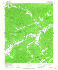 1966 Grandin1968 Print · USGSThe Yadkin River valley and the Wilkes-Caldwell county line are shown here in the mid-1960s. Genealogists can locate family landmarks like Fort Defiance and several rural congregations including German Chapel and Piney Grove Ch.
 - 1966 Map of Gilreath, 1968 Print
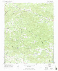 1966 Gilreath1968 Print · USGSThe foothills of the Blue Ridge come alive in this mid-century portrait of Wilkes and Alexander Counties. Genealogists and historians can trace family roots through numerous country landmarks like New Hope Ch, Old Gilreath, and Hunting Creek Cem.2 unique versions available
 - 1966 Map of Roaring River, 1968 Print
 1966 Roaring River1968 Print · USGSWilkes County in the mid-sixties reveals a landscape shaped by the Yadkin River and a thriving racing culture. Genealogists and historians can trace numerous rural congregations like Bethel Branch Ch and locate landmarks like the North Wilkesboro Speedway.
 - 1966 Map of Boomer, 1968 Print
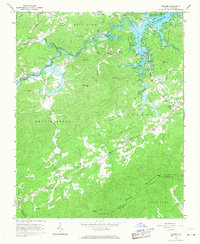 1966 Boomer1968 Print · USGSWilkes County life in the mid-sixties centered on the newly formed W Kerr Scott Reservoir and the surrounding peaks. Researchers can trace family roots at Ferguson and Boomer, or locate landmarks like the Boomer-Ferguson Sch and Zion Hill Ch.
 - 1966 Map of Moravian Falls, 1968 Print
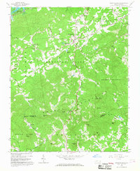 1966 Moravian Falls1968 Print · USGSThe foothills of Wilkes and Alexander counties are captured in the mid-1960s, just as the W Kerr Scott Reservoir was reshaping the local landscape. Genealogists and historians can trace community roots through numerous landmarks like Walnut Grove Ch, Pores Knob Lookout Tower, and the settlement of Boomer.
 - 1966 Map of Maple Springs, 1968 Print
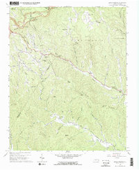 1966 Maple Springs1968 Print · USGSWilkes and Watauga counties in the mid-sixties are shown as a network of ridge-top overlooks and creek-bed communities. Researchers can trace family history through local landmarks like Mt Zion, Yellow Hill Ch, and the many cemeteries dotted along the Blue Ridge Parkway.2 unique versions available
 - 1966 Map of Wilkesboro, 1968 Print
 1966 Wilkesboro1968 Print · USGSWilkesboro and the upper Yadkin River valley are captured here in the mid-sixties during a period of significant local infrastructure growth. Trace the development of North Wilkesboro alongside long-standing landmarks like Peoples Tabernacle and the Kerr Scott Reservoir.2 unique versions available
Showing maps 1-25 of 175
Top cities of Wilkes County
Frequently asked questions
- What are the different types of historical maps available for Wilkes County?
- What is the oldest map of Wilkes County?
- Where can I purchase historical maps of Wilkes County for my home or office?
- Where can I download high-res historical maps of Wilkes County?
- Are there historical topographic maps available for Wilkes County?
- Is there historical aerial imagery available for Wilkes County?
- Where are historical maps of Wilkes County sourced from?