Old Maps of Yancey County, North Carolina for Hiking & Exploration
Hike through history with 66 historic maps of Yancey County. Explore old trails, ghost towns, and forgotten backroads — perfect for outdoor adventurers and local explorers.
- Rediscover forgotten places: Map out old mining camps, roads, and footpaths that no longer exist on modern maps.
- Layer with modern tools: Combine with LiDAR or satellite views to plan hikes through historical terrain.
- Made for exploration: Popular among hikers, overlanders, and local history lovers.
Use these maps to find adventure and explore the hidden past of Yancey County.
Yancey County, NC maps
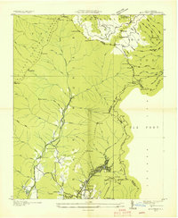
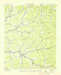
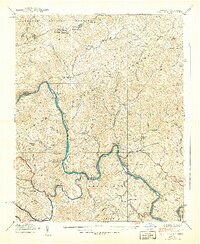
(66)- 1891 Map of Roan Mountain
 1891 Roan Mountain1891 Print · USGSCovers Yancey County, including Johnson City, Kingsport, and other nearby areas
 - 1894 Map of Asheville
 1894 Asheville1894 Print · USGSCovers Yancey County, including Asheville, Waynesville, and other nearby areas2 unique versions available
 - 1894 Map of Roan Mountain
 1894 Roan Mountain1894 Print · USGSCovers Yancey County, including Johnson City, Kingsport, and other nearby areas3 unique versions available
 - 1900 Map of Mount Mitchell, 1963 Print
 1900 Mount Mitchell1963 Print · USGSCovers Yancey County, including Asheville, Black Mountain, and other nearby areas3 unique versions available
 - 1901 Map of Asheville
 1901 Asheville1901 Print · USGSCovers Yancey County, including Asheville, Waynesville, and other nearby areas9 unique versions available
 - 1902 Map of Mount Mitchell, 1937 Print
 1902 Mount Mitchell1937 Print · USGSCovers Yancey County, including Asheville, Black Mountain, and other nearby areas3 unique versions available
 - 1904 Map of Roan Mountain
 1904 Roan Mountain1904 Print · USGSCovers Yancey County, including Johnson City, Kingsport, and other nearby areas4 unique versions available
 - 1934 Map of Micaville
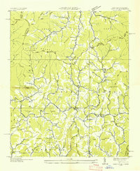
 1934 Micaville1934 Print · USGSCovers Yancey County, including Bandana, Ledger, and other nearby areas
 - 1934 Map of Parts Of Celo And Black Brothers
 1934 Parts Of Celo And Black Brothers1934 Print · USGSCovers Yancey County, including Celo, Hamrick, and other nearby areas
 - 1934 Map of Bakersville
 1934 Bakersville1934 Print · USGSCovers Yancey County, including Bakersville, Buladean, and other nearby areas2 unique versions available
 - 1934 Map of Parts Of Old Fort and Montreat
 1934 Parts Of Old Fort and Montreat1934 Print · USGSCovers Yancey County, including Old Fort, Dendron, and other nearby areas
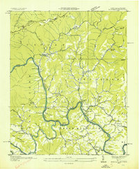
 - 1935 Map of Montreat
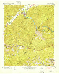
 1935 Montreat1935 Print · USGSCovers Yancey County, including Black Mountain, Montreat, and other nearby areas
 - 1935 Map of Black Brothers
 1935 Black Brothers1935 Print · USGSCovers Yancey County, including Murchison, Eskota, and other nearby areas
 - 1935 Map of Chestoa
 1935 Chestoa1935 Print · USGSCovers Yancey County, including Erwin, Lost Cove, and other nearby areas
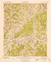
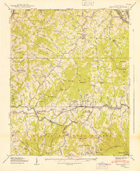
 - 1935 Map of Burnsville
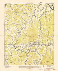 1935 Burnsville1935 Print · USGSCovers Yancey County, including Burnsville, Green Mountain, and other nearby areas
 - 1935 Map of Huntdale
 1935 Huntdale1935 Print · USGSCovers Yancey County, including Upper Pigeonroost, Sioux, and other nearby areas
 - 1935 Map of Bald Creek
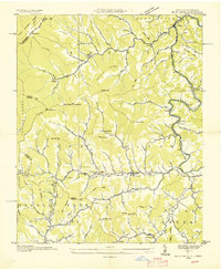 1935 Bald Creek1935 Print · USGSCovers Yancey County, including Cane, Cane River, and other nearby areas
 - 1935 Map of Barnardsville
 1935 Barnardsville1935 Print · USGSCovers Yancey County, including Barnardsville, Rockview, and other nearby areas
 - 1936 Map of Sams Gap
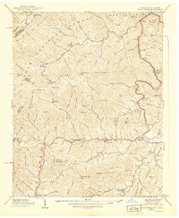
 1936 Sams Gap1936 Print · USGSCovers Yancey County, including Rice Bend, Foster Creek, and other nearby areas
 - 1939 Map of Bald Creek
 1939 Bald Creek1939 Print · USGSCovers Yancey County, including Cane, Cane River, and other nearby areas7 unique versions available
 - 1939 Map of Chestoa
 1939 Chestoa1939 Print · USGSCovers Yancey County, including Erwin, Lost Cove, and other nearby areas5 unique versions available
 - 1939 Map of Huntdale
 1939 Huntdale1939 Print · USGSCovers Yancey County, including Upper Pigeonroost, Sioux, and other nearby areas5 unique versions available
 - 1939 Map of Burnsville, 1956 Print
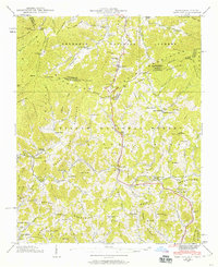
 1939 Burnsville1956 Print · USGSCovers Yancey County, including Burnsville, Green Mountain, and other nearby areas5 unique versions available
 - 1939 Map of Sams Gap, 1960 Print
 1939 Sams Gap1960 Print · USGSCovers Yancey County, including Rice Bend, Foster Creek, and other nearby areas5 unique versions available
 - 1940 Map of Burnsville
 1940 Burnsville1940 Print · USGSCovers Yancey County, including Burnsville, Green Mountain, and other nearby areas2 unique versions available
Showing maps 1-25 of 66
Top cities of Yancey County
Frequently asked questions
- What are the different types of historical maps available for Yancey County?
- What is the oldest map of Yancey County?
- Where can I purchase historical maps of Yancey County for my home or office?
- Where can I download high-res historical maps of Yancey County?
- Are there historical topographic maps available for Yancey County?
- Is there historical aerial imagery available for Yancey County?
- Where are historical maps of Yancey County sourced from?