1990s Maps of Yancey County, North Carolina
Explore 6 historic maps of Yancey County from the 1990s. These maps offer a rare glimpse into what life looked like during the 1990s — showing old roads, neighborhoods, homes, and landmarks that have changed or disappeared over time.
Whether you're researching your family's past, planning a metal detecting trip, or studying how Yancey County's landscape evolved across the 1990s, these high-resolution maps are a powerful tool for exploring the history of this region.
- Focus on a specific era: All maps on this page are from the 1990s, giving you a focused view of this time period.
- See what’s changed: Compare century-old streets, trails, and buildings to today's modern landscape using overlays and satellite layers.
- Research with precision: Use these maps for genealogy, historical research, land use analysis, or educational projects.
- View, download, or print: Maps are fully viewable online in high resolution, and can be downloaded or printed for your own records.
Start exploring Yancey County's history through authentic maps from the 1990s. This is your window into the past.
Yancey County, NC maps
(6)- 1994 Map of Celo, 1998 Print
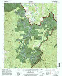 1994 Celo1998 Print · USGSThe South Toe River valley in the 1990s offers a detailed view of Appalachian settlement and forestry. Researchers can trace family names at the Gibbs Cemetery or Robinson Cemetery, and locate rural landmarks like the South Toe River School.
 - 1994 Map of Montreat, 1998 Print
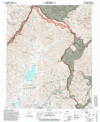 1994 Montreat1998 Print · USGSHigh peaks and protected watersheds dominate the Buncombe County landscape in the 1990s as the Blue Ridge Parkway skirts the eastern ridges. Researchers can trace the grounds of Black Mountain College or locate the Graphite Mine and Homers Chapel in the valleys below.
 - 1994 Map of Old Fort, 1998 Print
 1994 Old Fort1998 Print · USGSWestern North Carolina's high-country transition is captured in the mid-1990s as the Blue Ridge meets the Catawba River valley. Genealogists and hikers can trace family landmarks and backcountry trails through Old Fort, Siloam Cemeteries, and Piney Grove Church.
 - 1997 Map of Bakersville, 2001 Print
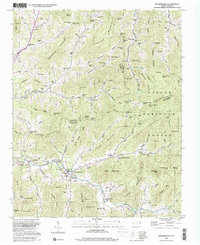
 1997 Bakersville2001 Print · USGSThe high peaks of Mitchell and Yancey counties are captured here in the late twentieth century, showing a landscape of deep coves and narrow valley settlements. Genealogists can locate family landmarks like Harrell Cem, Bakersville Cem, and the community of Loafers Glory.
 - 1998 Map of Burnsville, 2001 Print
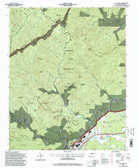
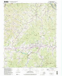 1998 Burnsville2001 Print · USGSYancey County's mountainous terrain is shown here during the late twentieth century, centered on the valley town of Burnsville. Genealogists and local historians can trace family roots through numerous landmarks, including Day Book, Clearmont Cem, and Harris Memorial Ch.
 - 1998 Map of Barnardsville, 2001 Print
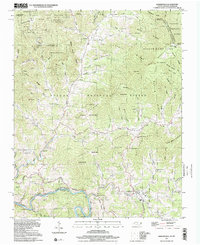
 1998 Barnardsville2001 Print · USGSBarnardsville and the surrounding Blue Ridge hollows are shown here at the turn of the 21st century. Genealogists can locate family names at Big Ivy Cem or Whitaker Cem and trace the old settlements of Dillingham and Democrat.
End of results
Showing maps 1-6 of 6
Top cities of Yancey County
Frequently asked questions
- What are the different types of historical maps available for Yancey County?
- What is the oldest map of Yancey County?
- Where can I purchase historical maps of Yancey County for my home or office?
- Where can I download high-res historical maps of Yancey County?
- Are there historical topographic maps available for Yancey County?
- Is there historical aerial imagery available for Yancey County?
- Where are historical maps of Yancey County sourced from?