1930s Maps of Yancey County, North Carolina
Explore 17 historic maps of Yancey County from the 1930s. These maps offer a rare glimpse into what life looked like during the 1930s — showing old roads, neighborhoods, homes, and landmarks that have changed or disappeared over time.
Whether you're researching your family's past, planning a metal detecting trip, or studying how Yancey County's landscape evolved across the 1930s, these high-resolution maps are a powerful tool for exploring the history of this region.
- Focus on a specific era: All maps on this page are from the 1930s, giving you a focused view of this time period.
- See what’s changed: Compare century-old streets, trails, and buildings to today's modern landscape using overlays and satellite layers.
- Research with precision: Use these maps for genealogy, historical research, land use analysis, or educational projects.
- View, download, or print: Maps are fully viewable online in high resolution, and can be downloaded or printed for your own records.
Start exploring Yancey County's history through authentic maps from the 1930s. This is your window into the past.
Yancey County, NC maps
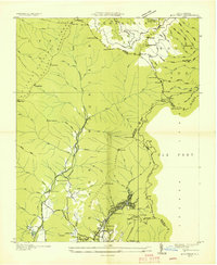
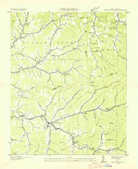
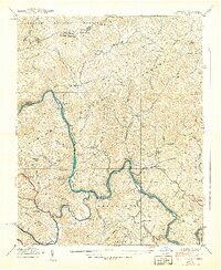
(17)- 1934 Map of Micaville
 1934 Micaville1934 Print · USGSCovers Yancey County, including Bandana, Ledger, and other nearby areas
 - 1934 Map of Parts Of Celo And Black Brothers
 1934 Parts Of Celo And Black Brothers1934 Print · USGSCovers Yancey County, including Celo, Hamrick, and other nearby areas
 - 1934 Map of Bakersville
 1934 Bakersville1934 Print · USGSCovers Yancey County, including Bakersville, Buladean, and other nearby areas2 unique versions available
 - 1934 Map of Parts Of Old Fort and Montreat
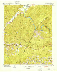
 1934 Parts Of Old Fort and Montreat1934 Print · USGSCovers Yancey County, including Old Fort, Dendron, and other nearby areas
 - 1935 Map of Montreat
 1935 Montreat1935 Print · USGSCovers Yancey County, including Black Mountain, Montreat, and other nearby areas
 - 1935 Map of Black Brothers
 1935 Black Brothers1935 Print · USGSCovers Yancey County, including Murchison, Eskota, and other nearby areas
 - 1935 Map of Chestoa
 1935 Chestoa1935 Print · USGSCovers Yancey County, including Erwin, Lost Cove, and other nearby areas
 - 1935 Map of Burnsville
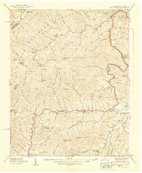
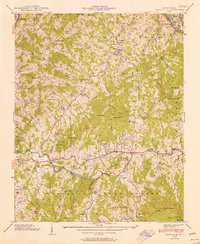
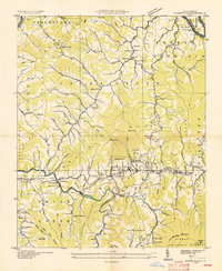 1935 Burnsville1935 Print · USGSCovers Yancey County, including Burnsville, Green Mountain, and other nearby areas
 - 1935 Map of Huntdale
 1935 Huntdale1935 Print · USGSCovers Yancey County, including Upper Pigeonroost, Sioux, and other nearby areas
 - 1935 Map of Bald Creek
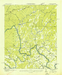
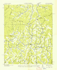
 1935 Bald Creek1935 Print · USGSCovers Yancey County, including Cane, Cane River, and other nearby areas
 - 1935 Map of Barnardsville
 1935 Barnardsville1935 Print · USGSCovers Yancey County, including Barnardsville, Rockview, and other nearby areas
 - 1936 Map of Sams Gap
 1936 Sams Gap1936 Print · USGSCovers Yancey County, including Rice Bend, Foster Creek, and other nearby areas
 - 1939 Map of Bald Creek
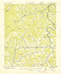
 1939 Bald Creek1939 Print · USGSCovers Yancey County, including Cane, Cane River, and other nearby areas7 unique versions available
 - 1939 Map of Chestoa
 1939 Chestoa1939 Print · USGSCovers Yancey County, including Erwin, Lost Cove, and other nearby areas5 unique versions available
 - 1939 Map of Huntdale
 1939 Huntdale1939 Print · USGSCovers Yancey County, including Upper Pigeonroost, Sioux, and other nearby areas5 unique versions available
 - 1939 Map of Burnsville, 1956 Print
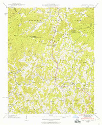
 1939 Burnsville1956 Print · USGSCovers Yancey County, including Burnsville, Green Mountain, and other nearby areas5 unique versions available
 - 1939 Map of Sams Gap, 1960 Print
 1939 Sams Gap1960 Print · USGSCovers Yancey County, including Rice Bend, Foster Creek, and other nearby areas5 unique versions available
End of results
Showing maps 1-17 of 17
Top cities of Yancey County
Frequently asked questions
- What are the different types of historical maps available for Yancey County?
- What is the oldest map of Yancey County?
- Where can I purchase historical maps of Yancey County for my home or office?
- Where can I download high-res historical maps of Yancey County?
- Are there historical topographic maps available for Yancey County?
- Is there historical aerial imagery available for Yancey County?
- Where are historical maps of Yancey County sourced from?