Old Maps of Yancey County, North Carolina for Academic Research
Study the evolution of Yancey County with 114 high-resolution historic maps. Whether you're teaching, researching, or modeling changes in land use, these maps provide essential visual documentation of urban, environmental, and geographic change.
- Analyze long-term change: Track patterns in development, transportation, and natural features.
- Ideal for environmental or urban studies: Support academic projects with primary historical map data.
- Use in the classroom or lab: Educators and researchers rely on these maps to bring historical context to life.
These maps are a powerful tool for teaching, research, and visualizing how Yancey County has changed over the decades.
Yancey County, NC maps
(114)- 1891 Map of Roan Mountain
 1891 Roan Mountain1891 Print · USGSThe Tennessee-North Carolina border country comes alive in the 1890s, when narrow-gauge railroads and mountain ferries still moved the region's goods. Genealogists and historians can trace early crossings like Shipley's Ferry, industrial sites at Embreeville, and high-country settlements like Cloudland.
 - 1894 Map of Asheville
 1894 Asheville1894 Print · USGSAsheville and the French Broad River valley are shown here in the 1890s, when rail travel was transforming the Southern Appalachians. Genealogists can locate family landmarks like Gudgers Mill, Pendletons Mill, and the early development of Biltmore.2 unique versions available
 - 1894 Map of Roan Mountain
 1894 Roan Mountain1894 Print · USGSNortheast Tennessee and Western North Carolina are mapped here in the late nineteenth century as the rail network expands through the Unaka Range. Trace early industrial footprints and family lands near Elizabethton, Terry Furnace, and the high summit at Cloudland.3 unique versions available
 - 1900 Map of Mount Mitchell, 1963 Print
 1900 Mount Mitchell1963 Print · USGSWestern North Carolina at the turn of the century shows a landscape of high peaks and isolated river settlements before the arrival of modern highways. Genealogists and mountain historians can trace early homesteads along the Cane River or follow the Southern RR through Old Fort and Black Mountain.3 unique versions available
 - 1901 Map of Asheville
 1901 Asheville1901 Print · USGSWestern North Carolina at the turn of the century shows a mountain landscape adapting to the arrival of major railroads. Genealogists and historians can trace family-named peaks and early communities like Mars Hill, Hot Springs, and the estates at Biltmore.9 unique versions available
 - 1902 Map of Mount Mitchell, 1937 Print
 1902 Mount Mitchell1937 Print · USGSThe high peaks of Western North Carolina are captured here at the start of the twentieth century, showing the rail and river corridors that shaped the region. Trace early settlements like Burnsville, Montreat, and the winding Southern Railway.3 unique versions available
 - 1904 Map of Roan Mountain
 1904 Roan Mountain1904 Print · USGSUpper East Tennessee and Western North Carolina are documented here at a time when river fords and narrow-gauge railroads still connected mountain hollows. Trace the paths to Hodge Ore Bank, find old Poplar Ridge Church, or locate river crossings like Yoakley Ferry.4 unique versions available
 - 1934 Map of Micaville
 1934 Micaville1934 Print · USGSThe forks of the Toe River and the Clinchfield rail line define the Yancey and Mitchell County border in the mid-1930s. Researchers can trace ancestral locations like Double Island School, Hootowl Mine, and the many cemeteries including Rebels Creek Cem.
 - 1934 Map of Parts Of Celo And Black Brothers
 1934 Parts Of Celo And Black Brothers1934 Print · USGSYancey County's high-country settlements and forest boundaries are meticulously detailed in this mid-1930s survey. Researchers can locate community hubs like Harvard Sch and Edges Store or trace the steep terrain of Mt Mitchell.
 - 1934 Map of Bakersville
 1934 Bakersville1934 Print · USGSBakersville and its surrounding Mitchell County peaks are captured in the mid-1930s, showing a landscape of remote mountain gaps and rail-side settlements. Genealogists can trace early homesteads near Loafers Glory, Toecane, and schools like Bad Creek Sch.2 unique versions available
 - 1934 Map of Parts Of Old Fort and Montreat
 1934 Parts Of Old Fort and Montreat1934 Print · USGSThe Black Mountains reached a turning point in the mid-1930s as state and national parklands began to formalize. You can trace the early Blue Ridge Parkway, find the remote Loftis Cabin, and locate the Green Knob Fire Tower.
 - 1935 Map of Montreat
 1935 Montreat1935 Print · USGSMontreat and the surrounding Black Mountains are shown here in the mid-1930s, documenting the area's religious centers and early park development. Genealogists and hikers can trace the Toll Road up to Clingmans Peak or locate old community landmarks like Brookside Sch and Homers Chapel.
 - 1935 Map of Black Brothers
 1935 Black Brothers1935 Print · USGSThe high peaks of the Black Mountains dominate this mid-1930s survey of Yancey County. Local historians can trace the steep Aerial Tramway and old transport routes like the Toll Road connecting Pensacola to high-altitude landmarks like Camp Alice.
 - 1935 Map of Chestoa
 1935 Chestoa1935 Print · USGSThe Tennessee and North Carolina borderlands come alive in the mid-1930s as the Clinchfield RR snakes through the Nolichucky River gorge. Researchers can trace rural life through numerous landmarks like Love Station, Raven Cliff Sch, and Newdale Ch.
 - 1935 Map of Burnsville
 1935 Burnsville1935 Print · USGSThe Cane River valley and the Burnsville townsite are captured here in the mid-thirties as rural infrastructure expanded across Yancey County. Genealogists and historians can trace family locations through numerous landmarks like Clermont Cem, Mine Fork Sch, and the State Prison Camp.
 - 1935 Map of Huntdale
 1935 Huntdale1935 Print · USGSThe Nolichucky River valley comes alive in the mid-1930s as the Clinchfield RR winds through the mountains of Mitchell and Yancey Counties. Genealogists and historians can locate dozens of small community hubs including Huntdale, the Brummett Creek Sch, and Jacobs Mill.
 - 1935 Map of Bald Creek
 1935 Bald Creek1935 Print · USGSWestern North Carolina's high country is captured here in the mid-1930s, documenting the remote mountain valleys and ridge-top borders of Yancey County. Genealogists can trace family homes near Possumtrot, Bee Log, and rural schools like Horton Hill Sch.
 - 1935 Map of Barnardsville
 1935 Barnardsville1935 Print · USGSBarnardsville and the surrounding Blue Ridge foothills are captured in the mid-1930s before modern development altered these mountain hollows. Researchers can trace family roots through numerous burial sites like Whitaker Cem and locate vanished centers of community like Just PO and Sodom.
 - 1936 Map of Sams Gap
 1936 Sams Gap1936 Print · USGSThe North Carolina and Tennessee borderlands come alive in the mid-1930s, showing a landscape of high ridges and deep hollows before modern development. Genealogists can trace family landmarks like Shelton Cem, English Bright Hope Sch, and the Flume Mill.
 - 1939 Map of Bald Creek
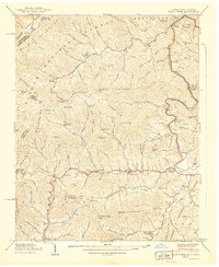 1939 Bald Creek1939 Print · USGSThe North Carolina and Tennessee borderlands appear here in the late 1930s, showing a rugged landscape of high peaks and river-valley settlements. Genealogists can locate family landmarks like Cane River (P.O.), Piney Grove Sch, and Robinson Cem during an era when the Appalachian Trail was newly established.7 unique versions available
 - 1939 Map of Chestoa
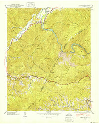 1939 Chestoa1939 Print · USGSThe Tennessee and North Carolina borderlands in the late thirties were defined by the deep gorge of the Nolichucky River and the winding Clinchfield RR. Genealogists and hikers can trace old mountain routes like the Appalachian Trail past Lost Cove and schools like Temple Hill Sch.5 unique versions available
 - 1939 Map of Huntdale
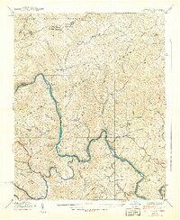 1939 Huntdale1939 Print · USGSThe Nolichucky River valley along the North Carolina and Tennessee border is shown here just before the Second World War. Genealogists can trace family roots through mountain settlements like Huntdale, rural landmarks like Worrick Cem, and the path of the Clinchfield Railroad.5 unique versions available
 - 1939 Map of Burnsville, 1956 Print
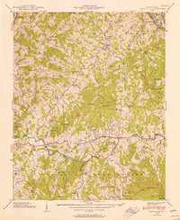 1939 Burnsville1956 Print · USGSBurnsville and the surrounding Yancey County ridges are captured here just before mid-century, showing a landscape defined by mountain gaps and river valleys. Genealogists can trace family names through numerous landmarks like Dellinger Cem, Banks Creek Ch, and the Day Book (P.O.).5 unique versions available
 - 1939 Map of Sams Gap, 1960 Print
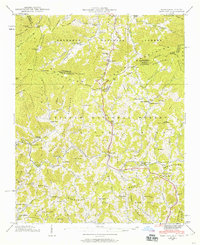 1939 Sams Gap1960 Print · USGSThe high ridges of the North Carolina and Tennessee border come alive in this late 1930s survey. Genealogists and historians can trace family land near Blankenship Cem, Halls Store, and Upper Laurel Ch in the shadow of the Bald Mountains.5 unique versions available
 - 1940 Map of Burnsville
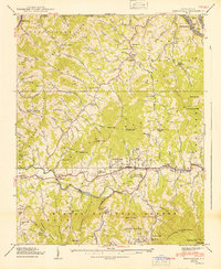 1940 Burnsville1940 Print · USGSYancey County in the late Depression era shows a landscape of tightly knit mountain communities and early state infrastructure. Researchers can locate family landmarks like the Clearmont Cem, the State Prison Camp, and the remote Day Book post office.2 unique versions available
Showing maps 1-25 of 114
Top cities of Yancey County
Frequently asked questions
- What are the different types of historical maps available for Yancey County?
- What is the oldest map of Yancey County?
- Where can I purchase historical maps of Yancey County for my home or office?
- Where can I download high-res historical maps of Yancey County?
- Are there historical topographic maps available for Yancey County?
- Is there historical aerial imagery available for Yancey County?
- Where are historical maps of Yancey County sourced from?