Old Maps of Minnewaukan, North Dakota
Explore 18 old maps of Minnewaukan, spanning from 1932 to today. These high-resolution historic maps reveal how streets, neighborhoods, landmarks, and natural features evolved over time — perfect for genealogy, metal detecting, research, and local history exploration.
What you can do with these maps:
- See how Minnewaukan changed over time: Compare historical maps to modern-day views to trace roads, homesites, rail lines & more.
- View detailed metadata: Each map includes creators, publishers, year, scale, and archive source.
- Overlay maps with satellite & LiDAR: Visualize the past alongside modern tools to explore terrain & human change.
- Trusted historical sources: Maps sourced from the USGS, Library of Congress, and other archives.
- Access maps your way: View online, download high-res files, or order prints for personal or research use.
Start exploring old maps of Minnewaukan to uncover forgotten places, hidden landmarks, and the deep history beneath your feet.
Minnewaukan, ND maps
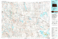
(18)- 1932 Map of Grahams Island
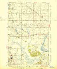 1932 Grahams Island1932 Print · USGSDevils Lake and Grahams Island are seen here in the early 1930s as a complex network of prairie schools and railroads. Genealogists can locate family landmarks like St Paul Cem, Antiochia Ch, and the many numbered schools scattered across Normania and Coulee.
 - 1950 Map of Grahams Island, 1959 Print
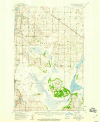 1950 Grahams Island1959 Print · USGSDevils Lake and its rugged shoreline dominate this mid-century survey of Benson and Ramsey counties. Local historians can trace the legacy of rural education and faith at School No 5, St Paul Cem, and the Old Military Reservation.2 unique versions available
 - 1951 Map of Minnewaukan East
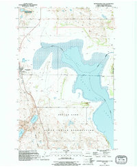
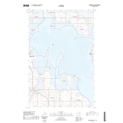
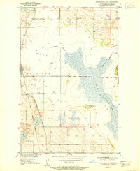 1951 Minnewaukan East1951 Print · USGSThe Benson County shoreline in the early 1950s shows the complex water levels of Devils Lake and the rural reaches of Minnewaukan. Genealogists and local historians can locate early landmarks like School No 1, the Northern Pacific rail line, and family landmarks like Sams Hill.
 - 1953 Map of Devils Lake, 1968 Print
 1953 Devils Lake1968 Print · USGSNorth Dakota's northern plains are captured here in the mid-fifties, showing a landscape of rail-fed grain elevators and prairie wetlands. Genealogists can locate family landmarks like Rose Hill School, Hurricane Lake Church, and the Turtle Mountain Indian Reservation.3 unique versions available
 - 1956 Map of Devils Lake
 1956 Devils Lake1956 Print · USGSNorthern North Dakota is shown at a mid-century peak of rail-driven agriculture, where the Soo Line and Great Northern railroads cross the prairie. Trace the borders of the Turtle Mountain Indian Reservation and locate local landmarks like Rose Hill School or Camp Grafton.
 - 1958 Map of Minnewaukan West, 1959 Print
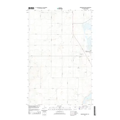
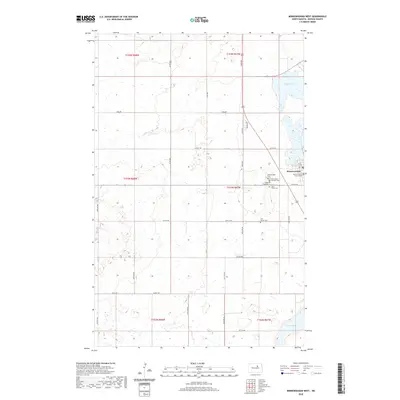
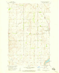 1958 Minnewaukan West1959 Print · USGSBenson County's prairie landscape is captured here in the late fifties as the town of Minnewaukan sits at a rail and water crossroads. Researchers can trace the Northern Pacific line or locate family sites at St Peter Cem and Free Church Cem.2 unique versions available
 - 1985 Map of Leeds, 1994 Print
 1985 Leeds1994 Print · USGSBenson and Ramsey counties are shown during the mid-eighties as a patchwork of prairie agriculture and vital wetland habitats. Researchers can locate family roots at Knox Cem, trace the Soo Line rail corridors, or explore the fringes of Devils Lake.
 - 1994 Map of Minnewaukan East, 1995 Print
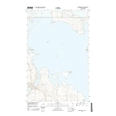
 1994 Minnewaukan East1995 Print · USGSBenson County's lakeside landscape comes into focus in the mid-1990s as it transitions from the town of Minnewaukan into tribal lands. Genealogists and historians can trace the boundaries of the Sioux Indian Reservation and locate local landmarks like Humphrey Memorial Park or Sams Hill.
 - 2011 Map of Minnewaukan East, 2011 Print
 2011 Minnewaukan East2011 Print · USGSCovers Minnewaukan, including Crow Hill District, Benson County, and other nearby areas
 - 2011 Map of Minnewaukan West, 2011 Print
 2011 Minnewaukan West2011 Print · USGSCovers Minnewaukan, including Crow Hill District, Benson County, and other nearby areas
 - 2014 Map of Minnewaukan West, 2014 Print
 2014 Minnewaukan West2014 Print · USGSCovers Minnewaukan, including Crow Hill District, Benson County, and other nearby areas
 - 2014 Map of Minnewaukan East, 2014 Print
 2014 Minnewaukan East2014 Print · USGSCovers Minnewaukan, including Crow Hill District, Benson County, and other nearby areas
 - 2017 Map of Minnewaukan East, 2017 Print
 2017 Minnewaukan East2017 Print · USGSCovers Minnewaukan, including Crow Hill District, Benson County, and other nearby areas
 - 2017 Map of Minnewaukan West, 2017 Print
 2017 Minnewaukan West2017 Print · USGSCovers Minnewaukan, including Crow Hill District, Benson County, and other nearby areas
 - 2020 Map of Minnewaukan West, 2020 Print
 2020 Minnewaukan West2020 Print · USGSCovers Minnewaukan, including Crow Hill District, Benson County, and other nearby areas
 - 2020 Map of Minnewaukan East, 2020 Print
 2020 Minnewaukan East2020 Print · USGSCovers Minnewaukan, including Crow Hill District, Benson County, and other nearby areas
 - 2024 Map of Minnewaukan East, 2024 Print
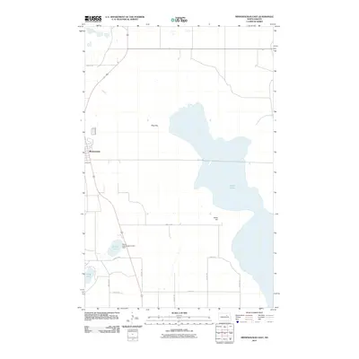
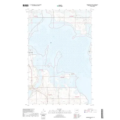
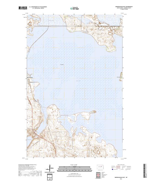 2024 Minnewaukan East2024 Print · USGSThe town of Minnewaukan borders the expansive Devils Lake in this contemporary 2024 survey of the North Dakota landscape. Researchers can trace the protected wetlands of the Benson County Waterfowl Production Area and locate landforms like Grahams Island.
 - 2024 Map of Minnewaukan West, 2024 Print
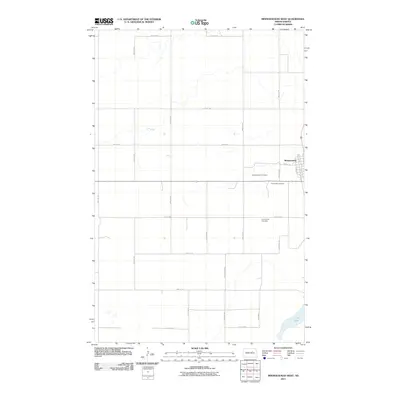
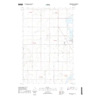
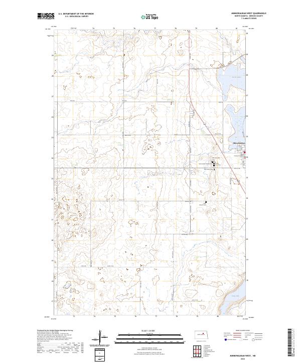 2024 Minnewaukan West2024 Print · USGSThe Benson County seat at Minnewaukan is shown here on the western edge of Devils Lake in the modern day. Genealogists and researchers can trace local heritage through the Benson County Court House and several country cemeteries like Saint Peter Cem and Free Church Cem.
End of results
Showing maps 1-18 of 18
Top cities near Minnewaukan
- Leeds historical maps
- Lallie historical maps
- Oberon historical maps
- Churchs Ferry historical maps
- Brinsmade historical maps
Frequently asked questions
- What are the different types of historical maps available for Minnewaukan?
- What is the oldest map of Minnewaukan?
- Where can I purchase historical maps of Minnewaukan for my home or office?
- Where can I download high-res historical maps of Minnewaukan?
- Are there historical topographic maps available for Minnewaukan?
- Is there historical aerial imagery available for Minnewaukan?
- Where are historical maps of Minnewaukan sourced from?