
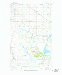
1950 Map of Grahams Island
USGS Topo · Published 1959About this map
Grahams Island rises as a prominent landmark within the shifting waters of Devils Lake, a landscape defined by its complex shoreline and recessed bays. The map shows the region at a time of established rural infrastructure, evidenced by a dense network of numbered schools, such as School No 7 and School No 1, and country congregations like Antiochia Ch and Big Coulee Ch. The Fort Totten Indian Reservation Boundary cuts across the southern portion of the sheet, where an Old Military Reservation is noted alongside Sullys Hill National Wildlife Refuge.
Find a feature on this map
49 named features on this map. Tap any name to fly to it.
Don’t see what you’re looking for? This feature index may not catch every label — zoom into the map to look around manually.
Map Details
Editions of this 1950 Grahams Island Map
2 editions found
Other maps of this area

1928 · Tokio
USGS Topo · 1:62,500

1931 · Oberon
USGS Topo · 1:62,500

1931 · Tokio
USGS Topo · 1:62,500

1931 · Devils Lake
USGS Topo · 1:62,500

1932 · Flora
USGS Topo · 1:62,500

1932 · Grahams Island
USGS Topo · 1:62,500

1950 · Devils Lake
USGS Topo · 1:62,500

1950 · Oberon
USGS Topo · 1:62,500

1951 · Crow Hill
USGS Topo · 1:24,000

1951 · Oberon
USGS Topo · 1:24,000