
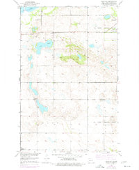
1951 Map of Crow Hill
USGS Topo · Published 1951About this map
The Old Military Reservation Boundary cuts through the northern sections of this landscape, a remnant of early frontier administration in North Dakota. Surveyed just after mid-century, the terrain is characterized by the fluctuating shoreline of Devils Lake and the prominent rise of Crow Hill. The map reveals a dense network of local civic life through its numerous rural schools and houses of worship. Small settlements or gathering points are anchored by institutions like St Jerome Ch and Lakeview Sch No 2, indicating a rural population still deeply tied to its local school districts. The presence of multiple denominations, including Presbyterian Ch and Christian Ch, highlights the cultural diversity of the townships of Lallie, Rock, and Twinee during this era.
Find a feature on this map
15 named features on this map. Tap any name to fly to it.
Don’t see what you’re looking for? This feature index may not catch every label — zoom into the map to look around manually.
Map Details
Editions of this 1951 Crow Hill Map
2 editions found
Other maps of this area

1928 · Tokio
USGS Topo · 1:62,500

1931 · Oberon
USGS Topo · 1:62,500

1931 · Tokio
USGS Topo · 1:62,500

1931 · Devils Lake
USGS Topo · 1:62,500

1932 · Grahams Island
USGS Topo · 1:62,500

1950 · Oberon SW
USGS Topo · 1:24,000

1950 · Sheyenne
USGS Topo · 1:24,000
1950 · Tokio SW
USGS Topo · 1:24,000

1950 · Grahams Island
USGS Topo · 1:62,500

1950 · Devils Lake
USGS Topo · 1:62,500
Featured Places
- Fort Totten District, ND
- Crow Hill District, ND
- Fort Totten, Fort Totten District
- Benson County, ND
- United States