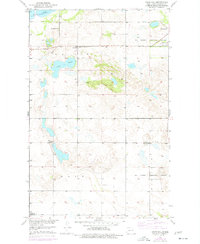
1951 Map of Crow Hill
USGS Topo · Published 1977About this map
Devils Lake dominates the northern horizon of this North Dakota landscape, as recorded during a mid-1970s revision of earlier 1950s field data. The terrain is defined by the glacial geography of Lallie and Twin Tree, where the prominent Crow Hill rises above a cluster of smaller water bodies including Twin Lakes. This area of Benson County shows a transition from the water's edge to a prairie landscape marked by rural infrastructure and historical boundary lines.
Find a feature on this map
14 named features on this map. Tap any name to fly to it.
Don’t see what you’re looking for? This feature index may not catch every label — zoom into the map to look around manually.
Map Details
Editions of this 1951 Crow Hill Map
2 editions found

Other maps of this area

1928 · Tokio
USGS Topo · 1:62,500

1931 · Oberon
USGS Topo · 1:62,500

1931 · Tokio
USGS Topo · 1:62,500

1931 · Devils Lake
USGS Topo · 1:62,500

1932 · Grahams Island
USGS Topo · 1:62,500

1950 · Oberon SW
USGS Topo · 1:24,000

1950 · Sheyenne
USGS Topo · 1:24,000
1950 · Tokio SW
USGS Topo · 1:24,000

1950 · Grahams Island
USGS Topo · 1:62,500

1950 · Devils Lake
USGS Topo · 1:62,500
Featured Places
- Fort Totten District, ND
- Crow Hill District, ND
- Fort Totten, Fort Totten District
- Benson County, ND
- United States